HADRIAN’S WALL: Boundary Monument for the
Northern Frontier of Roman Britannia!
John F. BROCK, Australia

John F. Brock
1)
This paper will be presented at the FIG Working Week 2017 in Helsinki,
Finland, 29 May – 2 June. Much hypotheses and over-thinking has taken place over hundreds of
years in an effort to attribute purposes for the raison d’etre of the
wall across northern Britain erected at the behest of the formidable
Roman Emperor whose name has been ultimately used to describe this
intriguing edifice. John Brock makes his own offering to the discussion
table about what served as the main reasons for the erection of such a
notable memorial to the time of the renowned civilization during the
second century.
ABSTRACT
“A man’s worth is
no greater than his ambitions.”
– Marcus Aurelius |
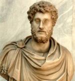 |
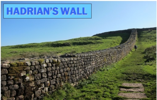
Fig. 1 A section of Hadrian’s Wall in north England showing material and
construction type
Much hypotheses and over-thinking has taken place over hundreds of
years in an effort to attribute purposes for the raison d’etre of the
wall across northern Britain erected at the behest of the formidable
Roman Emperor whose name has been ultimately used to describe this
intriguing edifice.
Was it built for defence, border control, a
demonstration of power or any number of associated intentions as a
strategic military device at the extremity of the territorial outskirts
of the Great Empire? Many postulations have been advanced by engineers,
stone masons, clerks of works, military experts, academics,
archaeologists, historians, paleontologists and all the usual suspects.
However I have only sourced one other opinion for its creation put
forward by another land surveyor like myself having been offered by my
very good friend from the US Mary Root who I see at least once a year at
the Surveyors Rendezvous held annually in different locations within the
USA to celebrate the local Surveying history of many notable places in
the Land of the Free and President Surveyors (please note that US
Presidents Washington, Jefferson and Lincoln were all land surveyors!).
Well it just so happens that I am not just a practising “historical
detective” (as I label those involved in my profession!) but I am an
active field historian with a Masters degree in Egyptology from
Macquarie University in Sydney. In addition to this area of
personal and professional interest I have done considerable research
into ancient Greek and Roman surveying together with a diversion into
the surveyors of China’s antiquity as a background to my paper “The
Great Wall of China: The World’s Greatest Boundary Monument!”
With such a cursory introduction to my own research base
I will be making my own offering to the discussion table about what
served as the main reasons for the erection of such a notable memorial
to the time of the renowned civilization during the second century.
After I elaborate further about my analysis of the wall’s design with
specific attention drawn to certain features not before grouped together
along with a focus on the desires and intentions of Emperor Hadrian
himself there may be some agreement that this iconic line across the
topography is a true boundary monument in the ancient Roman traditions
as a demarcation line of the northern limit of the Empire’s frontier in
the north western territory of its second century enforced tenure.
1. INTRODUCTION
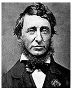 |
“It is not what
you look at that counts; it is what you see!”
- Henry David Thoreau, Philosopher/Surveyor. |
On the five occasions that I have travelled to the United Kingdom on
only one instance have I gone by road northwards to Scotland during
which I only caught a fleeting glimpse of Hadrian’s Wall in 1998.
After nearly 19 years I will actually be staying at the town of Wall in
accommodation adjacent to this legendary symbol of Roman times within
the area such premises having been constructed with stones from the
original structure itself. My subsequent curiosity with this
ancient Roman masterpiece was propagated by initial readings of various
texts and web articles most of which I procured from the UK itself.
Most authors have proposed that the Wall had multiple purposes for its
installation dismissive of a principal motive for placement as a
defensive barrier or fortification suitable for the Roman forces from
which to mount an armed resistance. Through my interpretations of
the various features of the Wall’s design combined with an instinctive
feeling for the mood of the Roman Ruler himself I will mount a
convincing proposition that the main purpose of Hadrian’s Wall was as a
boundary monument placed to delineate the dividing territorial line for
the northern limit of Roman Britannia at the same time serving notice to
any would-be interlopers that any transgressions past that line would
bring great trauma.
May I emphasise that my research is not totally exhaustive but I
have obtained many excellent publications issued over many hundreds of
years which have provided me with a quite broad understanding of how
many surveyors were employed by the great Empire to maintain and
supervise all matters pertaining to matters of civic jurisdiction and
orderly inhabitation of the lands over which claims had been
established. Roman Surveying Law and Doctrines were well versed
and enforced by a Surveying Profession which bore great esteem and
respect along with a dependency on such experts to solve boundary
disputes and facilitate the creation and operation of new towns, roads
and aqueducts considered vital for the convenience and livelihood of its
citizens and vast military regiments.
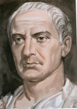
2. JULIUS CAESAR INVADES BRITANNIA
“Veni, vidi, vici”
(“I came, I saw, I conquered.”)
– Julius Caesar (47 BC)
 |
The first incursions by Rome across the sea into
Britannia were made by Julius Caesar in 55 and 53 BC with continuing
intensity over the years under the reigns of subsequent emperors
Augustus, Tiberius and Caligula. It would not be until almost another
hundred years before the Romans finally conquered Britain in 43 AD when
Claudius dispatched four legions to finalise the job and even from then
on there was still formidable opposition to keep the usurping legions
south of what is considered Caledonia (visa vie later most of
Scotland). There was the perception that there was little wealth or
suitably arable lands upon which income could be generated added to the
tenacity of the battle hardened highlanders whose fight to the death
toughness would make many a seasoned soldier reluctant to take them on
in their own surroundings. These eras of Rome’s expansionary ambitions
are not the basis for this paper but they do serve as a salutary source
as to what drove Hadrian to bring about the laying of what has become a
renowned landmark of the Roman Empire at its mightiest during the second
to the fourth centuries after Christ. What has been labelled “the Fall”
of the Roman Empire was already well into its death rolls by the time
the Romans ultimately evacuated their Britannic stronghold in 411 during
the rule of Emperor Jovinus and his Consul Honorius et Theodosio.
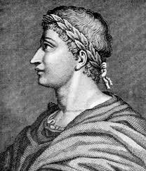
3. HADRIAN BECOMES ROME’S EMPEROR
 |
“Better than a thousand hollow words is one word that brings
peace”- Buddha |
If the word “wall” was inserted where “word” is in this
quote it may go some way to explain Hadrian’s strategy to put up his
wall in northern Britannia when he toured his western colony in 122.
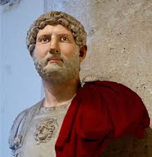
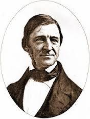
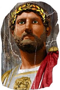
Fig. 2 Roman Emperor Hadrian
In 117 AD Rome’s second “friendly” regent Trajan passed
away leaving control of Rome’s extensive holdings to his successor
Hadrian who was 41 (born Publius Aelius Hadrianus in 76 possibly in
Itallica which is now part of Spain – but it has been suggested that in
fact he was born in Rome itself?) when taking over control. Rebadging
himself as Caesar Traianus Hadrianus Augustus the new ruler clearly
portrayed his traditionalist attitude with a distinct bias towards the
classical culture of the ancient Greeks along with archaic literature
and writings of folklore as well as displaying his veneration for his
First Emperor Augustus through the inclusion of his name in that which
he had adopted. One writer says that he was a “dedicated devotee of
Octavian-Augustus, and had a bust of Octavian in his bedroom.” I am
sure that his wife was delighted! Shelving the expansionist policies of
some of his predecessors which had stretched the capacity of the
governing regime to maintain control and order at the extreme edges of
those regions far removed from the Rome-based Senate responsible for its
existence Hadrian saw the need for more passive measures to be
employed. The new ruler embarked on a program to consolidate the
current holdings of the dominion in order to minimize the exposure of
invasions and raids against the thinly spread legions guarding the
vulnerable outer limits of the Empire’s furthest perimeters. Hadrian
had a resolute character as well as having been remembered as a leader
with moderation along with Nerva (96-98), Trajan (98-117) and his
successors Antoninus Pius (138-161) and Marcus Aurelius (161-180)
collectively referred to as “The Five Good Emperors.” In a paradox of
his personality his moderation in areas of governance were matched by
his extravagance in public works such as the enlargement of The Pantheon
and of course the placement of the Britannic Wall. The concept of
territorial limits had more to do with the identification of lands
currently under Roman control and those destined to be, rather than a
declaration that the lines identified would remain at the outermost
edges of the Empire. There was also a paranoic perception, sometimes
justified, that the far removed generals at a tyranny of distance would
be driven to forge alliances with those nearby chieftains outside the
designated lines and sever ties with the Empire. Emperor Domitian
(81-96) introduced frontier works in Germany with timber towers linking
forts while Trajan had added fortlets just prior to Hadrian erecting a
timber palisade in this colony (PH p.15). Where naturally occurring
major landscape features such as rivers, cliffs or water table crest
lines existed they were charted as the boundary of the Empire lands for
the outside regions.
In legalistic parlance rightful ownership of property is
demonstrated by what are referred to as “Acts of Dominion” such as
maintaining an estate in good order, paying the required Council rates
and land taxes (if applicable), plus various other actions but with one
very specific action being tantamount to secure a right of ownership
which is the construction of a dividing barrier between one claimant and
his neighbour usually being a fence or wall along the property line of
subdivision. Hence Hadrian saw an urgent need to clearly demarcate
where he believed his line of dominion had reached along the northern
frontier of his western colony of Britannia. Done without mutual
consent clearly the non consentual parties could only regard the
placement of this Wall as an act of aggression or at the very least a
provokatory signal to future confrontations by the angry rebels.
Through his extensive tour de force inspecting his absolute realm to
its entirety Hadrian formulated a capital works program to clearly
designate the limits of his power through the placement of artificial
lines of demarcation where no natural geography presented itself to
adopt as suitable frontier perimeters known as “limes” which were those
external boundaries as compared with “limites” being dividing lines
between provinces within the overall total regime. During his
visit of 122 AD to Britannia he oversaw the erection of the great
construction dividing wall 80 Roman miles (a Roman mile was 5,000 Roman
feet being equivalent to 4,854 Imperial feet – a pace was equal to 5
Roman feet) from Wallsend-on-Tyne to Bowness-on-Solway along the
northern territorial rim of his western colony (a distance of about 120
kms).
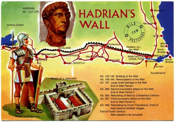
Fig. 3 A postcard showing Emperor Hadrian’s bust looking over
his impressive wall
The new leader was determined to enforce “peace through
strength” thus devoting his efforts to erect clear symbols of might
enclosing all that was his. In so doing he was giving defiant notice to
any tribes outside those fortifications who contemplated crossing these
barriers with ill intent they most certainly would attract the full
retribution of the Roman legions in response. Clearly the Wall was
solidly and substantially built but with the relatively sparse
positioning of fortlets (with gates) between quite extended stretches of
narrow stone walls it was far from impregnable. The gates placed were
to allow passage to and from the adjoining lands with a tacit intent of
frontier control for selective admissions and exclusions as decreed.
For many years after the refocus directed towards the royal edifice
since the 17th century “rediscovery” of the Wall there was much dispute
about who actually issued the decree to bring about its construction but
subsequently two powerful items have emerged to prove conclusively that
its paternity belongs to Hadrian himself. Hadrian’s alleged biographer
Aelius Spartianus from the Scriptores Historiae Augustae (translated as
Augustan History) estimated to have been compiled some time between AD
285 and 335 declares in Hadrian XI, 2-6: “And so, having reformed the
army quite in the manner of a monarch, he set out for Britain, in 122.
There he corrected many abuses and was the first to construct a wall,
eighty miles in length, which was to separate the barbarians from the
Romans.” Then as though the ancient emperor was watching over the
modern proceedings and discussions concerning the archaeological
investigations and restorations of his paean glorious in 1715 at Hotbank
Milecastle No. 38 an inscribed slab of stone (now held in the Museum of
Antiquities, Newcastle) was discovered dated to the time of Britannic
Governor Nepos from 122-126 AD which in Latin states: “Imp(eratoris)
Caes(aris) Traiani / Hadriani Aug(usti) / A(ulo) Platorio Nepote
leg(ato) pr(o) pr(aetore)”, translated into English saying: “Of the
emperor Caesar Traianus Hadrianus Augustus, the legion II Augusta (built
this), while Aulus Platorius Nepos was legate with powers of a praetor.”
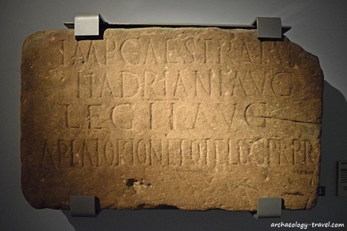
Fig. 4 Stone inscribed c. 122-124 to
verify that Hadrian’s Wall had been authorised by the
Emperor personally around 122 that section having been built by Legion
II Augusta
Indeed another monumental artefact bore witness to the
approximate completion date of the Wall around 136 adding testimony to
one of the other total of three legions which carried out the massive
project found near the east gate of Moresby fort translated to read:
“(This work) of the Emperor Caesar Trajan Hadrian Augustus, father of
his country, the XX Legion Valeria Victrix (built).” (stone dated
128-138). Fig. 5 A section of the Great Wall of China showing some
fortlets. Another parallel for a stone wall erected as a solid symbol of
ownership to those outside hordes are the early stages of China’s Great
Wall initiated by the first Emperor some time around 200 BC. The wall’s
height and breadth could not prevent them crossing it but any such
breach of the stone ramparts was a sure passport to big trouble for
those warlike groups not remaining on their side of it. The more well
known Great Wall of China with high walls lined with castellations along
wide interconnecting fortifications was modified and amplified to this
impressive megastructure during the Ming Dynasty (1368-1644) but this
battle-ready bastion saw very little wartime activity during the tenure
of this legendary ruling clan famous for their ornate blue pottery.
4. THE APPARENT ENIGMA OF THE VALLUM – ITS REAL FUNCTION
 |
“Once we accept our limits, we go beyond
them” – Albert Einstein |
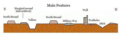
Fig. 6 Cross sectional diagram of the
Wall construction
Many writers have dismissed the inclusion of the Vallum as
inexplicable in its function. The Vallum is a trench dug inside the
south side of the Wall with earth mounds lining the top edges on both
sides running for its entire length apart from where natural features
like rocky outcrops or river banks interrupt its progress. One
author states that it has been surveyed like a road but is unlikely to
have been used for this reason while another pronounces it may have been
included as an additional defensive mechanism as an obstruction to
invading armies. At its depth and location in addition to the many
lengths of narrow wall too thin from which to wage even defence by a
single line of archers let alone catapults or pots of boiling oil it
would appear less probable that the Vallum was placed to serve any
credible second line of resistance after this first ineffective barrier
had been breached by any sizeable swarms of invading marauders.
If I may digress now to a much earlier archaic period in
pre-Roman history in support of my suggestion that the Vallum in fact
formed part of the traditional techniques of construction adopted for
the creation of boundaries first attributed to Aeneas who is said by
mythology to be the direct ancestor of Romulus and Remus, the mythical
wolf-suckling twins who founded Rome. As an illustration of the
extent to which the Romans incorporated the establishment of new towns
into their folkloric sagas the writer Virgil describes how Aeneas
founded a city in Sicily:
“Meanwhile Aeneas marks the city out
By ploughing; then he draws the homes by lot”
All Roman Surveyors were aware through their training of
the old custom whereby the limits of a new town were marked out by the
consul by ploughing a furrow around it. Another author Ovid, a studier
of the law including that pertaining to surveying, said that the
dividing up of land with balks (limites) by a “careful measurer” (cautus
mensor) emphasised the importance attached to the art of surveying.
The line drawn around a town was referred to by Virgil
as sulcus primigenius (“the original furrow”) and was monumented with
boundary stones according to Tacitus and Plutarch. Actual boundary
stones have been discovered at Capua placed during the Second
Triumvirate bearing inscriptions “By order of Caesar (Octavian), on the
line ploughed”. When the Emperor wanted to extend the limits of Rome he
maintained the traditional inclusion of the “original furrow” placing
inscriptional carved boundary stones which are still present today in
evidence to his realignment of the boundaries of the eternal city.
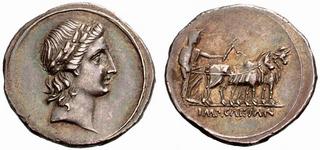
Fig. 7 Caesar Augustus coin (29-27 BC)
with the ploughing of Rome’s first boundary furrow
Revered first Emperor Caesar Augustus so much cherished
the ancient folklore of Rome that he had a Denarius coin struck dated c.
29-27 BC with his bust on the obverse and the ploughing of Rome’s first
boundary furrow on the reverse during his reign for the citizens to bear
recognition of their hallowed traditions. Emulating his legendary idol
Caesar Augustus Hadrian was not going to miss a chance to present
himself in a similar portrayal of himself as the City Founder ploughing
the new boundaries with a team of oxen on a coin from Aelia Capitolina
(Jerusalem) in about 131-136 AD in a very clear demonstration of his
admiration for his predecessor together with the folkloric divine
creation of a limes in the form of a Vallum or Pomerium.
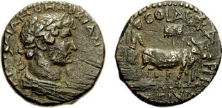
Fig. 8 Hadrian coin (c.131-136 AD) with
the symbolic ploughing of a new first boundary furrow
Indeed the folklore of the birth of Rome itself said to
be in 753 BC has Romulus and Remus as direct descendants of the Trojan
Prince Aeneas founding the new city. One version of the myth has
Romulus cutting a sulcus primigenius (first furrow) around the perimeter
of where he decreed the city limits to be incorporating the Palatine and
Capitoline Hills just as his ancestor Aeneas had done in other towns
before him in what is believed to be an Etruscan ritual which was
inclusive of the proposed line undergoing selection and final placement
by auguries exercising divine control. In this recital of the folkloric
epic when Remus ridicules this action by his brother by jumping back and
forth over the sacred furrow Romulus kills him in what must be regarded
as an extreme act in border control indeed. Subsequently a
substantial wall was erected outside this trench with the area between
the inside of the wall up to and including the ditch being termed “The
Pomerium” within which building construction was forbidden together with
other bans prohibiting various legal actions otherwise enforceable
within the inner property zone by the duly empowered judicial
appointees. Entry from outside this line of strong delineation
could take place only with permission granted by those authorities
entrusted with the protection of the livelihoods of the citizens of
Rome. In fact the dictator Lucius Cornelius Sulla expanded the limits
of the City of Rome in 80 BC in an act of absolute power with his new
town limits further marked out by white marker stones called cippi which
were commissioned by Claudius to delineate his extension of The Pomerium
some of which survey monuments are still in situ today as recorded by
Tacitus and outlined by Aulus Gellius.
The Romans even had a god called Terminus - God of the Boundary
Stones closely affiliated with the principal deity Jupiter. Indeed
it is the Romans who introduced the Feast of Terminalia which is an
annual ceremony with pomp, pageantry and identification of the boundary
stone monuments designating the area within which protection is
guaranteed and order maintained. Boundary stones took many
different forms with particular types of monuments being set to indicate
the nature of the tenure under which the enclosed properties were held.
Another absolutely
splendid effort in scholarly publishing is Brian Campbell’s
handsome volume on “The Writings of the Roman Land Surveyors”
(in Latin Corpus Agrimensorum Romanum) which most astutely
translates the Latin texts of the Roman authors who compiled a
veritable instructional handbook on how surveying was to be
conducted within the Roman Empire. May I say that this work is
extraordinary and has given me a detailed appreciation for the
technical and judicial expertise which was vested in the
Surveyors privileged to undertake such activities for the
administratively thorough control imposed upon its charges.
I need to clarify the interpretation of the word Vallum as
literally it means a “mound of earth” but in the context of
Hadrian’s Wall it more specifically describes the trench
following the line of the limes or boundary line which has
mounds of earth along its top edges just as the sulcus
primigenius (“first furrow”) had placed along its upper edges
formed from the earth excavated from the trench itself. |
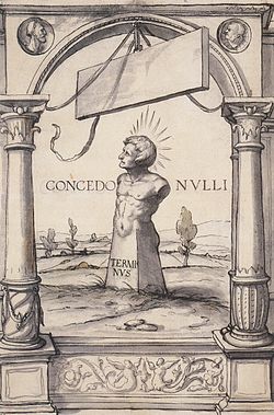
Fig. 9 Terminus as a boundary stone |
To
my amazement and delight on page 273 of Brian’s superb book he deciphers
the original Latin text in the Section “…Discussion About Lands” to say:
“Villa comes from vallum, that is, a heap of earth, which is normally
established in front of a limes” which is actually the borderline of the
outside extremity of a Roman frontier dividing it from international
lands held by neighbouring nations or peoples. Furthermore on page
263 under the title: “Here Begins a Discussion of Boundary Markers Set
Up in Various Provinces” is stated:
“I have established a small ditch, which was dug out, on
a boundary as a marker.
Bigger ditches you will also certainly find as boundary markers.
You will undoubtedly discover a raised limes, that is, a balk.
I have built walls from limestone to mark boundaries.
I have established banks that have been dug out to mark boundaries.
You will find piles of earth marking boundaries.”
These incredible discoveries add firm weight that the
Vallum incorporated within the design specifications for Hadrian’s Wall
was following those strict instructions laid down in the Roman Surveyors
Instruction Manual for the presentation of an International Border Line.
This invaluable nexus to the times of the Roman surveyors translates a
voluminous corpus of texts providing all historians but more especially
surveyors with a detailed overview of what types of boundary marking
were carried out, classifications of land types, as well as all manner
of natural feature which could be adopted as boundary lines where
suitable. There are even descriptions and diagrams of what style
boundary markers and boundary stones were to take in given
circumstances. For any interested Surveyor historian this
publication is a must-have and I would recommend the supplier “Book
Depository” on the internet who have the best price together with free
delivery anywhere in the world!
In an historical essay in what has been termed by its
composer as “the puzzle of the Vallum” this scholar went one giant step
towards explaining “the inexplicable!” Published in a 1921 issue of a
journal called “The Vasculum” R.G. Collingwood titled his work: “The
Purpose of the Roman Wall” in which he says: “… the continuous line was
at first designed to serve simply as a mark to show where the Roman
territory ended.” Precisely Mr. C as any suggestion that the Vallum was
a defensive earthwork is itself indefensible. For rampaging bands of
villains it was merely a ditch with a speed hump. He goes on to
reiterate: “The puzzle of the Vallum simply disappears when it is
suggested that it was not a defensive work but a frontier-mark, a line
indelibly impressed upon the earth to show the wandering native where he
might not go without accounting for his movements.” Could not have said
it better myself!
Well I am now going to propose a more definitve reason
and origin for the placement of the Vallum combined with its true
purpose. It surprises me that none of these astute writers who are
perplexed by the Vallum have not seized upon the very first indicator of
why this structure was an essential element of this territorial border
line – the Roman names first applied to it were the Vallum Hadriani or
the Vallum Aeliani or Aelium (Hadrian’s family name was Aelius).
With strict adherence to the instructions issued to the Roman land
surveyors to delineate a limes (international line of demarcation) it
was an explicit directive to make a Vallum (literally “earth mound”).
Naturally to form the earth mound required to construct this visible
line of subdivision the quickest way available the legionary project
supervisors devised the earthwork technique of digging the required
quantity of material from the ground leaving a trench alongside then
stacking the spoil solidly along the edge of this continuous excavation.
Hence once again illustrating the interpretation of the meaning of a
Vallum evolved to include the trench AND the mound in its description.
With the benefit of the aforementioned facts to
corroborate my following pronouncement may I propose that the Vallum was
the first inclusion in the design for the limes (boundary line) to
demarcate the northern limit of Rome’s Empire with the famous Wall an
additional barrier added to provide a show of power. The western
part of this limes was initially placed consisting of a Vallum only
until the stone creation was extended sometime later to complete the
imagery of dominance. Thus the creation of the Vallum was the
first step in the establishment of this northern borderline once again
with the more sturdy stone divider being set at some time well after the
first delineator had been laid down.
5. WALL DESIGN AND CHARACTERISTICS
“Make the
workmanship surpass the materials.”
- Ovid (43 BC-17 AD) |
 |
A burning question which has divided all scholars on the
planning, design and project management of this major construction in
the Roman capital works program has been just how much direct personal
association the Emperor Hadrian himself had in its detail and execution.
Well another author with whom I forthrightly concur is Paul Frodsham who
mounts a compelling argument in his book: “Hadrian and His Wall” that
the architecturally inclined Ruler not only had input into the
pre-planning of the Wall’s design but also personally directed some
aspects of the building work while on his site inspection during the
Britannic leg of his Royal Tour. With such a notion in mind it is
not hard for me to further incorporate Hadrian’s penchant for history
and tradition as alluded to previously in hypothesizing that the Vallum
was added during the erection of the Wall at its earliest incarnation to
create the true legendary image of a boundary line as had been initiated
by Aeneas, Romulus and a host of his predecessors in very much a
recreation of The Pomerium originally enclosing the Eternal City of Rome
itself. Such a final masterpiece with historic overtures would
most certainly have pleased the man mostly honoured with the exceptional
monument bearing his name for posterity to admire and marvel upon.
Within the wall were incorporated what have been called
milecastles due to their occurrence at every Roman mile thus totalling
80 with two turrets in between each of these structures to provide look
out posts at each intervening 1/3 Roman mile thus adding up to be about
160 thereto. Apart from offering a view to the north to detect
foreign troop movements all of the manned stations looked more clearly
towards the south to allow for a continuous ability to forewarn
regiments of soldiers camped within the forts and villages of impending
assault.
As has been irrefutably established by many more learned
of the Wall than I for a considerable percentage of its length it was
not a fortified bastion or even bore formidable dimensions to singularly
deflect any major incursions. The size of the Wall varied from a
nominal height of 10 feet (3 metres) with an equivalent width up to 20
feet (6 metres) high also with a matching girth so for much of its
coverage the sections with the lesser height presented no significant
restriction to those warring groups who wished to create conflict on
their foreign oppressors.
Fig. 10 Photo of the US/Canada borderline which is the
unfenced trench at Blaine in Washington state |
A modern example of a trench being
placed to demonstrate the division between two countries can be
found even today on the US/Canadian borderline at the north
western US town of Blaine within the which my very good friends
Denny and Delores Demeyer reside. Even though the depth and
width of this sunken barrier does not preclude access there will
always be a very interested US Border Patrolman staking out his
continuous vigil on the southern side of the border keeping a
very concerned eye over anyone making an unauthorized or
uninvited crossing of this line of division with a similar
intent as those Roman sentries who manned the turrets along the
lengths of Hadrian’s Wall. |
6. SURVEYING AND BUILDING THE WALL
 |
“Every wall is a door”
– Ralph Waldo Emerson. |
I am quite sure that Hadrian had no desire to make his Wall anything
like a door to encourage hostile northern tribes to cross into the Roman
domain but the deterrent qualities of his Wall were not so physical
rather than more indicative for in some ways his Wall was very passable
not representing a true decisive barrier to opposing camps. Three
legions were assigned the duty of erecting this symbol of territorial
division II Augustus, VI Victrix and XX Valeria Victrix but upon its
completion it was manned by auxiliaries rather the legions themselves
which were called to other pressing duties somewhere removed within the
extensive perimeter of the Roman Empire. There is some
inscriptional evidence for a detachment of the British Fleet making some
of the granaries at the forts.
All materials used upon the Wall construction were
quarried locally thus giving the final product a variety of finish only
possible through the utilisation of natural resources sourced from the
surrounding geological deposits with their distinctive evolutionary
origins and nearby timber where such wooden carpentry was included or
necessary.
Through a very excellent and thoroughly researched
publication by Peter Hill titled: “The Construction of Hadrian’s Wall”,
Peter has estimated just how many legionary surveyors were available to
carry out the task of surveying the long straight sections of the wall
construction as well as the likely work schedule providing a likely time
for completion of the survey work required. For the reconnaissance and
surveying required to facilitate the site selection and final
positioning of the Wall I have formulated the Survey Work Statement for
the activities necessary for a project of this proportion. Departing
from any possible ritual selection of the Wall’s location by the Consul
or auguries the ultimate function of this divisional barrier was to
signify the limit of territorial governance while also setting an
adequate line of sight both northerly and southerly for the sentries on
watch to detect any likely trouble which may have been brewing along
with the dual capacity to sound the alert of any likely attack.
Later I am going to inform you of how many surveyors
were available to each Roman legion as indicative of just how much
manpower was devoted to the vital capacity of carrying out the survey
requirements for the Roman nation throughout its widely distributed
colonies.
The first duty was to survey and fix the exact line of the Wall such
location governed by the preceding parameters of sight lines and
prevailing topography taking into account interceding natural features
which themselves could serve as obstructions to foreign access such as
cliffs, riverbanks and whinsills. Due to the extensive period of
time during which the nearby land had already been under occupation it
is quite likely that the preliminary scouting party had a fairly
definitive idea of where the Wall would be best placed with the crags of
the whinsills dividing the future work into western and eastern sectors
punctuated by this extant natural barrier building westerly towards the
Solway Firth and in the opposite direction to the Tyne River.
During this reconnaissance the surveyors would have left small rock
cairns possibly with a small line of stones in the direction towards the
next visible marker or landmark as well as stakes between which the
later construction survey parties could align straight sections of wall
and make realignments for angles where necessary. As these
probably wooden stakes may not have been painted another contemporary
author on the Roman surveyors observed these men placing stakes with
flags on them for easier sighting against a camouflaging background of
similarly textured vegetation. The ultimate route chosen ran
between the banks of the River Tyne near Wallsend on the eastern
seaboard and the shores of Solway Firth at the western end. Peter
Hill estimates that there were about 10 mensores (surveyors) present in
each legion forming part of a group known as the immunes as with their
fellow professional compatriots such as architects, engineers, builders
et al as they were immuned from carrying out other military work due to
the requirements of their designated speciality. The surveyors
were called mensori (singular mensore) with a team of them referred to
as a metatore. This meant that there was a surveying pool of
around 30 surveyors to lay out the straight lines where they could fit
the landscape as well indicating the spots for the erections of
milecastles (every Roman mile) with two intermediate turrets (or look
out towers) at around 1/3 mile separation in addition to selecting sites
for troop encampments for the total workforce.
Without reiterating the specifics of Peter’s
calculations if I may I will summarise the final approximations of the
various sections into which the legionary surveyors may have split their
overall task. In Wall miles the likely sections surveyed were Wallsend
to Ouseburn 3 miles; Ouseburn to Dere Street 18 miles; Dere Street to
North Tyne 5 miles; North Tyne to the eastern end of Whin Sill (MC34) 7
miles; Whin Sill 13 miles; Western end of Whin Sill (say MC46) to
Irthing 3 miles; Irthing to the Eden 17 miles; Eden to Bowness 14 miles.
Peter’s predicted time to complete the initial survey, setting out the
milecastles and turrets most probably from one end together with
straight alignments and angles when required could have done in about a
month. Subsequent construction of the Wall itself is believed to
have taken at least fourteen (14) years with some later modifications
being added after this time where such additions were regarded
necessary. Thus the anticipated completion date for the Wall came
only two years before Hadrian’s passing which meant that he never got to
finally witness his testimonial before his death.
7. HOW LONG DID HADRIAN’S WALL LAST?
|
|
“The reward of a thing well done is
having done it.” – Ralph Waldo Emerson |
Between 139 and 140 (or
some say 142) Hadrian’s successor Antoninus Pius had what is now
known as The Antonine Wall built of earth and timber
substantially further north at about 140 miles (224 kms) by road
than the Wall we are more concerned with connecting a shorter
overall distance of 37 miles (59 km) from the Firth of Forth to
the Firth of Clyde.
Once again the antiquarian Roman name given for this newly
positioned limes was the Vallum Antonini and this new
construction conformed rigidly to the written regulation to make
it a Vallum with the compacted earth mound along the rim of the
dug out channel. This earth wall standing at approximately 10
feet (3m) tall with an average width of 16 feet (5m) so making
this structure an even less imposing deterrent to possible
invasion than Hadrian’s Wall did. As monitoring and observation
of foreign troop movements was vital watch towers and fortlets
made of timber were inserted along this shorter territorial
limit around 100 miles (160 kms) directly north of its more
impressive southern counterpart. |
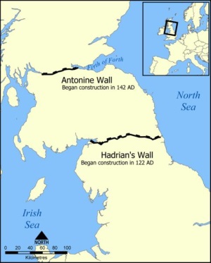
Fig. 11 Map showing the location of Hadrian’s Wall and the later
Antonine Wall |
Even though it had been further
strengthened with the insertion of more forts along its length the order
to abandon this later less substantial barrier was given in 163 with a
troop withdrawal back to the more substantial wall. With reasons
unclear there are some who attribute this retreat to an uprising by the
Brigantes with 15 years of revolts ensuing with other tribes joining the
feisty Caledonians. Periods of rebuilding Hadrian’s Wall due to
damage incurred during this ongoing resistance served to reinforce the
importance of this northern bastion in Rome’s colonies along with
providing it with greater longevity which allows us to enjoy and study
it in the 21st Century. Along with a letter sent in 410 from Roman
Emperor Honorius to the Roman Britannic forces “to look to their own
defences” against the accelerating hostility from the Saxons, Scots,
Picts and Angles came a refusal by Rome to send any reinforcements thus
sounding the death knell for Roman Britain. However Hadrian’s Wall
had represented the symbol of the northern frontier of the Roman Empire
in the West for nearly 300 years being now a celebrated treasure for
archaeologists, historians and land surveyors to swoon and walk over
instead of the hordes of angry tribesmen intent on vengeance during its
time as a boundary divider.
8. SURVEYORS – ROME’S ULTIMATE LAND EXPERTS!
| “Waste no more time
arguing what a good man should be. Be one!” – Marcus Aurelius
|
 |
We know that surveyors were on the list of immunes
because a list of specialists for the legions was compiled in the sixth
century in a law code copied from an earlier (list) put together by a
man known under many similar aliases as Taruttiensus Paternus,
Tarruntiensis or Tarrutenius who was possibly the same individual
mentioned by writer Dio as ab epistulis Latinis (secretary for Latin
correspondence) to Marcus Aurelius then acting as independent military
commander in 179 AD. The military manual written by this man was titled
De Re Militare or Militiarium listing the tasks to be carried out by
stone cutters, carpenters, glass workers, plumbers, cartwrights,
blacksmiths, coppersmiths, lime-burners and charcoal-burners, surveyors
and ditchers as well as several clerical immunes keeping legionary
records of strength, enlistments, discharges, transfers, expenses and
pay records. Architecti were also included as most essential with two
known to be Amandus at Birrens and Aelius Verines at Mainz.
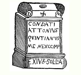
Fig. 12 Stone altar of Attonius Quintianus |
A most exciting discovery was a record of the discovery of
stone altar in 1709 at a place called Coniscliffe which I can
gather is near Piercebridge which unfortunately is now lost.
From the adjacent sketch the inscription is interpreted to say:
D(eo) M(aris)
Condati
Attonius
Quintianus
Men(sor) evoc(atus) imp(erratum)
Exins(su) sol(vit) l(ibens) a(nime) |
This inscription translates to be: “To the god Mars
Condates, Attonius Quintianus, Surveyor Evocatus, gladly fulfilled the
command by order.” What a brilliant find decoded by Gales, Thoresby and
Horsley said to be placed between 43 and 410 AD so most probably during
the time frame associated with Hadrian’s Wall but more thrillingly it
was funded by a Surveyor who is purported to be at the time a Mensor
Evocatus which is a military specialist having completed in excess of 16
years service purported to be receiving a most impressive salary of
200,000 sesterces per annum and may even have attained the rank of chief
centurion or praefect which is of great eminence within the realms of
the Roman legions. To understand the value of the Roman currency at the
time that this surveyor lived please see Appendix C at the end of this
paper. However I will quantify our man’s salary through comparison with
other amounts paid to differing levels of officials and legionaries.
From the time of Domitian (81-96 AD) a legionary was paid 1,200
sesterces per annum, a Centurion 20,000, a Chief Centurion 100,000, a
Procurator 60,000-100,000 while a Senior Proconsul, the Prefect of Egypt
and a senior Legate were on a hefty 400,000 pa. A small farm was valued
around 100,000 while an upmarket seaside villa in Italy or large estate
in the same country would set you back 3 million sestarces. Thus our
man Attonius was doing very very well indeed so it is not unexpected
that another erudite Roman official would portray the land surveyor in
the image of some sort of wizard or great mediator in his illustrious
5th century dissertation. It is heartening to note that a Councillor in
some Italian towns was paid 100,000 per annum being half of what our
surveyor Attonius was believed to be worth!
Without having to explain to other surveyors the essential and
indispensable work done by all of our illustrious colleagues it is time
for me to once again cite the description of a Roman official from a
time late in the civilisation’s existence even after the crushing
defeats at the hands of at a time when it would be contemplated that all
authority had been usurped from those legionary surveyors which were
part of an elite squad of professionals known as “the immunes.”
Enriching the status already attained by the land surveyors of Rome
during the mightiest eras of this imperious Empire it is not surprising
that erudite and astute Roman officials such as Cassiodorus when
referring to the agrimensore (land surveyor) could proclaim:
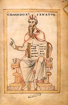
“He walks not as other men walk !”
| To see the entire quotation of this
very wise and astute man please look up my previous paper “Four
Surveyors of Caesar: Mapping the World” to understand a full
appreciation for just how well regarded the Roman surveyors were
combined with the awe with which their activities were held in
Roman society. |
 |
CONCLUSION
Hence to summarise my analysis of Hadrian’s Wall may I
please pronounce that the Wall had a principal function as a boundary
demarcation monument which designated the limit of the territory for
which Rome claimed jurisdiction and control over while being built with
symbolic recognition for the traditional formation adopted by the mighty
Empire for the limits of its cities and lands from the very first sulcus
primigenius marked out by the Founder of Rome which included such a
first furrow or trench adjoining the earthen mound known as the Vallum
which was the actual boundary of the limes or International Boundary
Line for the Roman Colony of Britannia.
For such a idyllic model of Roman greatness in engineering and
surveying to be so widely recognised by anyone anywhere in the world
truly links our profession with another legendary landmark which serves
as testimony to all who hear about or study this ancient edifice to the
skills that surveyors have demonstrated from the earliest times of
history even before such feats were recorded by the first historians.
 |
 |
|
Fig. 12 Hadrian’s mausoleum in Rome at the |
Fig. 13 Hadrian the Great Emperor |
It makes me proud and truly grateful to see a nation
like Finland whose surveyors have been forthright in claiming their
rightful status within the community and with whom it is a delightful
privilege and distinction to share this memorable FIG Working Week at
Helsinki in 2017 amongst men and women of dignity and achievement of all
ages from all corners of the globe (even though the globe is an oblate
spheroid?).
DEDICATION AND APPRECIATION
May I take this opportunity to dedicate this paper and presentation
to my very best friend in the World of Surveying History Jan De Graeve,
Chairman of our FIG International Institution for the History of
Surveying and Measurement from Brussels in Belgium for his dedicated and
tireless devotion to preserving and highlighting the marvels of the
History of Surveying across the entire planet demonstrative of his
passionate love of our most colourful Profession. Jan’s
encouragement and support to me over the many years during which we have
known each other since the wonderful XX FIG Congress in Melbourne in
1994 have always driven me to go further than circumstances would permit
and my obsessive love of Surveying History is matched only by my love
for him.
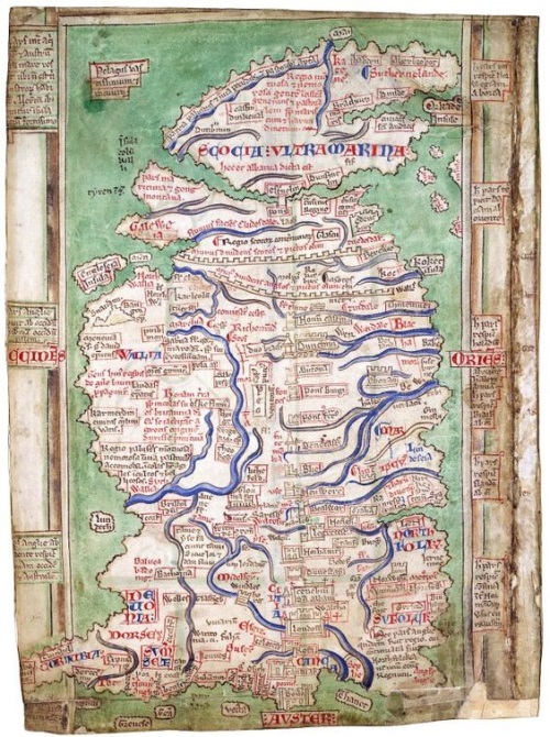
APPENDIX A
Reproduction of a 1250’s Map of Britain by Matthew Paris (who was a
monk at St. Alban’s Abbey) showing both Hadrian’s Wall and the Antonine
Wall despite being depicted incorrectly in a geographical perspective.
APPENDIX B
Table of Roman Standards of Distance Measurement
| 1 Roman inch = uncia = 0.97 Imp. inch = 24.6 mm |
| 1 Roman foot = pes = 0.97 Imp. foot = 0.296 metre |
| 1 pace (passus) = 5 Roman feet = 4.854 Imp. feet = 1.48 metres
|
| 1/8 Roman mile = 125 paces = a stadium = 625 Roman feet = 607 Imp. ft
(185m) |
| 1 Roman mile = 1000 paces = a miliarium = 5000 Roman feet = 4854 Imp.
feet = 1479.5 metres |
| 1500 paces = a lewa = 7500 Roman feet = 7281 Imp. feet =
2219 metres |
APPENDIX C
Table of Roman monetary values
| 1 gold aureus = 25 silver denarii = 100
bronze sesterii = 400 asses |
| 1 silver denarius = 4 bronze sesterii = 16 asses |
| 1 bronze sestertius = 4 asses |
APPENDIX D
List of Roman Emperors during the Imperial Period from Augustus to
the abandonment of Hadrian’s Wall in 411 AD
| Julio-Claudian Dynasty |
27 BC – 69 AD |
| Augustus |
27 BC – 14 AD |
| Tiberius |
14 – 37 AD |
| Gaius Germanicus (Caligula) |
37 – 41 AD |
| Claudius |
41 – 54 AD |
| Nero |
54 – 68 AD |
| Galba |
68 – 69 AD |
| Otho |
69 AD |
| Vitellius |
69 AD |
| Flavian Dynasty |
69 – 96 AD |
| Vespasian |
69 – 79 AD |
| Titus |
79 – 81 AD |
| Domitian |
81 – 96 AD |
| The Five Good Emperors |
96 – 180 AD |
| Nerva |
98 -117 AD |
| Trajan |
98 -117 AD |
| Hadrian |
117 – 138 AD |
| Antoninus Pius |
138 – 161 AD |
| Marcus Aurelius |
161 – 180 AD |
| Antonine Dynasty
|
138 – 193 AD |
| Antoninus Pius |
138 – 161 AD |
| Marcus Aurelius |
161 – 180 AD |
| with Lucius Verus |
161 – 169 AD |
| Commodus |
177 – 192 AD |
| with Marcus Aurelius |
177 – 180 AD |
| Pertinax |
193 AD |
| Didius Julianus |
193 AD |
| Pescennius Niger |
194 AD |
| Severan Dynasty |
193 – 235 AD |
| Septimus |
193 – 211 AD |
| Caracalla |
211 – 217 AD |
| with Geta |
211 – 121 AD |
| Macrinus |
217 – 218 AD |
| Diadumenianus |
218 AD |
| Elagabalus |
218 – 222 AD |
| Alexander Severus |
222 – 235 AD |
| The Soldier Emperors |
235 – 305 AD |
| Maximinus I |
235 – 238 AD |
| Gordian I and II (in Africa) |
238 AD |
| Balbinus and Pupienus (in Italy) |
238 AD |
| Gordian III |
238 – 244 AD |
| Philip the Arab |
244 – 249 AD |
| Trajan Decius |
249 – 251 AD |
| Trebonianus Gallus (with Volusian) |
251 – 253 AD |
| Aemilianus |
253 AD |
| Gallienus |
253 – 260 AD |
| Gallic Empire (West)
|
|
| following the death of Valerian |
|
| Postumus |
260 -269 AD |
| Laelian |
268 AD |
| Marius |
268 AD |
| Victorinus |
268 – 270 AD |
| Domitianus |
271 AD |
| Tetricus I and II |
270 – 274 AD |
| Palmyrene Empire |
|
| Odenathus |
c.250 -267 AD |
| Valballathus (with Zenobia) |
267 – 272 AD |
| The Soldier Emperors
(continued) |
|
| Claudius II Gothicus |
268 – 270 AD |
| Quintillus |
270 AD |
| Aurelian |
270 – 275 AD |
| Tacitus |
275 – 276 AD |
| Florianus |
276 AD |
| Probus |
276 – 282 AD |
| Carus |
282 – 283 AD |
| Carinus |
283 – 284 AD |
| Numerianus |
283 – 284 AD |
| Dioclatian (and Tetrarchy) |
284 – 305 AD |
| Western Roman Empire
|
|
| Maximianus |
287 – 305 AD |
| Constantinus I |
305 – 306 AD |
| Severus II |
306 – 307 AD |
| Constantine I (The
Great) |
307 – 337 AD |
| Eastern Roman Empire
|
|
| Diocletian |
284 – 305 AD |
| Galerius |
305 – 311 AD |
| Maxentius (Italy) |
306 – 312 AD |
| Maximinus Daia |
309 – 313 AD |
| Licinius |
308 – 324 AD |
| Constantine Dynasty |
337 – 364 AD |
| Empire reunited by Constantine’s defeat
of Licinius |
|
| Constantine II |
337 – 340 AD |
| Constans |
337 – 350 AD |
| Constantius II |
337 – 361 AD |
| Magnentius |
350 – 353 AD |
| Julian |
361 – 363 AD |
| Jovian |
363 – 364 AD |
| Western Roman Empire (after
death of Jovian) |
|
| Valentinian |
364 – 375 AD |
| Gratian |
375 – 383 AD |
| Valentinian II |
375 – 392 AD |
| Eugenius |
392 – 394 AD |
| Honorius |
395 – 423 AD |
| Eastern Roman Empire (after death of
Jovian) |
|
| Valens |
364 – 378 AD |
| Theodosius I |
379 – 395 AD |
| Arcadius |
395 – 408 AD |
| Theodosius II |
408 – 450 AD |
BIBLIOGRAPHY
| 1 |
Breeze, David |
Hadrian’s Wall – English Heritage Guidebook (English
Heritage, 2015) |
| 2 |
Breeze, David |
The Antonine Wall, (Birlinn Ltd., UK, 2009) |
| 3 |
Brock, John F. |
“Four Surveyors of Caesar: Mapping the World”
FIG History Symposium, (FIG Working Week 2012, Rome, Italy) |
| 4 |
Brock, John F. |
“The Great Wall of China: The World’s Greatest Boundary
Monument”,
FIG History Symposium, (XXV FIG Congress 2014, Kuala Lumpur,
Malaysia.) |
| 5 |
Bruce, John Collingwood |
The Wall of Hadrian, With Especial Reference to Recent
Discoveries – Two Lectures (1874) (Kessinger Publishing) |
|
6 |
Burton, Anthony |
Hadrian’s Wall Path – Official National Trail Guide, (Aurum
Press Ltd., London, 2016) |
|
7 |
Campbell, Brian |
The Writings of the Roman Land Surveyors; Introduction, Text
and Commentary, (The Society for the Promotion of Roman Studies,
London, 2000) |
|
8 |
Carter, Geoff |
“Theoretical Structural Archaeology” 40. Reverse engineering
the Vallum (29 November, 2014) |
| 9 |
Collingwood, R. G. (MA, FSA) |
“The Purpose of the Roman Wall”, The Vasculum, The North
Country Quarterly of Science and Local History, Vol. VIII No. 1
October, 1921) |
| 10 |
De La Bedoye |
Guy, Hadrian’s Wall: History and Guide, (Amberley, 2010) |
|
11 |
Dietrich, William |
Hadrian’s Wall: A Novel, (HarperTorch, NY, 2005) |
| 12 |
Dijokiene,Dalia |
“The Impact of Historical Suburbs on the Structural
Development of Cities (based on examples of European
cities)”, Department of Urban Design, Vilnius
Gediminas Technical University |
| 13 |
Eliot, Paul |
Everyday Life of a Soldier on Hadrian’s Wall, (Fonthill
Media, 2015) |
| 14 |
Fields, Nic |
Hadrian’s Wall AD 122-410, (Osprey Publishing Ltd., Oxford,
UK, 2010) |
| 15 |
Fields, Nic |
Rome’s Northern Frontier AD 70-235, (Osprey Publishing Ltd.,
Oxford, UK, 2008) |
|
16 |
Frodsham, Paul |
Hadrian and His Wall, (Northern Heritage Publishing, UK,
2013) |
|
17 |
Geldard, Ed |
Hadrian’s Wall – Edge of an Empire, (The Crowood Press Ltd.,
Wiltshire, 2011) |
| 18 |
Gonzale-Garcia |
A.C. Rodriguez-Anton, A. and Belmonte, J.A., “The
Orientation of Roman Towns in Hispania: Preliminary Results”,
Mediterranean Archaeology and Archaeometry, Vol.14 No. 3 (2014),
pp 107-119 |
|
19 |
Hill, Peter |
The Construction of Hadrian’s Wall, (Tempus Publishing Ltd.,
Great Britain, 2006) |
| 20 |
Jones, Clifford |
Hadrian’s Wall: An Archaeological Walking Guide,(The History
Press UK, 2012) |
| 21 |
Mark, Joshua J. |
“Hadrian’s Wall” (15 Nov., 2012.)
www.ancient.eu/Hadrians_Wall/ |
|
22 |
Moorhead |
Sam and Stuttard, David, The Romans Who Shaped Britain
(Thames & Hudson Ltd., London, 2012) |
| 23 |
Mothersole, Jessie |
Hadrian’s Wall, (Lightning Source UK Ltd.) |
| 24 |
Pham, Mylinh Van |
“Hadrian’s Wall: A Study in Function” (2014). Master’s
Thesis, Paper 4509, San Jose State University |
| 25 |
Poulter, John |
Surveying Roman Military Landscapes Across Northern
Britain: The Planning of Romand Dere Street, Hadrian’s Wall and
the Vallum, and the Antonine Wall in Scotland, (Archaeopress and
John Poulter, 2009) |
|
26 |
Richards, Mark |
Hadrian’s Wall Path Map Booklet: 1:25,000 Route Mapping’
(Cicerone Press, 2015) |
| 27 |
Richards, Mark |
The Spirit of Hadrian’s Wall, (Cicerone, Cumbria, 2008) |
| 28 |
Shotter, David C.A. |
The Roman Frontier in Britain: Hadrian’s Wall, the Antonine
Wall and Roman Policy in Scotland, (Carnegie Pub., 1996) |
|
29 |
Simpson, Gerald |
The Turf Wall of Hadrian 1895-1935, (Read Books, 2011) |
| 30 |
Southern, Patricia |
Hadrian’s Wall: Everyday Life on a Roman Frontier, (Amberley
Pub., UK, 2016) |
|
31 |
UNESCO |
“Frontiers of the Roman Empire WHS – Hadrian’s Wall
Management Plan 2008-14 |
| 32 |
Wilmott, Tony |
Hadrian’s Wall – Archaeological Research by English Heritage
1976-2000, (English Heritage, 2009) |
On the net:
| 1 |
Northumberland History – England’s North East, Hadrian’s
Wall:
www.englandsnortheast.co.uk/HadriansWall.html |
| 2 |
“The history of Hadrian’s Wall” – (22/01/2017):
explore-hadrians-wall.com/history/ |
| 3 |
h2g2 – “A Short History of the Roman Legion from the
Republic to the Imperial Era” (created Dec. 5, 2016)
h2g2.com/edited_entry/A87874096 |
BIOGRAPHY
Private land surveyor since 1973, Bachelor of Surveying (UNSW
1978), MA (Egyptology) from Macquarie Uni., Sydney (2000), Registered
Surveyor NSW 1981. Now Director of Brock Surveys at Parramatta (near
Sydney). Papers presented worldwide inc. Egypt, Germany, France, Hong
Kong, Canada, Brunei, New Zealand, Greece, UK, USA, Israel, PNG, Sweden,
Italy, Nigeria, Malaysia, Morocco and Bulgaria. Since 2002 regular
column Downunder Currents, RICS magazine (London) Geomatics World.
Stalwart of FIG Institution: History of Surveying & Measurement awarded
FIG Article of the Month March 2005 for: “Four Surveyors of the Gods:
XVIII Dynasty of New Kingdom Egypt (c.1400 BC)”, January 2012 – “Four
Surveyors of Caesar: Mapping the World” & June 2014 – “The Great Wall of
China: The World’s Greatest Boundary Monument.” Institution of Surveyors
NSW Awards – Halloran Award 1996 for Contributions to Surveying History,
Fellow ISNSW 1990 & 2002 Professional Surveyor of the Year. First
international Life Member of the Surveyors Historical Society (USA),
Rundle Foundation for Egyptian Archaeology & Parramatta Historical
Society, Foundation Member Australian National Maritime Museum & Friends
of National Museum of Australia. Member of Bradman Crest, International
Map Collectors Society, Royal Australian Historical Society, Hills
District Historical Society, Prospect Heritage Trust, Friend of Fossils
(Canowindra), Friends of May’s Hill and St. John’s Cemeteries.
CONTACTS
John Francis Brock
P.O. Box 9159,
HARRIS PARK NSW 2150, AUSTRALIA
Tel: +61(0)414 910 898
Email:
brocksurveys@bigpond.com
|


