FIG Article of the
Month - October 2021
|
FIG e-Working Week 2021 Keynote: The Impact
of COVID 19 on the Profession
Steven Ramage (GEO), Léa Bodossian (EuroGeographics) and Benjamin
Davis (FAO) with chair Kate Fairlie
Instead of a paper we would like to share with you a series of video
recordings from the keynote sessions of FIG e-Working Week 2021.
In October’s "Video of the Month" Steven Ramage, Léa Bodossian and
Benjamin Davis talk with Kate Fairlie about the impact the global
coronavirus pandemic has had on the geospatial industry worldwide and
the ways in which surveying and geospatial professionals have adapted to
these unexpected circumstances.
Are we still talking about covid-19? How we
could not?! There is no question that the global pandemic has
fundamentally changed the geospatial industry worldwide – whether it be
the way we work, the growth of digitalisation and the ever-growing
ubiquity of geospatial. But what permanent changes from our profession’s
pandemic response will we take forward? And what have we learned to
tackle tomorrow’s problems, before they happen?
The impacts of the global pandemic are not equal across cultures and
economies: different regions, different specialisations, different
sectors and industries have all been affected – and hence responded – in
different ways. Covid-19 has exacerbated the inequalities that exist –
furthering the divides between urban and rural, rich and poor, developed
and developing. Given the spatial dimensions at play, the surveying
profession arguably has a responsibility not just to respond, but to
direct change for the better, allowing us to use this break from reality
as an opportunity to leave poor practices behind, and embrace innovative
good practices in the future.
This session took the lens of three member-oriented international
organisations – GEO, EuroGeographics and FAO - to determine what impacts
they and their networks have experienced, how they are adapting, and
what they see as the future of the surveying and geospatial professions
in a post-pandemic world.
Equality was a major theme of the session, with supporting themes
including knowledge management, digitalisation and gender. Some key
points and takeaways for FIG included:
- Covid-19, through videoconferencing uptake and growth in
familiarity, has increased the speed and accessibility of
collaboration. Whether this has flattened existing hierarchies is
more nuanced: certainly there has been greater opportunity to
decentralise organisational knowledge and meeting attendance – but
this has not brought about universal inclusion. Steven reported
being asked for funding to enable speakers to buy sufficient data to
be able to present at key events, whilst Ben noted that some
projects with vulnerable and remote populations had been curtailed
due to limitations of reach. For FIG, there is a clear need to be
explicit about the nuances of openness, participation and
accessibility.
- Greater online presence and interaction also facilitates
knowledge management and peer-to-peer support across contexts – for
example, European cadastres were able to learn from each
other when digitalising and transitioning to online service
provision; in a hackathon that GEO supported, indigenous communities
from Kenya and Brazil worked together online to develop a spatial
app meeting their mutual challenges. There is a clear opportunity
for FIG to embrace and build on such initiatives.
- Recognition of the unequal burden of pandemic impacts on
women remains a key area of concern. These burdens range
from increased home and care responsibilities, greater likelihood of
job losses and exacerbation of existing inequalities – especially
around land tenure, loss of health services, increases in
gender-based violence, etc. This echoes growing recognition within
FIG of the need for enhanced work on gender, diversity and inclusion
– and gender and diversity issues should certainly remain at the
forefront of FIG’s agenda.
Our speakers had three distinct calls to action:
- To recognise the long-term consequences and many different
dimensions of inequality and particularly recognise that inequality
isn’t inevitable but does need to be explicitly addressed.
- To capitalise on the pace of policy change that was realised to
enable digitalisation of cadastres during the pandemic, and to use
these mechanisms and continued impetus to address inequalities.
- The need for FIG to look beyond our areas of specialisation to
really apply these to other domains and existing challenges – from
supply chains through to accelerating digital transformations and
governance.
As we’re all aware, Covid-19 has been a game changer in accelerating
widespread digitalisation and adoption of spatial data for analysis and
visualisation, and many geospatial professionals have been at the centre
of response, reporting and mitigation initiatives. Covid-19 has also
seen a slow but determined transition from the focus on technology and
policy, to a re-emphasis on people. As a community of professionals, FIG
has a responsibility to continue this focus – recognising that people,
and ensuring equality, are at the core of what we do. The clear
challenge to us all remains in moving beyond ‘reactivity’ to
‘proactivity’ in this new ‘covid endemic’ landscape.
Watch and be inspired by the keynote session here:
https://youtu.be/UGjxNG1l6Nw
About the keynote speakers
 |
Benjamin Davis,
Director, Inclusive Rural
Transformation and Gender Equality Division FAO
Benjamin has extensive experience in social protection,
social policies and agricultural economics.
He previously served
as Strategic Progrmme Leader, Rural Poverty Reduction and Deputy
Director of the Agricultural Development Economics Division at
FAO and he was team leader of the From Production to Protection
(PtoP) project. He has also worked as Social Policy Advisor for
the UNICEF Regional Office in Eastern and Southern Africa and as
a Research and Post-Doctoral Fellow at IFPRI.
He holds a PhD in
Agricultural Economics and a Master’s in Public Policy from UC
Berkeley
|
 |
Steven Ramage,
Head of External Relations at Group on
Earth Observations (GEO)
Steven Ramage leads external relations (communication and
policy teams) at the Group on Earth Observations (GEO)
Secretariat in Geneva, Switzerland. He is on the Governing Board
of Digital Earth Africa, Digital Earth Pacific and is a member
of the UK Space Agency Earth Observations Advisory Committee.
Steven was an owner/Director of 1Spatial for 10 years working
with national mapping and cadastre agencies globally. He then
joined the Open Geospatial Consortium (OGC) as Executive
Director before becoming Managing Director at Ordnance Survey
International. He joined GEO in 2016.
Steven is Visiting Professor at the Institute for Future
Cities, University of Strathclyde, Glasgow and a Fellow of the
Royal Geographical Society (RGS). He tweets as @steven_ramage
www.linkedin.com/in/stevenr
|
 |
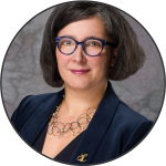
Léa Bodossian, Secretaire Generale Directrice
Executive EuroGeographics
Léa Bodossian was appointed Secretary General and Executive Director of EuroGeographics in 2020. She has a passion for geography, political sciences and European affairs.
She spent a large part of her carreer with a number of high-level representation, communication and management positions within the European Commission, in an EU Agency or in membership association, mostly in the field of aviation.
Léa has extensive experience in European representation. This includes presenting technical challenges and concerns into policy hearings and meetings at the European Parliament, and contributing to consultations and expert groups,
Léa holds Master’s degrees in geography urban planning and in political sciences – European affairs. She is also an invited lecturer for several French universities and a sought-after conference moderator.
|
 |
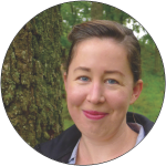
Kate Fairlie,
Land Administration Specialist, Former
Chair of FIG Young Surveyors Network
Kate Fairlie is a land administration
specialist with Land Equity International, with a key interest
in urban land issues, technology, youth and environment. She is
the Project Director for the UK Aid (FCDO) Papua Spatial
Planning project in Indonesia, and has broad-ranging experience
providing strategic institutional and systems-level advice to
governments through projects for the World Bank, UN-Habitat,
MCC, FAO and national governments. She has co-authored a number
of land administration tools, including most recently the State
of Practice White Paper on Land Information and Transaction
Systems and decision-tool for land IT system investment with the
Millennium Challenge Corporation.
With a long history of
engagement with the FIG, Kate is a former Chair of the Young
Surveyors Network, and has supported activities under a number
of Commissions, Task Forces and initiatives, including the
International Land Measurement Standard (ILMS) Standard Setting
Committee.
|


