TIME IS SHOWN IN CENTRAL
EUROPAN SUMMER TIME (CEST) WHICH IS UTC+2
Sunday, 20 June
Sunday, 20 June 08:40–11:00 STAGES
FIG General Assembly: Session 1 - agenda items Chair: Prof. Dr. Rudolf Staiger, FIG President, Germany
FIG General Assembly takes place on 20 and 25 June. This first General Assembly session will be held on 20 June and will include the Presidents report, the Financial Report, FIG Foundation, membership matters and other General Agenda items. Delegates are encouraged to submit questions and comments in advance, and during the session it will also be possible to ask questions to and comment the presidents report, financial report and other agenda items.
FIG General Assembly: Session 2 - Election - presentation of candidates Chair: FIG Vice Presidents Jixian Zhang, China and Orhan Ercan, Turkey
Get to know your candidates... This second General Assembly session will take place on 20 June and will focus on the elections that are going to take place. To be elected are two Vice Presidents, Commission Chairs Elects and the destination for FIG Working Week 2025. Presentation of candidates will be available in advance, and this session encourages discussions with the candidates to get to know the candidates. All are encouraged to take active part in this session.
OPENING CEREMONY Chair: Ms. Louise Friis-Hansen, FIG Director and Ms. Paula Dijkstra, Director a.i. of Kadaster International - co-conference director The opening ceremony will provide a spectacular introduction to the Working Week, its theme, and its unique virtual location - a festive start of the Week. Official welcome by:
Maarten Schurink, secretary general of Ministry of the Interior and Kingdom Relations
Opening Ceremony Keynote speaker:
Arnold Bregt, Dean of Education &
Professor Geo-Information Science - Wageningen University &
Research
Arnold Bregt is currently Dean of Education and professor of
Geo-information Science at the Wageningen University. He is
chairman of the Netherlands Centre of Geodesy and
Geo-informatics (NCG), a coordinating organisation for
fundamental and strategic research in geodesy and
geo-information in the Netherlands. NCG is also partner in
“GeoSamen (GeoTogether)”, a strategic cooperation agreement
between the Geo-business association, Government and
Geo-science institutes.
Welcome adresses by:
Ron Rozema, GIN President
Frank Tierollf, Chair Executive Board
Kadaster
Freek van der Meer, Dean ITC University
Twente
Rudolf Staiger, FIG President
Monday, 21 June 10:30–12:00 SESSIONS
FIG Member Association and Regional Bodies Forum Commission: FIG Council Chair: Mr. Jean Yves Pirlot, Belgium and Marc Vanderschueren, Belgium Rapporteur: Head of Delegation/President John Hohol, United States
This forum is held each year for member associations and regional bodies with topics of current interest. Two main topics are on the agenda this year:
How to attract young people to the profession, and
the impact of COVID 19 on member associations
The session is a discussion sessions and representatives from member associations and regional bodies are encouraged to participate and share their experience and ideas and hopefully get inspired by the ideas of other organisations.
Report
Introduction by Jean Yves Pirlot and Marc Vanderschueren
[Handouts]
Update from Fédération des Géométres Francophones (FGF)
[Handouts]
Update from National Society of Professional Surveyors (NSPS)
[Handouts]
Update from Ordre Luxumbourgeois des Geometres (OLG)
[Handouts]
Update from Surveying & Spatial Sciences Instutute (SSSI)
[Handouts]
Update from Ordre des Geometres-Experts (OGE)
[Handouts]
Update from South African Geomatics Institue (SAGI)
[Handouts]
Update from Suomen maan mittausinsinöörien liitto ry (MIL)
[Handouts]
Update from Gesellschaft für
Geodäsie, Geoinformation und Landmanagement (DVW)
[Handouts]
Update from Asociación Panamericana de Profesionales de la
Agrimensura y Topografía (APPAT)
[Handouts]
Update from Asia Pacific Capacity Development Network
[Handouts]
Update from Latvian Association of Surveyors
[Handouts]
Monday, 21 June 10:30–12:00 STAGES
Practical Digital Twin cases in the Netherlands Chair: Ms. Magdalena Grus, the Netherlands Rapporteur: Ms. Xanthe van Duivenbode, the Netherlands Five presentations will be given with a focus on demonstrating Digital Twin use cases. Five different companies will provide a view of the Digital Twin activities in the Netherlands. It will provide insight into data acquisition, data retrieval and data combination but also examples of their implementation. It tackles subjects concerning greening, sustainability measures, permits and their impact on people and environment. In the transition moments from one speaker to another, time will be taken for polls and a moment for questions. Henk Pauw, Commercial Project manager FACTO GEO
The importance of correct quality data: input for the Digital Twin and more
[handouts]
Tony Baving, Geo data specialist Kadaster
Fundament for Digital Twin
Niels van de Graaf, Market manager Governement by IMAGEM
Digital Twin is more than just a cool 3D visualization
Janne Verstappen, Geodan
Designing a smart district with future residents and developers
Monday, 21 June 10:30–12:00 STAGES
Valuation of unregistered land – a practice manual Chair: Mr. James Kavanagh, United Kingdom Jointly hosted by UN-Habitat/Global Land Tool Network (GLTN), International Federation of Surveyors (FIG) and Royal Institute of Chartered Surveyors (RICS). The session will examine the underpinning principals of the UN Habitat Global Land Tool Network 2021 - Valuation of unregistered land – a practice manual. The session is designed to inform policy makers and practitioners about the underpinning rational for the manual’s application. The session will explore areas of influence and recognition with the International Valuation Standards and the RICS’s Global Valuation Standards (Red Book).
This is at a time when valuation and its operation are undergoing a revolution in understanding and practice. Valuers are being asked to consider and include valuation decisions on all kinds of ‘assets’ from natural capital to social value as well as firm up on their protocols and standards on traditional concepts of ‘market value’. This important manual brings a lot of these thought processes to fruition as we look at ‘value’, and its attribution to unregistered land. Valuation is a critical element of for enabling effective land acquisition, taxation and transfer processes and is a key component of land administration systems.
Intro from UN Habitat GLTN
Danilo Antonio and John Gitau, GLTN
UN GLTN Unregistered Land Manual – intro
James Kavanagh (RICS)
[handouts]
Expert authors – Mike McDermott &
Peter Wyatt
Views on future use and development
Ben Elder, RICS, FIG Commission 9 and IVSC – the future
direction of valuation practice
Dr. Kwabena Obeng Asiama - FIG Young Surveyors network –
valuation, unregistered land and the YSN Volunteer Initiative
Monday, 21 June 10:30–12:00 STAGES
02.1 - Regional Academic Networks: Lessons from COVID-19 for SDG Goal 4 (education) Commission: 2 Chair: Dr. Dimo Todorovski, Netherlands Rapporteur: Mr. Marien de Bakker, Netherlands The aim of this session is to explore how the SDG Goal 4 targets and indicators would benefit from regional academic networks drawing on the lessons learned as we transitioned to fully online education.
Effective regional academic networks allow effective sharing of knowledge with good online learning management systems and learning materials, and the online platforms also allow good teachers to reach more students through effective regional networks connected online. This will potentially help support improvements in
Targets 4.3 and 4.5 - by improving access for both women and men.
Target 4.7 - the networks make it easier for learners to acquire the knowledge and skills needed to promote sustainable development.
Menare Royal Mabakeng, Stephnie De Villiers, Celina Awala, Ase Christensen and Uchendu Eugene Chigbu (Namibia): Supporting Capacity Development in Land Administration in Namibia: The NUST Experience (11034) [abstract] [paper] [handouts] [video]
Rodolfo Salazar, Ginella Jacome (Ecuador) and Dimo Todorovski (Netherlands): Latin America Land Administration Network (LALAN), Covid19 and SDG 4 (11084) [abstract] [paper] [handouts] [video]
Rosario Casanova and Paula Caram (Uruguay): Teaching on the ethical use of geographic information in America (11120) [abstract] [paper] [handouts] [video]
Jossam Potel (Rwanda) and Monica Lengoiboni (Netherlands): The Eastern African Land Administration Network and Covid 19: Effects and Implications (11148) [abstract] [paper] [handouts] [video]
Uchendu Eugene Chigbu (Namibia), Elias Danyi Kuusaana (Ghana) and Menare Royal Mabakeng (Namibia): Structural Holes in Academic Networks: Lessons from Bridging Competency Gaps in Land-Related Education and Learning in Africa (11170) [abstract] [paper] [handouts] [video]
Monday, 21 June 10:30–12:00 STAGES
03.4 -
Geospatial impact of COVID-19 Commission: 3 Chair: Prof. Markus Schaffert, Germany Rapporteur: Ms. Sahinkaya Cemre, Turkey The coronavirus is changing our lives worldwide. The session will focus on the importance of geo-information in dealing with the pandemic and the impact of COVID-19 on geospatial tasks. Speakers from four continents report and discuss their experiences.
Tapio Siltala and Jaana Mäkelä (Finland): Importance and Challenges of Location Intelligence in Corona Pandemic (11015) [abstract] [paper] [handouts] [video]
Dionysia - Georgia Perperidou, Georgios Moschopoulos (Greece) and Dimitrios Ampatzidis (Germany): Social Activities Impact and Covid 19 Second Wave: the Case of Thessaloniki, Greece (11181) [abstract] [paper] [handouts] [video]
Bastian Plaß, Jan Emrich, Selina Götz, David Kernstock, Christoph Luther
and Thomas Klauer (Germany): Evaluation of Point Cloud Data Acquisition Techniques for Scan-to-BIM Workflows in Healthcare (10968) [abstract] [paper] [handouts] [video]
Rosario Casanova, Carlos Chiale and Matilde Saravia (Uruguay): Data Privacy Protection and Geographic Data Use as an Answer to Covid-19 in Uruguay (11038) [abstract] [paper] [handouts] [video]
Further reading:
Yanqing Chang (China, PR): Analysis of the Impact of the COVID-19 Pandemic on Geospatial Listed Companies in China in 2020 (10990) [abstract] [paper] [handouts] [video]
Monday, 21 June 12:00–13:00 SESSIONS
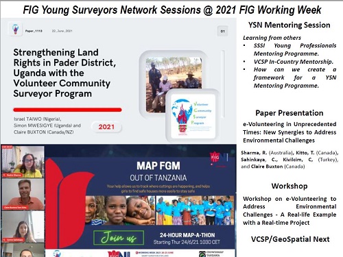
YSN Mentoring Session Commission: YSN The session will run for an hour. The first half-hour will be an interactive series of presentations which explore the different faces that mentoring can hold, from participants in VCSP in-Country Mentoring and the SSSI Mentoring Program. This will explore the value of mentoring to different people and the unexpected aspects of the mentoring experience and how it can change lives. The remaining hour will be spent in structured speed-mentoring, where seasoned surveyors will have the chance to speak with young surveyors in five-minute time slots one-on-one (virtually) over a series of set topic areas.
With the global trends, technological changes, as well as the declining number of surveyors in the world, the surveying profession is facing a number of challenges. One of the keys to sustaining the future of the surveying profession is a well connected global community.
Mentoring is a key part of professional development in our industry. This session brings together seasoned and young surveyors to explore and highlight the benefits of mentoring at many levels - to the mentee, the mentor, their organisation, and the profession. The session will comprise presentations and ‘speed-mentoring’ between seasoned and young surveyors present. Lessons from this session will be used together with lessons from previous mentoring programs and workshops to develop a strategy for a mentoring program within FIG and the FIG Young Surveyors Network.
[handouts]
Monday, 21 June 13:00–14:00 STAGES
KEYNOTE: THE IMPACT OF COVID-19 ON THE PROFESSION Chair: Ms. Kate Fairlie, Land Administration Specialist, Former Chair of FIG Young Surveyors Network What impact is the coronavirus pandemic having on the geospatial industry worldwide? How do we adapt to these unexpected circumstances and what have we learned so far from these challenges?
Benjamin Davis, Director, Inclusive Rural
Transformation and Gender Equality Division, FAO
Steven Ramage,
Group on Earth Observations (GEO)
Léa Bodossian,
Secretary General and Executive Director of
EuroGeographics
Monday, 21 June 14:15–14:40 SESSIONS
ESRI: Why GIS is the Foundation of your Cadastre Learn how GIS enables three key systems –a system of record, insight, and engagement–forming the foundation of modern cadastral system.
Additional information: GIS enables three key systems forming the foundation of your cadastral system – system of record, system of insight, and system on engagement. Attend this session and learn how ArcGIS enables these systems to improve parcel data management, valuation analysis, operational insight, internal data sharing, stakeholder engagement, and more.
Presenters:
Brent Jones
Brandon Tourtelotte
Monday, 21 June 14:15–14:40 SESSIONS
LAND-at-scale programme
During this session, we will present the LAND-at-scale programme. LAND-at-scale is a Dutch land governance support programme for developing countries, managed by the Netherlands Enterprise Agency (RVO).
Monday, 21 June 14:15–14:40 SESSIONS
Unleash the power of location, with HERE
A little deep dive into location data journey, through Data Sourcing, Community and Marketplace opportunities. Marketplace is the global to exchange and monetize location assets from trusted source. More information on:
https://www.here.com/platform/marketplace
Monday, 21 June 14:15–14:40 SESSIONS
New GNSS technologies for faster and more accurate
surveying
Introducing the latest GNSS receiver features
and technologies. With new iStar technology, IMU module
integration and enhanced field mapping Android App,
construction and surveying projects are completed with high
productivity and reliability, pushing the limits of
conventional GNSS RTK surveying.
Monday, 21 June 15:00–16:30 STAGES
Netherlands and Land Administration: Best Practice and Vision for the Future Chair: Ms. Corrie Jonkers, the Netherlands Kadaster manages almost 10 petabytes of data and 160 open datasets, which were viewed more than 20 billion times in 2020, over 6 billion more than a year earlier. Impressive figures. Governments and companies from all over the world are interested how Kadaster works with artificial intelligence, pointclouds and image generation (for the cadastral map). How is Kadaster moving with time and digital challenges?
In this session we discuss the issues, solutions and dilemmas we encounter in bringing our cadastre to the next level in a world where data are at the heart of society’s needs and our operations. We provide an insight how cadastres evolve in this data-driven world and contribute to sound decision making and recording in the spatial domain and the land market in particular. This requires that the data ecosystem of the cadastres is linked up with the data of other domains. Cadastres will be more data-centric and have to link up with other domains if they want to remain a relevant to the users.
Also we zoom in on how Artificial Intelligence was used to rebuild the cadastral map. Currently the map has a so-called graphic quality (standard deviation of boundaries are 20 cm for urban areas and 40 cm for rural areas), because of the different working methods over time and the production scale. Kadaster has started a research program to develop a map where the location of borders is so accurate, that the map is more in line with future developments. For this purpose, almost all (historical) field sketches have to be processed. An enormous challenge that requires far reaching automation. The research program has investigated whether it is possible to automatically extract the original measurements from the fieldwork reports and to combine this information and re-determine the location of the boundaries. In this session the concept is explained as well as, geodetics aspects and AI solutions.
Introduction
Martin Salzmann (Netherlands): The cadastre in the age of climate change and energy transition: juridical and environmental data as the foundation in the land market (10963) [abstract] [paper] [handouts] [video]
Ruben Busink, Frank Schouten, Jeroen Grift and Eric Hagemans (Netherlands): Rebuilding the Cadastral Map of the Netherlands: the Overall Concept (11073) [abstract] [paper] [handouts] [video]
Jeroen Franken, Wim Florijn, Maarten Hoekstra and Eric Hagemans (Netherlands): Rebuilding the Cadastral Map of the Netherlands: the Artificial Intelligence Solution (11000) [abstract] [paper] [handouts] [video]
Frank van den Heuvel, Gerbrand Vestjens, Gerard Verkuijl and Mark van den Broek (Netherlands): Rebuilding the Cadastral Map of the Netherlands, the Geodetic Concept (10919) [abstract] [paper] [handouts] [video]
Monday, 21 June 15:00–16:30 STAGES
The Role of the Geospatial Information in Responding to Crises and Accelerating the Progress on Achieving the SDGs Chair: Ms. Rumyana Tonchovska, FAO of the UN and Prof. Hartmut Müller, FIG Chair Commission 3 Rapporteur: Ms. Kate Fairlie, Australia Jointly organised by FAO, FIG, UNSD/UN-GGIM, UNECE and World Bank The objective of the session is to present the role of the geospatial information in responding to covid-19 pandemic and share good practices for using geospatial information to better respond to future crises and to accelerate the progress on the achieving the SDGs. 2020 was intended to welcome in a new decade of optimism. The ͚decade of action to accelerate progress towards achieving the Sustainable Development Goals (SDGs), while celebrating the 75th anniversary of the United Nations. However, by March 2020, with the arrival of the COVID-19 pandemic, optimism quickly deteriorated into an unprecedented global crisis. As a consequence, our world is now being forced to rapidly adapt to confronting social and economic changes and challenges, from local to global levels, across all industries and sectors, and in all areas of supply and demand. The pandemic has not only created new challenges, but reinforced the pre-existing obstacles to realizing the SDGs - structural inequalities, socio-economic gaps, and systemic challenges and risks and a lack of timely fundamental data and enabling technologies to measure and monitor what is happening where, when, and how. Viewed through a geospatial lens, the COVID-19 pandemic has reinforced the unprecedented need for data, geospatial information, enabling technologies, and insights for governments and citizens across the globe, to not only enable decision-makers to inform policies and planning, but to also minimize the risk to people, especially the most vulnerable population groups. This session will present the geospatial response to COVID-19, the future trends in geospatial information management to better respond to crises and accelerate the progress on the SDGs, the FAO and the World Bank support at the country level.
Opening: Hartmut Mueller, Chair of FIG Commission 3 and Rumyana
Tonchovska, FAO of the UN
COVID-19: Ready to Respond. The Role of the Geospatial
Community in
Responding to COVID-19,
Presenter Gregory Scott,
United Nations Statistics
Division
World Bank and FAO country level support,
Presenters Kathrine Kelm, World
Bank and Rumyana Tonchovska, FAO
UN-GGIM: The new trends in Geospatial Information
Management, Presenters: Ms. Christin Walter, Geospatial
Office, Ordnance Survey of Great
Britain on behalf of UN-GGIM.
Christin is the lead author of the third iteration of the UN-GGIM
Future Trends in
Geospatial Information Management Report
[handouts]
Case studies:
FAO-Serbia: Geospatial Information in
Response to Covid-19
pandemic – Looking Back-Looking Forward.
Presenter
Darko Vicetic,
Head of Center of Excellence for GIM, Serbian Republic Geodetic
Authority
COVID-19 Recovery Action Plan for Informal
Settlements in the
UNECE Region.
Presenter: Chryssy Potsiou,
on behalf of UNECE
[handouts]
Scenario Study on Future Land Administration in the
UNECE region. Presenter Fredrik Zetterquist on behalf of
UNECE
Borko Draskovic, Darko Vucetic (Serbia) and Rumyana Tonchovska (Italy): Geospatial Information in Response to Covid-19 Pandemic – Serbian Experience (11111) [abstract] [paper] [handouts] [video]
Monday, 21 June 15:00–16:30 SESSIONS
Reimagining the future of the Surveying Profession Post 2020 Chair: Dr. Diane Dumashie, FIG Vice President, United Kingdom Rapporteur: Mr. David Mitchell, Chair FIG Commission 2, Australia Special session organised by FIG Council with a focus on the skills and talent that we need to remain relevant as we move toward 2028. The achievements of the past 18 months brings into sharp focus an important question for our profession today; as we look to the future of surveying, What skills and talents will we need to possess to solve the problems of the 21st century, and why. We need to attract the brightest young people from the broadest reaches of our societies reflecting diversity form around the world to enter our profession and practices.
Our answer begins with a challenge. Our industry needs to find solutions to how the planet can accommodate human population growth yet remain within the bounds of the resilience of our planet. We will need new talent to help us archive this objective in a sustainable manner.
What better place to start addressing this challenge by asking our panellists of rising young stars from Asia, Europe, Australia and Africa (and USA). They will deliberate and challenge our current conventions and mind-sets to ensure that we evolve in sync with the communities we serve.
The session aims to draft a statement addressed to Council for inclusion in the Future 2028 strategy deliberations and to gain knowledge, to achieve results with land and property organisations, to exchange knowledge and to be inspired.
08.4 -
Spatial Planning, Land Use, and Land and Water Management Commission: 8 Chair: Ms. Marije Louwsma, Chair FIG Commission 8, the Netherlands Rapporteur: Prof. Walter Timo de Vries, Germany Optimising land use, preventing environmental hazards, proper waste management and early detection of deforestation all relate to sustainable development. The relevance of spatiality regarding the use, reuse and recycling of land and its resources is addressed in this session.
Walter Timo de Vries (Germany): Testing and Improving the 8r Framework of Responsible Land Management to Assess Major Land Interventions (10966) [abstract] [paper] [handouts] [video]
Reelika Piik (Estonia) and Jan Spijkerboer (Netherlands): Rail Baltica in Estonia, a challenging land acquisition project (10901) [abstract] [paper] [handouts] [video]
Doç.Dr. Yakup Çoruhlu and Bayram Uzun (Turkey): Legal Confiscating Based on Zoning Plan in Turkey (10921) [abstract] [paper] [handouts] [video]
Cemre Sahinkaya (Turkey) and Geoffrey K. Payne (United Kingdom): Evaluation of a Capital City's Transformation over 40 Years in Relation to the Sustainable Development Goals: The Case Study of Ankara, Turkey (11097) [abstract] [paper] [handouts] [video]
Szczepańska Agnieszka, Senetra Adam and Mirosław Bełej (Poland): Integrated Land and Water Management on the Example of the Recreational Function in the City (10879) [abstract] [paper] [handouts] [video]
Further Reading:
Adrianna Czarnecka and Wioleta Krupowicz (Poland): Sustainable Development of Road Network as an Element of Shaping the Rural Landscape in Poland (10890) [abstract] [paper] [handouts] [video]
Agung Nugroho Bimasena, Su Ritohardoyo and Andri Kurniawan (Indonesia): The Impact Analysis of “Tanah Desa” Land Utilization on Environmental Components at Sinduadi, Mlati, Sleman, Yogyakarta Special Region, Indonesia (10924) [abstract] [paper] [handouts] [video]
Tanka Prasad Dahal, Reshma Shrestha and Purna Bahadur Nepali (Nepal): Land Use Planning Through Land Use Zoning for Food Security in Nepal (10961) [abstract] [paper] [handouts] [video]
Bambang Edhi Leksono, Santi Azzahrah, Putri Rahmadani and Brilian Adie (Indonesia): Pangandaran Coastal Land Carrying Capacity Analysis for Tourism Activity (10973) [abstract] [paper] [handouts] [video]
Dionysia - Georgia Perperidou (Greece): Spatial planning in Greece: from the past to the economic crisis & the future (11177) [abstract] [paper] [handouts] [video]
Monday, 21 June 17:30–18:30 STAGES
KEYNOTE: THE CHALLENGES FOR SMART SURVEYORS IN A NEW REALITY Founder and President of Esri - Environmental Systems Research Institute, Jack Dangermond, talks with FIG President Rudolf Staiger on the impactful latest trends in GIS software technology, how they impact surveying and the FIG community as well as thoughts and considerations on the future of the profession.
Jack Dangermond, Founder and President
Esri - Environmental Systems Research Institute
Rudolf Staiger, FIG
President, Professor at the University of Applied
Sciences Bochum, Dept. of Surveying Engineering and
Geoinformatics.
Monday, 21 June 19:30–21:00 STAGES
03.3 -
Integrated Geospatial Information Management Commission: 3 Chair: Prof. Hartmut Müller, FIG Commission 3 Chair, Germany Rapporteur: Ms. Angela Omamuyovwi Etuonovbe, Nigeria Decades ago land information started to be organized within Spatial Data Infrastructures (SDI). More and more SDI’s evolved into platforms for integrated geospatial information management. This session will address selected requirements and best practices for such an integrated geospatial information management
Juerg Luethy and Carla Thoma (Switzerland): Multi-Purpose Building Models for Switzerland (11022) [abstract] [paper] [handouts] [video]
Haipeng Chen, Li Zhang, Wenjun Xie, Miao Li and Linbing Lyu (China, PR): Method and Practice of Quality Inspection and Evaluation of the Land Cover Classification Achievement in the Geographic Conditions Monitoring Project (10898) [abstract] [paper] [handouts] [video] This is a peer reviewed paper.
Markus Seifert (Germany): Smart Mapping - the new VectorTiles Map of Germany (10864) [abstract] [paper] [handouts] [video]
Nami Seimiya, Akihiro Sugita, Keiji Yamada, Bhuwneshwar Prasad Sah (Japan) and Lorenc Cala (Albania): Integrated Geospatial Information for Sustainable Land Development in Tirana-Durres Area in Albania (11123) [abstract] [paper] [handouts] [video]
Danny Yeung, Kwai-hing Tong and Lily Leung (Hong Kong SAR, China): Enrichment of Land Information Database for Smart City Development (11205) [abstract] [paper] [handouts] [video]
Janette Storm (Netherlands): Success and Growing Use of Geo Data Asks for Integrated Information Supply (11140) [abstract] [paper] [handouts] [video]
Further Reading:
Andre Kwitowski (Netherlands): The Development of NSDI - How to Start? The View on Number of Challenges and Solutions (10970) [abstract] [paper] [handouts] [video]
Hazel Slawson and Nath Reddy (United Kingdom): The Next Generation Enterprise Geospatial Data Capture (11002) [abstract] [paper] [handouts] [video]
Reshma Shrestha, Janak Raj Joshi, Deuja Jagat and Uma Shankar Panday (Nepal): Informal Settlers: Identifying the Genuine Settlers and Landless of Nepal (11004) [abstract] [paper] [handouts] [video]
Andrew Lai and Ben Chan (Hong Kong SAR, China): Re-engineering the Survey and Mapping Office for the Smart City Development in Hong Kong (11132) [abstract] [paper] [handouts] [video]
Alex Chu and Ko-kwan Fan (Hong Kong SAR, China): Development of the 3D Digital Map in Hong Kong (11201) [abstract] [paper] [handouts] [video]
Kenny Yiu, Cheong-wai Tsoi, Man-kong Tong and Yuk-ming Tau (Hong Kong SAR, China): Development and Challenges of Spatial Data Infrastructure in Hong Kong (11206) [abstract] [paper] [handouts] [video]
Monday, 21 June 19:30–21:00 STAGES
07.1 -
Responsible PPPs in Land Administration Commission: 7 Chair: Mr. John Meadows, Australia Rapporteur: Ms. Kate Fairlie, Australia In this session we turn again to the matter of PPP’s and their place and use in the context of land administration. This is a wide-ranging session covering the PPP ‘constellation’. We will be considering how taking Corporate Social Responsibility (CSR) to the next level brings a new dynamic to PPP’s. Inspired by the Danish experience we will hear how the use of a ‘cooperative’ approach to PPPs can, if emulated in developing countries, offer the flexibility required to create fit for purpose land administration systems that would otherwise not be possible if relying on the traditional top-down approach. We will consider the oft ignored but critically important commercial viability element of PPPs, discover how collaboration between the private and public sector is working in the context of maintaining the Spanish Cadastre and learn how ‘genuine’ public partnership is being used to deliver security of tenure in Zambia. This is a wide-ranging session that is a must for anyone with an interest in ensuring a responsible intersection of the public and private sectors towards providing inclusive land governance and administration.
Cecilie Ravn-Christensen and Kenneth Norre (Denmark): Private Sector Responsibility in Supporting Sustainable Development (10866) [abstract] [paper] [handouts] [video]
Søren Brandt Pedersen (Denmark): Public – Private – Partnerships as a Catalyst for Tenure Governance in Developing Countries (10979) [abstract] [paper] [handouts] [video]
Tony Burns (Australia), Fletcher Wright (USA), Kate Fairlie and Kate Rickersey (Australia): How to conceptualize a PPP for land administration services: understanding the private sector and commercial feasibility. (10984) [abstract] [paper] [handouts] [video]
Ase Christensen, Menare Royal Mabakeng (Namibia), Farai Shumba (Zambia) and Elina Teodol (Namibia): The Case for Private Conveyancing: Innovative Approaches for Land Tenure Documentation - Lessons from Zambia (11031) [abstract] [paper] [handouts] [video]
Amalia Velasco Martín-Varés, Carmen Femenia-Ribera, Jesús García Benito and Juan Carlos Ojeda Manrique (Spain): Finally, the Model of Collaboration Between Land Surveyor Engineer and the Spanish Directorate General for Cadastre Is Institutionalized (11211) [abstract] [paper] [handouts] [video]
Monday, 21 June 19:30–21:00 SESSIONS
09.1 -
Round Table – Introduction to the Tool Kit for the Valuation of Unregistered Land Commission: 9 Chair: Mr. Ben Elder, Chair FIG Commission 9, United Kingdom This round table will be a chance to explore the detail application of the recently published UN Habitat Global Land Tool Network 2021 - Valuation of unregistered land – a practice manual.
The authors of the manual will lead delegates through the background and thought processes that the maula brings together to enhance the approach to the valuation of unregistered land.
The session will be interactive and delegates are encouraged to bring details of the challenges they have experienced in practice to the session to see how the manual could be applied in those circumstances.
Monday, 21 June 22:00–23:30 STAGES
05.3 -
Vertical Datums Defined by GNSS and a Geoid Commission: 5 Chair: Mr. Nic Donnelly, New Zealand Rapporteur: Mr. David Avalos, Mexico When defining spatial coordinates, the most fundamental component is the inherent reference frame for the geospatial data. GNSS observations must have the context of the reference frame to determine positions and provide for safe navigation. Physical heights above a vertical surface are usually taken with respect to geometric reference frames. To obtain precision and accuracy, it is necessary to understand how the vertical datum relates to the geometric reference frame.
Basara Miyahara, Koji Matsuo, Tokuro Kodama and Shinobu Kurihara (Japan): Development of Gravimetric Geoid Model of Japan Using Airborne Gravity Data Covering Japan Archipelago (10914) [abstract] [paper] [handouts] [video]
Kevin Ahlgren (USA): An Updated Surface Gravity Prediction Model (xGRAV20) (11150) [abstract] [paper] [handouts] [video]
Christopher Pearson (New Zealand) and Sebastien Vielliard (France): Support for Dynamic Datums in Trimble Software (10897) [abstract] [paper] [handouts] [video]
Yaw Opoku - Gyamfi, Kwame Tenadu, Isaac Dadzie, Herbert Djaba and Michael Nyoagbe (Ghana): Establishing ghana’s active geodetic reference network as a tool for enhancing national socio – economic development buoyed by the realities of a pandemic (11141) [abstract] [paper] [handouts] [video]
Richard Stanaway (Australia): Approaches to Time-Dependent Transformations Between Reference Frames in Practice (11144) [abstract] [paper] [handouts] [video]
Martin Lidberg (Sweden), Wolfgang Söhne (Germany) and Karin Kollo (Estonia): Advancing the geodetic infrastructure in Europe through EUREF (11184) [abstract] [paper] [handouts] [video]
Further Reading:
Gershon Steinberg, Gilad Even - Tzur, Hagi Ronen, Hezi Hezi Sarid and Sagi Daliot (Israel): The development of the
Israeli official geoid undulation model
(10892) [abstract] [paper] [handouts] [video] This is a peer reviewed paper.
Machiel Bos, Rui Fernandes (Portugal), Mohammed Al-Marri, Mudher Abdulah (Qatar) and Hazem Barakat (Canada): The New Gravimetric Geoid Model of Qatar: QG2020 (11176) [abstract] [paper] [handouts] [video]
Sammy Matara, David Siriba, JohnBosco Kiema and Sammy Musyoka (Kenya): Predicting Displacement Effects of Tectonic Movements on the Kenyan Geodetic Reference Frame Network (KENREF) (10951) [abstract] [paper] [handouts] [video]
Gyula Iván (Hungary): Transformation Between Reference Ellipsoids, Using Non-Euclidean Relationships (11095) [abstract] [paper] [handouts] [video]
Tuesday, 22 June
Tuesday, 22 June 08:00–09:30 STAGES
Smart Surveying in the Netherlands: Totally 3D Chair: Mr. Harrie van der Werf, the Netherlands A cooperation between Rotterdam, The Hague and Amsterdam
This session covers three presentations with the following topics:
Mission and vision on 3D city modelling by Jane Hermans, Rotterdam, the Netherlands
Change management by Harrie van der Werf, The Hague, the Netherlands
Collaboration between Amsterdam, Rotterdam, The Hague, ministry of internal affairs and union of municipalities.
Mission and vision show the picture how we want to work with 3D-data in about five to ten years. At the moment most of the data used in the government are 2D. However, users of information and a lot of companies already work in 3D. In the exchange of information the government has to change incoming 3D survey data to 2D data as defined by law. After that the 2D data must be upgraded to 3D information for usage. A 3D process is more efficient. Furthermore the dialogue with citizens and other users is better facilitated. This happens for instance in the building sector where BIM is becoming the standard.
Changing from working in 2D to 3D is a great change. Technically it is complex, but a lot is available. Change management shows that the technical issues are a small part of what is needed. In this section of the presentation we will explain how change can be accomplished. And how this change is directly related to the necessity of working with an architecture of microservices and standards for interfaces and 3D databases.
The third part of the presentation will cover how the collaboration between the three cities takes place. The collaboration is based on a modern information architecture (‘common ground’). Here we will present what we are doing right now. Working in an agile environment we create best practices in the entire chain of 3D information. The best practices will become available to everyone. (Including you).
These three subjects (mission, change and practice) will create questions: that will be the fourth part. You are invited to ask us anything: we will probably need your questions to improve our work.
Tuesday, 22 June 08:00–09:30 STAGES
03.1 -
Geospatial Analytics Use Cases Commission: 3 Chair: Mr. Cemal Özgür Kivilcim, Turkey Rapporteur: Mr. David Elegbede, Nigeria Geospatial analytics is the backbone to answering location-based questions and making smart decisions related to our world. This session includes examples of the day-to-day increasing use of geospatial analytics.
Sharareh Akbarian (Australia), Arash Jouybari and Nina Grondstein (Sweden): Analysis of solar potential in an urban area using LiDAR data: A case study of Belgium (10870) [abstract] [paper] [handouts] [video] This is a peer reviewed paper.
Volkan Yildirim, Bura Adem Atasoy and Volkan Baser (Turkey): Determining Most Suitable Areas for Logistics Centers by Using GIS and S-MCDM (10913) [abstract] [paper] [handouts] [video]
Tugba Memisoglu Baykal and H. Ebru Colak (Turkey): Spatial Data Model Design for the Need to Identify Green Property Rights (10868) [abstract] [paper] [handouts] [video]
Further Reading:
Rudiney Pereira, Elisiane Alba, Juliana Marchesan, Mateus Schuh and Roberta Fantinel (Brazil): Pattern Mining in Sentinel 2B Satellite Images Using the Knime Analytics Platform (10937) [abstract] [paper] [handouts] [video]
Punya P Oli (Nepal): Spatial Database for Environment Studies of Projects (10878) [abstract] [paper] [handouts] [video]
Jacob Ehiorobo and Juliet Akpejiori (Nigeria): Geomatics Support View in Flood Control and Watershed Management Within the Niger Delta Region of Nigeria (10949) [abstract] [paper] [handouts] [video]
Nabed Abdelkader Nadir, Nadjai Saci and Saidi Djamel (Algeria): Digitization of the Rainfall Seltzer Map of Northern Algeria Using a Geographic Information System (10950) [abstract] [paper] [handouts] [video]
Bambang Darmo Yuwono, Heri Andreas and Hasanuddin Zainal Abidin (Indonesia): Assessing the Impact of Flood Induced by Sea Level Rise and Land Subsidence in Semarang City (10989) [abstract] [paper] [handouts] [video]
Azeez Alade (South Africa), Abdulazeez Abdulyekeen, Hussein Ahmadu, Abdulganiyu Yusuf and Abdulraheem Amoo (Nigeria): 3D Reconstruction of University of Ilorin Campus Using High Resolution Satellite Imagery and Conventional Survey (11003) [abstract] [paper] [handouts] [video]
Denny Lumban Raja, Murni Saripudin and Sabtanto Joko Suprapto (Indonesia): Identification of Geothermal Prospect Zone In Mount Lawu Using Geospatial and Geological Analysis (11151) [abstract] [paper] [handouts] [video]
Kaka Atta, Taiye Adewuyi, Musa Abubakar A., Olalekan Isioye, Lukman Giwa, Abdulazeez Onotu and Ebenezer Akomolafe (Nigeria): Site Selection of Electoral Polling Unit Using Geospatial Technology for Zaria, Kaduna State Nigeria (11168) [abstract] [paper] [handouts] [video]
Matteo Sgrenzaroli and Giorgio Paolo Vassena (Italy): Mapping the Geospatial Data of Hundreds of Real Estate Buildings, by Imms Instruments and Web-Cloud Based Software Platforms (11193) [abstract] [paper] [handouts] [video]
Tuesday, 22 June 08:00–09:30 STAGES
07.5 -
Sustainability, Land Tenure and Land Administration Commission: 7 Chair: Dr Mila Koeva, Netherlands Rapporteur: Simon Hull, South Africa Insecure land tenure, inadequate land management and administration, and unrecorded land rights are challenges that face many people around the world. These challenges may contribute to poverty, hunger, and non-realisation of human rights for those affected. In this session, some solutions to address these challenges are presented. Researchers are using innovative tools and collaborative approaches to improve tenure security and support land rights for all.
Solomon Njogu (Kenya), Danilo Antonio (Philippines), John Gitau (Kenya), Simon Mwesigye (Uganda) and Raja Ram Chhatkuli (Nepal): Flexible Land Information System Championing Reform Towards Formal Cadaster in Developing Countries (11088) [abstract] [paper]
[handouts] [video]
Raja Ram Chhatkuli, Janak Raj Joshi, Jagat Deuja and Uma Shankar Panday (Nepal): Participatory Mapping as a Smart Survey Technique to Support Land Rights for All: Experiences and Expectations (Nepal)
(11130) [abstract] [paper]
[handouts] [video]
Auriol Degbelo, Claudia Stöcker (Germany), Kaspar Kundert (Rwanda) and Malumbo Chipofya (Netherlands): SmartLandMaps - from Customary Tenure to Land Information Systems (11155) [abstract] [paper]
[handouts] [video]
Charisse Griffith-Charles (Trinidad And Tobago): Use of Global Indicators and Cadastral Information for Tracking Gender and Tenure Issues in the Caribbean (11204) [abstract] [paper] [handouts] [video]
Israel Taiwo (Nigeria), Simon Mwesigye (Uganda) and Claire Buxton (Canada): Strengthening Land Rights in Pader District, Uganda with the Volunteer Community Surveyor Program (11113) [abstract] [paper] [handouts] [video]
Ugonna Nkwunonwo (Nigeria): Meeting the Needs of Sustainable Land Management (SLM) in Africa Through Utility of Open-source Geospatial Infrastructure for Urban Growth Assessment (10932) [abstract] [paper] [handouts] [video]
Mulyadi Mulyadi, Prasetya Prasetya, Muhammad Nurdin and Agus W Kushendratno (Indonesia): Forest Area Boundary Situation Survey: A National Land Strategic Program to Support Land Tenure Security in Indonesia (10995) [abstract] [paper] [handouts] [video]
Voltaire Giovanni Tila, Angela Arnante and Rhea Lyn Dealca (Philippines): Pioneering the Use of Unmanned Aerial System (UAS) for Land Surveys and Titling in the Philippines (11104) [abstract] [paper] [handouts] [video]
Saad Yahya and Madi-Jimba Yahya (Kenya): PROTECTING LAND RIGHTS OF THE AGED
Dealing with land theft among old people (11016) [abstract] [paper]
[handouts] [video]
Tuesday, 22 June 08:00–09:30 STAGES
08.3 -
Water Governance – Facing the Effects of Climate Change Commission: 8 Chair: Prof. Isaac Boateng, Ghana Rapporteur: Dr. Diane Dumashie, FIG Vice President, United Kingdom A climate resilient approach for water governance, securing the availability of water as a resource, yet finding adaptive and mitigating strategies to deal with rising sea levels and flooding is much needed. Building resilience secures liveability, ecological, environmental, and economic viability for both urban and rural areas. This session presents some current thinking about water governance policies, managing water resources, and future scenarios strategies to guide professionals and practitioners in water management.
Dupe Olayinka (Nigeria): Assessing Social Vulnerability to Floods and Coping Strategies in Adamawa Catchment, Nigeria (11091) [abstract] [paper] [handouts] [video] This is a peer reviewed paper.
Isaac Boateng, Ellen Kwarteng, and Kofi Adu-Boahen (Ghana): A Survey and Analysis of The Effects of River Pollution on Floodplain Agriculture in Ghana: A Case Study of River PRA (11235) [abstract] [paper] [handouts] [video]
Marija Juric and Jennifer Ullgren (Sweden): The Rebuilding of Slussen and Securing the Right to Drinking Water for over Two Million People (10882) [abstract] [paper] [handouts] [video]
João Lobo (Mozambique) and Carlos Antunes (Portugal): Conceptual Model of a Marine and Coastal Spatial Data Infrastructure for Mozambique (11035) [abstract] [paper] [handouts] [video]
Diane A. Dumashie (United Kingdom): Governance in African Transboundary Water Basins (11212) [abstract] [paper] [handouts] [video]
Further Reading:
Hassan Musa and Adamu Bala (Nigeria): Development of a Hydrological Model for Automation of Watershed Analysis (10975) [abstract] [paper] [handouts] [video]
Ali Erdem Ozcelik (Turkey): Water Resources Management Framework using Blockchain Technology integrated with INSPIRE and Turkey National GIS (TUCBS) (10976) [abstract] [paper] [handouts] [video]
Edward A. A. Kwesi, Kwame Tenadu, John K. Annan, Matthew Homiah and Jonathan Annobil (Ghana): Integration of Groundwater Vulnerability Assessment in Landfill Site Screening at the Local Level: Case Study in the Prestea Huni-Valley Municipality of Ghana (11076) [abstract] [paper] [handouts] [video] This is a peer reviewed paper.
Ali Erdem Ozcelik (Turkey): Water Resources Management Framework using Blockchain Technology integrated with INSPIRE and Turkey National GIS (TUCBS) (11079) [abstract] [paper] [handouts] [video]
Leila Hashemi-Beni (USA): Inundation Mapping Using UAVs: Fixed Wing Vs. Multirotor (11203) [abstract] [paper] [handouts] [video]
Richard Pagett (United Kingdom), Isaac Boateng, Kwasi Appeaning Addo, Philip-Neri Jayson-Quashigah and Kofi Adu-Boahen (Ghana): Good Practice for Resilience Planning to Address Water Governance Challenges in Africa (11210) [abstract] [paper] [handouts] [video]
Tuesday, 22 June 10:30–12:00 SESSIONS
Book Corner Session- Presenting the book: Real Estate Registration and Cadastre. Practical Lessons and Experiences download Commission: FIG/FAO Chair: Ms Rumyana Tonchovska The session objective is to present practical lessons and experiences in implementing Real Estate Registration and Cadastre projects and have an open discussion on the key challenges and hot topics in the coming years.
Overall considerations and lessons for preparing, implementing and managing a project for Property Registration and Cadastre
Presenter Gavin Adlington, UK
Legal Framework
Presenter Gavin Adlington, UK
Boundaries and Cadastral Survey
Presenter Gavin Adlington, UK
IT Systems for Cadastre and Property Registration
Presenter Rumyana Tonchovska, UN FAO, Italy
Land Information Services
Presenter Robin McLaren, UK
HARD TALKS - Open Q&A and discussion based on interventions from the participants
Gavin Adlington (United Kingdom), Rumyana Tonchovska (Italy), Tony Lamb (Australia) and Robin McLaren (United Kingdom): eBook: Real Estate Registration and Cadastre. Practical Lessons and Experiences (11110) [abstract] [paper] [handouts] [video]
Tuesday, 22 June 10:30–12:00 SESSIONS
UN-GGIM Framework for Effective Land Administration (FELA) Chair: Mr. Kees De Zeeuw, Netherlands Organised by the UN GGIM Expert Group on Land Administration and Management The Framework for Effective Land Administration (FELA) has been developed by the Expert Group on Land Administration and Management over the last few years, and has been adopted by the Committee of Experts of UN GGIM in September 2020. The purpose of this session is to give insight in what FELA is and to have an open discussion on the uptake of the framework in the FIG community, a communication plan and to share first ideas on implementations and use cases. The outcome would be that participants understand the current status of FELA and how this specialisation of IGIF can be used in the domain of Land Administration.
After an introduction by Eva-Maria Unger (with plenty of room for questions), two themes will be discussed with the participants (this is an interactive session):
What is needed to get FELA taken up by the FIG community?
What is the right global communication approach for FELA?
Eva-Maria Unger (Netherlands), Rohan Bennett (Australia), CheeHai Teo (USA) and Kees de Zeeuw (Netherlands): Framework for Effective Land Administration - Nine Pathways to Transformational Change (11178) [abstract] [paper] [handouts] [video]
Tuesday, 22 June 10:30–12:00 STAGES
02.2 - Innovation in Professional Education during COVID-19 - Session 1 Commission: 2 Chair: Mr. William Kelly, United Kingdom Rapporteur: Mr. Eugen Niculae,
Ireland This session aims to provide examples of good practice in responding to the constraints of COVID-19 and the rapid move to online and remote education. During 2020 all teaching and training institutions had to adapt very quickly so they could respond to the need for remote learning.
During this transformation to online learning we saw may very innovative and inspiring approaches to online learning. However, we also found that online learning has very definite disadvantages. Some students really cannot cope well with online learning, and some learning activities need to be face-to-face. These experiences allow us to reflect on the good and bad aspects on transforming our education online. It is now generally accepted that online learning will be part of the future approaches to education, and that the challenge will be to find the best “blend” of online and face-to-face learning.
In this session we aim to hear from leading academics and training organisations about the most innovative ways they adapted their learning and teaching to online. We also aim to have a discussion about these innovative approaches and how they help us to develop an appropriate “blend” of online and face-to-face learning going forward. This session will help inform the final Commission 2 report on Blended Learning for Surveyors.
Adrian Bussolini (Argentina): Multidisciplinary Approach to Surveying from Geographic Information Systems (10977) [abstract] [paper] [handouts] [video]
Vladimir Zablotskii (Russia): Ten-Years Pedagogical Experiment at Moscow University of Geodesy and Cartography: C++ Programming Course Tailored for Surveying Students (10883) [abstract] [paper] [handouts] [video]
Derek Spalton, Richard Self and Omar Hamza (United Kingdom): Designing Simulated Work for Scanning, a Case Study on the Falkirk Wheel, and Implementation of Findings. Scotland. Derek (10899) [abstract] [paper] [handouts] [video]
Marinus de Bakker, Michiel Jellema and Susan Van Dijk (Netherlands): Sustainable Development Goals in Applied Geo-Information Science Education, an Example How to Incorporate Societal Challenges in a Curriculum. (10926) [abstract] [paper] [handouts] [video]
Maria Amalia Florez Huertas, Daniel Casalprim, Hernando Maldonado Pachon, Oscar Heli Jerez Jaimes and Oscar Alexis Gil Rojas (Colombia): Education Strategy Proposal to Close Skill Gaps for a New Land Administration System in Colombia 2021-2024 (10929) [abstract]
[paper] [handouts] [video]
Samuel Garba (Nigeria): Strategy for Organizing a Smart Department of Geomatics in Nigeria – a Case Study (10985) [abstract] [paper] [handouts] [video]
Klaas van der Hoek (Netherlands): The Role of Historical Knowledge in a Modern Cadastre (11080) [abstract] [paper] [handouts] [video]
Tuesday, 22 June 10:30–12:00 STAGES
03.2 -
Emerging Technologies for Geospatial Analysis Commission: 3 Chair: Prof. Charalabos Ioannidis, Greece Rapporteur: Ms. Roshni Sharma, Australia Technologies such as Artificial Intelligence (AI), Big data analytics, linked data, eXxtended Reality (XR) are becoming increasingly important for geospatial data analysis. The session will highlight the latest use of specific technologies
Robert Jentink, Edwin Paree, Col Offermans, Elisabeth Addink and Maarten Kleinhans (Netherlands): Geomorphological Mapping of Intertidal Areas with Object Based Image Analysis (11060) [abstract] [paper] [handouts] [video]
Florian Thiery, Timo Homburg, Sophie Charlotte Schmidt, Jakob Voß (Germany) and Martina Trognitz (Austria): SPARQLing Geodesy for Cultural Heritage – New Opportunities for Publishing and Analysing Volunteered Linked (geo-)data (11032) [abstract] [paper] [handouts] [video] This is a peer reviewed paper.
Charalabos Ioannidis, Sofia Soile, Argyro-Maria Boutsi, Styliani Verykokou and Chryssy Potsiou (Greece): From 3D Documentation to XR Representation of Cultural Heritage Buildings – the Case of the Katholikon of St. Stephen, Meteora (11027) [abstract] [paper] [handouts] [video] This is a peer reviewed paper.
Dillon Pullano and Michael Barry (Canada): Applying Conformal Geometric Algebra Algorithms to 3-D Survey Plan Boundary Topology Problems (11049) [abstract] [paper] [handouts] [video]
Mudit Kapoor, Rahul Dev Garg (India), Venkataraman Lakshmi (USA) and David Hicham Bassir (France): Solar Energy Planning Using Geospatial Techniques and Big-Data Analytics (11171) [abstract] [paper] [handouts] [video]
Further Reading:
Mike Klonsinski (USA): RFID – The Smart Way to Enhance the Accuracy of Infrastructure
Asset Tracking and Monitoring (10877) [abstract] [paper] [handouts] [video]
Hristo Nikolov and Mila Atanasova (Bulgaria): Using Information Obtained from Sar Data to Assess Flood Affected Areas in the Area of Bregovo, Bulgaria (11007) [abstract] [paper] [handouts] [video]
Tuesday, 22 June 10:30–12:00 STAGES
04.1 -
Hydrography in Support of Land and Water Management
Commission: 4 Chair: Dr. M.D.E.K. Gunathilaka Rapporteur: Dr. Abdullah Hisam OMAR , Malaysia In addition to its role in providing data for the production of nautical charts for safe navigation, hydrographic surveys also play an important role in water management. This session is dedicated to the hydrographic surveys in support of the various projects associated with the water management.
Ljerka Vrdoljak and Jelena Kilić (Croatia): Bathymetry Modelling from Altimeter-Based Gravity and Satellite Multispectral Images in the North Adriatic (10940) [abstract] [paper] [handouts] [video]
Erwin Heine (Austria): Bathymetry and lakebed mapping of Lake Altaussee using Multibeam Echo Sounding, UAV photogrammetry and underwater ROV imagery (11067) [abstract] [paper] [handouts] [video] This is a peer reviewed paper.
Emily Tidey (New Zealand): Looking Astern to Chart Our Way Forward (11188) [abstract] [paper] [handouts] [video]
Ivan Detchev (Canada): Theoretical and Practical Course Design and Development Aspects in Hydrographic Surveying (11229) [abstract] [paper] [handouts] [video] This is a peer reviewed paper.
Kengo Okada (Japan): Reclamation Cooperation Between the Netherlands and Japan from the Samurai Period. Thoughts Through Samurai Dream and Recent Water Disaster. (10992) [abstract] [paper] [handouts] [video]
Further Reading:
Juan Javier Duron Diaz (Mexico): The Use of Digital Elevation Models and Orthoimages for the Determination of Riverbeds of Hydrographic Basins in the Zone of Tixtla, Guerrero (10987) [abstract] [paper] [handouts] [video]
AbdulAzeez Aliyu, Adamu Bala, AbdulHameed Isiaka, Zainab Attah and Muhammad Tijjani (Nigeria): Mapping of Inundation Extent along River - Kaduna from Spaceborne Optical Sensor (11036) [abstract] [paper] [handouts] [video] This is a peer reviewed paper.
Edwin Danson (United Kingdom): Meeting the Environmental and Engineering Challenges of Climate Change Through the TSA’s Bespoke Inland Hydrography Training Course. (11059) [abstract] [paper] [handouts] [video]
Alain De Wulf, Axel Annaert, Lars De Sloover, Philippe De Maeyer and Greet Deruyter (Belgium): New Belgian E-Learning Oriented IHO Cat. B Hydrography Program (2021) (11161) [abstract] [paper] [handouts] [video]
Tuesday, 22 June 10:30–12:00 STAGES
05.4 -
GNSS Augmentation Services Commission: 5 Chair: Ryan Keenan, Australia Rapporteur: Dr. Suelynn Choy, Australia To obtain accurate and precise coordinates in a reference frame, there are many aspects of GNSS positioning that must be mastered. Key concepts and topics are covered in this session relating to all types of GNSS.
Johan Vium Andersson, Amin Alizadeh Khameneh and Anna Miskas (Sweden): Project Adapted Network-RTK (10895) [abstract] [paper] [handouts] [video]
Johannes Kröger, Yannick Breva, Tobias Kersten and Steffen Schön (Germany): Are Phase Center Corrections Identical for Identical Frequencies from Different GNSS? (10909) [abstract] [paper] [handouts] [video] This is a peer reviewed paper.
Robert Galatiya S.B. Suya, Yung-Tsang Chen, Chiew-Foong Kwong, Penghe Zhang (China, PR) and Craig Hancock (United Kingdom): The Contribution of BeiDou-3 Binary Offset Carrier Signals to Single Point Positioning (10986) [abstract] [paper] [handouts] [video]
Christina Esch (Germany): The BfG-GNSS Monitoring Network – Delivering a Continuous Georeferencing Service for Waterway Management Tasks (11010) [abstract] [paper] [handouts] [video]
Salih Alcay, Omer Faruk Atiz, Sermet Ogutcu and Ibrahim Kalayci (Turkey): Investigation of the Kinematic PPP-AR Positioning Performance with Online CSRS-PPP Service (11018) [abstract] [paper] [handouts] [video]
The presentations are followed by a panel
discussion:
Ryan Ruddick, representing Geoscience
Australia (Government) Eldar Rubinov,
representing FrontierSI (Research/University)
[handouts]
Luis Elneser, representing Position Partners
(Industry)
[handouts]
Further Reading:
Tihui Zhou and Linbing Lyu (China, PR): Application of Ground Based GPS Technology in Rainstorm Detection (10893) [abstract] [paper] [handouts] [video]
Omer Faruk Atiz, Sermet Ogutcu, Salih Alcay and Ibrahim Kalayci (Turkey): Analysis of the Static Positioning Performance of CSRS-PPP Service (11014) [abstract] [paper] [handouts] [video]
Anat Schaper, Qianwen Lin, Kim Sarah Janecki, Dennis Mußgnug, Max Heiken, Vimal Chawda, Lucy Icking, Johannes Kröger and Steffen Schön (Germany): Improving Multi-GNSS Solutions with 3D Building Model
and Tree Information
(11028) [abstract] [paper] [handouts] [video]
Vangelis Zacharis, Vassilis Pagounis, Demitris Paradissis and Dimitrios Anastasiou (Greece): Modelling of Geodetic Refraction Coefficient Using GNSS Data (11070) [abstract] [paper] [handouts] [video]
Daniel Gillins, Ira Sellars, Mark Schenewerk and Weibing Wang (USA): GVX: The GNSS Vector Exchange File Format and its Application in OPUS-Projects (11199) [abstract] [paper] [handouts] [video]
Tuesday, 22 June 10:30–12:00 STAGES
07.3 -
Quality Management in Cadastral Surveying Commission: 7 Chair: Ms. Sanne Hekman, the Netherlands Rapporteur: Ms Chethna Ben, Fiji Quality data, enhancements and upgrades of cadastral systems during an age of technology is changing the role of land surveyors globally. This session hosts a debate on the topic “Technological progress is changing the expectation towards surveying and marginalising the role of a surveyor” followed by a panel discussion from leading experts in the field of quality data management. Lessons that can be taken home include how quality management of cadastral surveying can be incorporated into practice.
Tim Hodson and Christine Leslie (USA): Integrating Least Squares Analysis with GIS for Cadastral Data Quality Enhancements (10902) [abstract] [paper] [handouts] [video]
Amir Bar-Maor (Netherlands): Quality Management for Cadastral Systems (10906) [abstract] [paper] [handouts] [video]
Okan Yildiz (Turkey): Cadastral map data quality in Turkey and methods used for updating its. (10935) [abstract] [paper] [handouts] [video]
Leikny Gammelmo (Norway): Measuring Data Quality of Cadastral Data (10964) [abstract] [paper] [handouts] [video]
Željko Obradović, Denis Tabučić and Sead Hadžić (Bosnia and Herzegovina): Data Integration & Interoperability of Public Land Administration Services in Bosnia and Herzegovina (11074) [abstract] [paper] [handouts] [video]
Ludmila Pietrzak, Pawel Hanus and Andrzej Hopfer (Poland): Profession of Land Surveyors in the Age of the Technological Revolution (11090) [abstract] [paper] [handouts] [video]
Martin Haller Engsig (Denmark): Quality of coastal boundary lines in the cadastral map – Increased use of the cadastral map requires quality improvements (11136) [abstract] [paper] [handouts] [video]
Andrii Martyn and Taras Ievsiukov (Ukraine): Research of the Land Surveying Industry in Ukraine Through the Creation of an Electronic Register of Land Surveying Documentation (11156) [abstract] [paper] [handouts] [video]
Tuesday, 22 June 13:00–14:00 STAGES
KEYNOTE: A DECADE FOR FIT-FOR-PURPOSE LAND ADMINISTRATION: KEY LESSONS AMD FUTURE DIRECTIONS Chair: Dr. Jaap Zevenbergen, Head of Department of the Urban and Regional Planning and Geoinformation Management University of Twente ITC Faculty It’s already well recognised that well organised land administration systems can support countries achieving sustainable development goals. They can support responsible land policies and land management strategies, assist land dispute reduction, enable fair investment opportunities, support social and spatial justice, and overall good governance. However, a large number of people-to-land relationships (read: tenures) are unaccounted for in formal land administration systems, especially in the developing countries. This undermines equity, equality and the achievement of the Sustainable Development Goals (SDGs). For many reasons, conventional surveying approaches have been proven not to be efficient when it comes to scaling and completing land administration systems. Fit for Purpose approaches challenge the paradigm: seek lower costs, less recording time, and appropriate spatial data qualities. With FFPLA having now being formally on the FIG agenda for almost a decade, this session will reflect the successes, challenges, and future directions of the FFPLA approach.
Emmanuel Nkurunziza, Director General
of the Regional Centre for Mapping of Resources for
Development (RCMRD)
Stig Enemark,
Honorary FIG President, Senior Consultant and Professor
Emeritus of Land Manaement, Aalborg University Denmark.
Amy Coughenour,
CEO of Cadasta Foundation
Tuesday, 22 June 15:00–16:30 SESSIONS
FIG Director Generals Forum - The importance of IT governance in your organisation Chair: Mr. Frank Tierolff, Chair of the Board of Management, Kadaster, The Netherlands
By invitation only
The annual FIG Director Generals Forum brings together Chief Executives or Director Generals of national (or provincial) agencies and FIG Affiliate Members that have responsibility over mapping, cadastre, valuation, planning and development, land administration and management from around the world. The Forum allows peer-to-peer engagement to address the present challenges and opportunities, including the responsibility of national agencies to stay relevant and effective.
In line with the overall theme of the Working Week, the DG Forum this year will focus on sharing a vision on the role of our profession in land and water management and the challenges in a new reality.
As a Director General or Chief Executive you should join this session to:
Meet and acquaint with other Director Generals: networking
Discuss issues at the level of Director Generals: vision development
Share vision and advice to FIG Council on thematic future directions from the Directors Generals perspective
Tuesday, 22 June 15:00–16:30 SESSIONS
FRENCH SPEAKING SESSION 1 Chair: Mr. Marc Vanderschueren, Belgium Rapporteur: Mr. Florian Lebourdais, France This session is in French to permit an active participation for the non-English speaking members of FGF (Federation of the French Speaking Surveyors ) and give the possibility to the FIG members to dialogue in French.
Jean-François Dalbin (France): Expériences croisées de l'intervention d'un géomètre-expert sur les problèmes de la maitrise foncière et l'eau (11252) [abstract] [paper] [handouts] [video]
Francis Roy (Canada): La gouvernance foncière au temps de la pandémie: Quelles leçons doit-on en retenir? (11259) [abstract] [paper] [handouts] [video]
Marc Vanderschueren (Belgium): La Fédération des Géomètres Francophones (FGF) : états des lieux « 2021 » et… perspectives (11250) [abstract] [paper] [handouts] [video]
Tuesday, 22 June 15:00–16:30 STAGES
Fit for Purpose (FFP) for Land and Water Management –The Relationship of the Water and Land Tenure Nexus Chair: Ms. Tea Dabrundashvili, Land Tenure Officer, FAO and Ms. Marije Louwsma, FIG Commission 8 Chair Jointly organised by FAO and FIG
The special focus of this session will be on the role of participatory mapping experiences using FFP technologies such as Open Tenure (OT) in programmes and projects.
Introducing Water management as fundamental resource, mapping on water – a new approach using Fit for Purpose technologies on water and combined participatory methodology as a way to prevent/mitigate conflicting interests over the water. Water tenure relates to land tenure and data structure.
FAO will present participatory mapping experiences using FFP technologies such as Open Tenure (OT) from in country implementations as an example of Smart Surveyors for Land and Water Management Challenges. Virginie Gillet, Land and Water Officer, FAO
Building on land tenure to build innovative approaches to assess water resources
[handouts]
Alsaad Ndayizeye, River Flood Control Officer, and acting as Water Permits Officer, Rwanda Water Resources Board
Rwanda Case study on Main finding of the revision and updating the water users and use assessment
[handouts]
Panel discussion/Presentations - country experiences on fit-for-purpose
Ghana- Mr. Justice Camillus Mensah, GIS & M&E officer, Ghana
Sierra Leone- Buawah Jobo Samba, Director of GIS and Remote Sensing and Head of the National Land Reform, Sierra Leone
[handouts]
Tuesday, 22 June 15:00–16:30 STAGES
05.1 -
Managing the Land/Water Interface: WGS84 vs. the ITRS Commission: 4 and 5 Chair: Dr. Mohd Razali Mahmud, FIG Commission 4 Chair, Malaysia Rapporteur: Dr. Daniel Roman, FIG Commission 5 Chair, United State Coordination of geodetic and geospatial information is critical when trying to meld different sources of data at the shoreline. A comprehensive model of the transition from just offshore to just inshore is critical to effectively manage land and water systems.
Ami Hassan Md Din, Nur Adilla Zulkifli, Mohammad Hanif Hamden, Mohd Razali Mahmud and Leow Hui Xian (Malaysia): Geodetic Datum in Hydrographic Survey Practices: WGS84 versus ITRF (11261) [abstract] [paper] [handouts] [video]
Kevin Kelly and Michael Dennis (USA): WGS84 versus ITRF (11274) [abstract] [paper] [handouts] [video]
Roman Daniel (USA): Determining an Optimal Geoid-Based Vertical Datum (10876) [abstract] [paper] [handouts] [video]
Further Reading:
Jovana Maksimović and Nevena Cvijanović (Serbia): Combined Geodetic Surveying Methods for 2D Flood Modeling (10911) [abstract] [paper] [handouts] [video]
Rhaegar Lei (China, PR): The Unmanned Surface Vehicle Used in Hydrographic Surveying (10944) [abstract] [paper] [handouts] [video]
Felix Lorenz, Thomas Artz, Thomas Brüggemann, Julius Reich and Robert Weiß (Germany): Simulation-based Measurement Strategies for Dune Tracking with Multi Beam Echosounders
Beam Echosounders (11006) [abstract] [paper] [handouts] [video]
Gomaa Dawod and Hoda Mohamed (Egypt): Assessing ITRF Conversion Models for Kinematic GNSS Topographic Mapping in Coastal Areas: A Case Study in Egypt (11042) [abstract] [paper] [handouts] [video]
Jacob Heck (USA) and Michael Craymer (Canada): Updating the International Great Lakes Datum: Enabling the Integration of Water and Land Management in the Great Lakes Region (11046) [abstract] [paper] [handouts] [video]
Jean-Louis Carme, Benjamin Weyer (France), Hamza Mazih (Morocco), Moaz Alakhdar (Syria) and Mansoor Sarooj (United Arab Emirates): Height Modernization in the Emirate of Sharjah: Determination of a Gravimetric Geoid, Precise Orthometric Heights and the Mean Sea Level Variation Around the Strait of Hormuz (11107) [abstract] [paper] [handouts] [video] This is a peer reviewed paper.
Tuesday, 22 June 15:00–16:30 STAGES
06.1 -
Geohazards, Environment and Geo-resources - Surveying Techniques for Risk Mitigation and Sustainable Exploration
Commission: 3, 5 & 6 Chair: Ms. Corinna Harmening, Austria Rapporteur: Dr. Vassilis Gikas, Greece Surveying techniques are increasingly relevant not only in geohazards and environmental studies but also for contributing for better and safer extraction of the limited geo-resources available. This relevance can be verified by the diversity of interesting themes and solutions included in this technical session.
Spyros Nsubuga and Maria Tsakiri (Greece): Data Mining Tools for Decision Support Purposes in the Early Stages of a Tunnel Project (11017) [abstract] [paper] [handouts] [video]
Angelica Maria León (Colombia): Topography, Mining and Sustainability in Times of Pandemic (10874) [abstract] [paper] [handouts] [video]
Jens-André Paffenholz, Bastian Steinhoff-Knopp (Germany) and Corinna Harmening (Austria): 3D Point Cloud Based Spatio-Temporal Monitoring of Natural Objects (11119) [abstract] [paper] [handouts] [video]
Alessandro Capra, Cristina Castagnetti, Francesco Mancini and Paolo Rossi (Italy): Underwater Photogrammetry for Change Detection (10971) [abstract] [paper] [handouts] [video]
Aaron Rooke, David Borja and Eric Saczuk (Canada): Thermal Mapping of Wedgemount Glacier (11041) [abstract] [paper] [handouts] [video]
Wolfgang Niemeier (Germany): Vertical Land Movements in Coastal Areas Around Northern and Baltic Sea Within Germany (11139) [abstract] [paper] [handouts] [video]
Mila Atanasova-Zlatareva and Hristo Nikolov (Bulgaria): Applications on SAR and GNSS Data Used in Studying a Landslide “Trifon Zarezan” - Bulgaria (10922) (10922) [abstract] [paper] [handouts] [video]
Greet Deruyter, Jeffrey Verbeurgt, Lars De Sloover (Belgium), Sander Vos (Netherlands) and Alain De Wulf (Belgium): Monitoring Sand Dynamics based on Hypertemporal Terrestrial Lidar data (11160) [abstract] [paper] [handouts] [video]
Tuesday, 22 June 15:00–17:30 SESSIONS
01.1 - Discussion Session on Ethics Commission: 1 Chair: Ms. Winnie Shiu, FIG Commission 1 Chair, Hong Kong SAR, China and Mr. Tim Burch, United States To introduce the new version of
International Ethics Standards published by the
International Ethics Standards Coalition and to discuss with
members if there were successful cases to prove how this
standard has been successfully applied in the surveying related
profession. To review if
FIG Publication No. 17 Statement of Ethical Principles and Model
Code of Professional Conduct should be replaced by the IES
or should they be co-existed.
Punya Oli (Nepal): Ethics in Surveying in Nepal (10915) [abstract] [paper] [handouts] [video]
Andre Kwitowski (Netherlands) and Alexander Samborsky (Uzbekistan): Is there a need for Code of Conduct and Ethics also for Land Administrations (LA) organisation? - If yes, how it should be approached? (10974) [abstract] [paper] [handouts] [video]
Timothy Burch (USA): Ethics, Climate Change, and the Role of the Surveyor (11121) [abstract] [paper] [handouts] [video]
Tuesday, 22 June 17:30–19:00 SESSIONS
FRENCH SPEAKING SESSION 2 Chair: Mr. Jean-Francois Dalbin, France Rapporteur: Mr. Florian Lebourdais, France This session is in French to permit an active participation for the non-English speaking members of FGF (Federation of the French Speaking Surveyors ) and give the possibility to the FIG members to dialogue in French.
Godelive Phanzu Bitaka (Democratic Republic of Congo): « Contribution à l’autonomisation et à la sécurisation foncière de la femme en République Démocratique du Congo ».
« A de la propriété foncière de la femme rurale »
(11254) [abstract] [paper] [handouts] [video]
Jean-François Dalbin (France): Tout ce que vous avez voulu savoir sur le BIM sans jamais oser le demander (11251) [abstract] [paper] [handouts] [video]
Jean-Yves Pirlot (Belgium): L'introduction du Test de Proportionnalité en matière de Réglementation professionnelle: le cas de la Belgique (11258) [abstract] [paper] [handouts] [video]
Tuesday, 22 June 17:30–19:00 STAGES
Launch of “Urban-Rural Land Linkages: Concept and Framework for Action
Chair: Rafic Khouri, Arab Union of Surveyors
(AUS)/Co-lead, GLTN International Professional Bodies
Cluster
Panel Moderator: Rafic Khouri,
UN-Habitat/GLTN
Rapporteur: John Gitau, UN-Habitat/GLTN Jointly hosted by UN-Habitat/Global Land Tool Network, International Federation of Surveyors (FIG), Arab Union of Surveyors and Namibia University of Science and Technology
Urban and rural spaces are inextricably linked economically, socially and environmentally. Hence, the development discourse must depart from urban and rural dichotomy, but rather adopt an integrated and inclusive approach. Central to this is the need to understand the urban-rural land linkages particularly in addressing land governance and land tenure challenges. This session will present the conceptual framework around the urban-rural land continuum and the recommendations to address land specific problems within the intersection of urban and rural development.
Introduction - Opening Remarks by Rafic Khouri,
Session Chair
[handouts]
Panel Discussion Danilo Antonio, Moderator
Tentative Questions:
What is the state of URLLs in developing countries?
What opportunities exist for the use of the “URLLs:
Concept and Framework for Action”?
Panelists:
Marije Louwsma, Chair, FIG Commission 8
Daniel Roberge, Former Chair, FIG Commission
7 Menare Royal Mabakeng, NUST, Namibia Raja Ram Chhatkuli, UN-Habitat/GLTN (Nepal)
Kwabena Asiama, Young Surveyors Network
(YSN)
Launch of the “URLLs: Concept and Framework for
Action” Publication Rafic Khouri, Session Chair
Resource Persons:
Uchendu Eugene Chigbu, NUST / Co-Chair
GLTN Research and Training Cluster Marije Louwsma, Chair FIG Commission 8
Danilo Antonio, UN-Habitat/GLTN
Tuesday, 22 June 17:30–19:00 STAGES
Coordination of Global to Regional Geodetic Efforts through the United Nations Commission: 2 & 5 Chair: Mr. Dan Roman, Chair FIG Commission 5, United States The United Nations Committee of Experts on Global Geospatial Information Management (UN-GGIM) tasked the Subcommittee of Geodesy (UN SCoG) with implementing the Global Geodetic Reference Frame (GGRF). The UN SCoG has pursued development of a Global Geodetic Center of Excellence (GGCE) and is developing a geodesy layer for the International Geospatial Information Framework (IGIF). Updates will be provided on these topics with a view to significance to the regional and National levels.
After the three presentations, a panel will be convened with the three presenters as well as representatives from FIG Regional Capacity Development Network - Asia and the Pacific and Africa.
Allison Craddock (USA), Graeme Blick (New Zealand), Ryan Keenan (Australia), Mikael Lilje (Sweden) and Rob Sarib (Australia): A Geodetic and Positioning Thematic Layer – Identifying Tools to Connect the GGRF and IGIF (11081) [abstract] [paper] [handouts] [video]
Nicholas Brown (Australia): How the United Nations Subcommittee on Geodesy Is Strengthening Geodetic Foundations to Improve Decision Making (11225) [abstract] [paper] [handouts] [video] Presented by Mikael Lilje
Johannes Bouman (Germany): Update on the UN Global Geodetic Centre of Excellence (GGCE) (11226) [abstract] [paper] [handouts] [video]
Tuesday, 22 June 17:30–19:00 STAGES
Trimble Business Center (TBC) at the epicenter of all of your surveying operations This session will focus on the use of Trimble Business Center, arguably the industry’s leading office software application that streamlines the workflow operations from the field to the office and the creation of requisite deliverables. It will discuss the typical applications of the software for cadastral surveying and engineering surveying with a focus on monitoring. It will provide practicing surveyors with an in-depth overview of the software and the best practices in processing a variety of data for a myriad of applications. Presenters:
Boris Skopljak
Joe Blecha
William Marbell
Riley Smith
Tuesday, 22 June 20:00–21:00 STAGES
KEYNOTE: INTEGRATED GEOSPATIAL INFORMATION FOR TRANSFORMATIONAL CHANGE Chair: Mr. Anders Sandin, Director, Lantmäteriet The Swedish mapping cadastral and land registration authority
The Integrated Geospatial Information Framework (IGIF) was adopted in 2020, and provides a basis and guide for developing, integrating, strengthening and maximizing geospatial information management and related resources. The IGIF focuses on location information and are important for a nation's development priorities and the Sustainable Development Goals. The purpose of the session is to present the current status of the development of IGIF, and what steps and actions are needed by member states for the implementation of IGIF. FIG has an interest to encourage the implementation and creation of country level action plans.
Greg Scott, Inter-Regional Advisor,
UN-GGIM Environment Statistics and Geospatial
Information Branch United Nations Statistics Division
Department of Economic and Social Affairs
Rosamond Carter Bing,
Chief Executive Officer for the Ministry of Lands and
Natural Resources for the Government of the Kingdom of
Tonga
[handouts]
Anders Sandin,
Director, Lantmäteriet The Swedish mapping cadastral
and land registration authority
Tuesday, 22 June 21:15–21:40 SESSIONS
ESRI: Modernizing Your Mapping
Learn how to automate the production and maintenance of multi-scale data and cartographic products from a single best scale database with GIS.
Reduce your costs, production schedules and staff time by modernizing your production mapping with ArcGIS. Learn how to automate the production and maintenance of multi-scale data and cartographic products from a single best scale database. See how national mapping and geospatial authorities are streamlining collection, management, production and sharing of their data in new ways to meet their customers’ needs.
Presenters:
Mark Cygan
Nick Land
Tuesday, 22 June 21:15–21:40 SESSIONS
Why everybody should learn GIS?
Does your organisation need a boost in education on
GIS or surveying-related topics? Come have a chat with us and
explore the possibilities.
Tuesday, 22 June 21:15–21:40 SESSIONS
Turnkey solution for the establishment of regional
and national GNSS RTK networks
The technology evolution combined with affordability
makes the establishment of GNSS RTK networks accessible to a
wide range of users. CHCNAV's P5 GNSS reference stations and
CPS GNSS Network software provide outstanding reliability and
availability of RTK correction services. You will discover
how this solution ensures uninterrupted operation 24/7 with
the highest accuracy. On top of the solution, CPSWEB provides
a complete user management platform, including LBS, data
plan, online subscription and front-end management of GNSS
networks.
Tuesday, 22 June 21:15–21:40 SESSIONS
Experiences with SDG’s, HAS University of Applied
Sciences
Students and lecturers will illustrate and discuss how
HAS University, Applied Geo-information Science is
implementing the SDG’s in education.
Tuesday, 22 June 22:00–23:30 STAGES
Integrated Geospatial Information for Transformational Change at the Country-Level Chair: Mr. Kwabena Asiama, Chair FIG Young Surveyors Network Rapporteur: Ms. Ferah Pirlanta Köksal , Vice Chair FIG Young Surveyors Network Jointly organised by UN GGIM and FIG
The purpose of the session is to present the current status of the development of IGIF, the the IGIF – High Level Forum as well as needed steps and actions by member states for the implementation of IGIF. The purpose is also to discuss the role of FIG in all this.
The outcome would be that participants understand the current status of IGIF and how to move forward with the development of Country Level Action Plans. Another outcome would be the that member states understand how to contribute to the development of IGIF.
Panelists:
Mr. Tulu Besha Bedada
Mr. Rudolf Staiger, FIG president
Mr. Myagmarjargal Mendbayar, Agency for Land Administration and Management, Geodesy and Cartography (ALAMGC), Mongolia
Mr. Kees de Zeeuw, Kadaster International, the Netherlands
Ms. Meizyanne Hicks, Pacific Geospatial and Surveying Council, Fiji
Tuesday, 22 June 22:00–23:30 STAGES
07.2 -
Cadastral Maintenance and Modernisation Commission: 7 Chair: Dr. Rohan Bennett, Netherlands Rapporteur: Mr. Charles Atakora, United Kingdom When it comes to industry developments or sector showcases in land administration, the issue of ‘maintenance’ is often the poor cousin to ‘initial registration’ or ‘system creation’. This is despite the entire success and sustainability of the any developed system being reliant on the approach taken to maintenance. In this session, ‘maintenance’ is unashamedly given centre stage. We’ll take a global tour with industry leaders and practitioners, exploring why land administration maintenance has been so problematic, and more importantly, we’ll unpack the emerging vendor technology solutions and country-level implementations that seek to do maintenance better.
Martine Besse (Switzerland): The Cadastre of Public-Law Restrictions on Landownership (PLR Cadastre) in Switzerland (10960) [abstract] [paper] [handouts] [video]
Rohan Bennett (Netherlands): How Does the ‘new Normal’ Impact Land Administration? (10988) [abstract] [paper] [handouts] [video]
Fajar Buyung Permadi, Dony Ferdiansyah, Yuli Ardianto Wibowo, Gama Eko Nurwanto and Wahyuni Wahyuni (Indonesia): Implementation of the Tensorflow Framework with the API Detection Object Method and Convolutional Neural Network on Land Documents in Electronic Services at the Ministry of Agrarian Affairs and Spatial Planning / National Land Agency (11020) [abstract] [paper] [handouts] [video]
Tim Hodson (USA): Maintaining Cadastral Measurement Data in GIS (10903) [abstract] [paper] [handouts] [video]
Brandon Tourtelotte and Timothy Fella (USA): Digital Submission Challenges and Opportunities with the Next Generation Parcel Fabric (10925) [abstract] [paper] [handouts] [video]
Further Reading:
Hannu Rönty, Petri Notko and Jani Hokkanen (Finland): Parcel Lifecycle: from Unseparated Parcel to Independent Real Estate (10873) [abstract] [paper] [handouts] [video]
Brinkman Terry (USA): Cadastral System Modernization: the Technology and Business Requirements That Drive the Next Wave of Disruption (10908) [abstract] [paper] [handouts] [video]
Narayan Thapa (Nepal): Land Parcel Information System Using Free and Open Source Platform (10910) [abstract] [paper] [handouts] [video]
Liisa Kallela (Finland): The Data of 1.5 Million Apartments into a New System - the National Land Survey of Finland (NLS) is Responsible for the System’s Implementation and Maintenance, but the Data is Collected by a Number of Different Parties (10939) [abstract] [paper] [handouts] [video]
Peter Kyseľ and Ľubica Hudecová (Slovakia): Cadastral Survey of a Fishpond Using UAV Photogrammetry (10952) [abstract] [paper] [handouts] [video]
Cornel Paunescu (Romania), Chryssy Potsiou (Greece), Alexandru Cioaca (Romania), Konstantinos Apostolopoulos (Greece) and Florin Nache (Romania): Introducing New Technology in the Cadastral Surveying (11137) [abstract] [paper] [handouts] [video]
Stjepan Grdjan, Irena Benasic, Igor Tomic, Olga Bjelotomic Orsulic and Martina Nemet (Croatia): Digital Geodetic Elaborate System (SDGE) (11152) [abstract] [paper] [handouts] [video]
Rapid urbanization poses several challenges for sustainable and inclusive cities. This session highlights various aspects of sustainable and inclusive cities, such as affordable housing, capturing public value, informal settlements and diversity of land use within urban areas.
Frank Friesecke (Germany): How to Create Affordable Housing? New Directions for Land Regulations and Housing Policy in Germany (11045) [abstract] [paper] [handouts] [video]
Felician Komu (Tanzania): Affordable Housing in Africa – the Quandary of Financialization of Housing in Tanzania (11149) [abstract] [paper] [handouts] [video]
Claire Buxton (Canada): Experience Versus Expectation - The Effect of Land Development Professionals’ Decisions on Sense of Community, Sense of Place, and Flexibility of Tenure (11078) [abstract] [paper] [handouts] [video]
Olga Matuk and Elżbieta Bielecka (Poland): Comparison of the Thematic Data on the Use of Land in Urbanized Areas in Selected European Countries (10953) [abstract] [paper] [handouts] [video]
Ahmet Yilmaz (Turkey): Public Value Capture Tools in Turkey (11103) [abstract] [paper] [handouts] [video]
Steven Nystrom (USA), Chryssy Potsiou (Greece), Rik Wouters (Netherlands) and Maike Salize (Switzerland): Post COVID-19 Recovery in Informal Settlements (11061) [abstract] [paper] [handouts] [video]
Further Reading:
Du Shunji and He Qian (China, PR): Basic Data Survey and Investigation of Urban Renewal and Reconstruction Based on Multi-technology Integration (11098) [abstract] [paper] [handouts] [video]
Wednesday, 23 June
Wednesday, 23 June 08:30–09:30 STAGES
KEYNOTE: MAKING THE LAND AND PROPERTY SECTOR SUSTAINABLE AND RESILIENT: ENSURING DIVERSITY AND INCLUSION Chair: Dr. Diane Dumashie, FIG Vice President, United Kingdom
Attracting new young professionals is an imperative to foster resilience in our sector. To attract the best people we need to demonstrate that our sector and practices are truly diverse and inclusive business environments that respects all human differences in the widest sense. There are increasing calls to recognize and actively implement D&I. A key part of this D& I conversation is to do more to increase the number of women in our professional world of land, construction and real estate.
This panel brings together exceptional women leaders to listen to their experience, their vision and hear their discussions on what we can all do now to explore how to achieve better outcomes.
Narelle Underwood, Surveyor-General of
NSW, Australia
Chitra Weddikkara, Dean, Colombo
School of Construction Technology Colombo Srilanka As
Managing Director of Q Serve Pte Ltd .Professor Chitra
Weddikkara’ contribution to the construction
Paul Olomolaiye, Pro Vice-Chancellor -
Equalities and Civic Engagement at Univercity of the
West of England
Victoria Stanley, Senior Land
Administration Specialist
Wednesday, 23 June 09:45–10:10 SESSIONS
ESRI: Getting Started with Valuation with GIS Leverage powerful spatial analytical capabilities to improve your property valuation processes. Use GIS location analytics to uncover trends and patterns and to detect errors and outliers. Quickly map results for easily understandable visualizations.
Presenters:
Katherine Smyth
Brent Jones
Wednesday, 23 June 09:45–10:10
EXHIBITION
Latest Multiplatform Mobile Mappers open new
horizon for LiDAR surveys
Learn how CHCNAV's LiDAR solutions are innovating the
way we do mapping by seamlessly adapting to diverse
applications across different survey perspectives: ground,
airborne and water. The CHCNAV Mobile Mapper series' high
accuracy capabilities and multiplatform design provide an
innovative solution to 3D geospatial data acquisition
challenges.
Wednesday, 23 June 10:30–12:00 SESSIONS
Book Corner: Introduce FIG 76 Publication - International Boundaries on Unstable Ground Commission: 1 & SDG Taskforce Chair: Dr. Haim Srebro, Israel and Mr. Bill Robertson, New Zealand Introduction: To introduce the publication and discuss with the audience the way forward on the work of the working group to further promote and achieve the aim of SDG No.16 on Peace, Justice and Strong Institutions. Accepted boundaries are very important for peace making and the maintenance of peace, it is also an important element the current UN-GGIM Policy and Legal Frameworks.
Haim Srebro (Israel): Unstable International Boundaries and FIG Publication NO 76 (11068) [abstract] [paper] [handouts] [video]
Smart (AI) Solutions from the Netherlands for Global Challenges
Chair: Mr. Marien de Bakker, the Netherlands
Rapporteur: Ms. Divyani Kohli, the
Netherlands
Arjan Ooms (Netherlands): AI in deformation analysis of historic quay walls in the Netherlands (11270) [abstract] [paper] [handouts] [video]
Pooja Mahapatra (Netherlands) and Keith Owens (USA): Geo-data for making better decisions on climate change programs – focus on small islands (11271) [abstract] [paper] [handouts] [video]
Christopoulos Konstantinos (Netherlands) and Jati Pratomo (Indonesia): Developing property and tax registration using AI algorithms: automated mapping the Municipality of Kendal, Indonesia, (11272) [abstract] [paper] [handouts] [video]
Steenbakkers Jeroen (Netherlands): Digital Twin for crowd management in cities during COVID (11273) [abstract] [paper] [handouts] [video]
Wednesday, 23 June 10:30–12:00 STAGES
02.5 -
Innovation in Professional Education during COVID-19 - Session 2 Commission: 2 Chair: Dr. Mohsen Kalantari, Australia Rapporteur: Mr. Ali Asghari, Australia This second session on Innovation in Professional Education during COVID-19 aims to provide examples of good practice in responding to the constraints of COVID-19 and the rapid move to online and remote education. During 2020 all teaching and training institutions had to adapt very quickly so they could respond to the need for remote learning.
During this transformation to online learning we saw many innovative and inspiring approaches to online learning. However, we also found that online learning has very definite disadvantages. Some students really cannot cope well with online learning, and some learning activities need to be face-to-face. These experiences allow us to reflect on the good and bad aspects on transforming our education online. It is now generally accepted that online learning will be part of the future approaches to education, and that the challenge will be to find the best “blend” of online and face-to-face learning.
Guenther Retscher (Austria), Vassilis Gikas (Greece) and Regine Gerike (Germany): Curricula Enrichment for Sri Lankan Universities Delivered through the Application of Location-Based Services to Intelligent Transport Systems (10865) [abstract] [paper] [handouts] [video] This is a peer reviewed paper.
Dimitris Anastasiou, Vangelis Zacharis, Vassilis Pagounis and Maria Tsakiri (Greece): An Interactive Virtual Environment for Teaching Total Station Surveying (10957) [abstract] [paper] [handouts] [video]
Andrey Kupriyanov (Russia): Scientific and Engineering Approaches of Study Courses
Based on The GNSS-RTK/PPP Technology (10991) [abstract] [paper] [handouts] [video]
Deni Santo, Kariyono Kariyono and Mulyadi Mulyadi (Indonesia): Blended Learning Method to Improve Licensed Cadaster Surveyor Competency Standard in Indonesia (11043) [abstract] [paper] [handouts] [video]
Chetha Ben (Fiji): Experiences and Innovation in land courses at the University of South Pacific (11238) [abstract] [paper] [handouts] [video]
Wednesday, 23 June 10:30–12:00 STAGES
3.5 -
Participatory Geospatial Approaches Commission: 3 Chair: Dr. Sagi Dalyot, Israel Rapporteur: Mr. Cemal Kivilcim, Turkey Much is done nowadays in respect to the investigation and identification of initiatives and projects that make use of user-generated spatial content as an enabler to processes, infrastructures, and services. This session will present current research related to collection, processing, mining, and interpretation of user-generated spatial content, as well as present new means and technologies on how to exploit and make use of user-generated spatial content and derived information to geoscientific disciplines.
Markus Schaffert, Thorsten Becker and Torge Steensen (Germany): Spatial Information Supporting a Collaborative Landscape-Based Place Branding (10978) [abstract] [paper] [handouts] [video] This is a peer reviewed paper.
Anouk Huisman - van Zijp and Jaap-Willem Sjoukema (Netherlands): Boosting Data Quality by a Participatory Approach: the Success of Quality Dashboards and Crowdsourced Feedback (10884) [abstract] [paper] [handouts] [video]
Roshni Sharma (Australia), Tom Kitto (Canada), Cemre Sahinkaya, Cemal Ozgur Kivilcim (Turkey) and Claire Buxton (Canada): e-Volunteering in Unprecedented Times: New Synergies to Address Environmental Challenges (11128) [abstract] [paper] [handouts] [video]
Konstantinos Apostolopoulos,
John Retsas and Chryssy Potsiou (Greece): An Open Source Application for Gamification in Cadastral Surveying (11138) [abstract] [paper]
[handouts] [video]
Further Reading:
Arthur Costa Falcão Tavares, João Pedro Dos Santos Verçosa, Wellington Tavares dos Santos, Ramón Salgueiro Cruz, Flávio Henrique Dos Santos Silva, Alexandre Guimarães Duarte and Henrique Ravi Rocha De Carvalho Almeida (Brazil): Applying Free Geotechnologies and Offline Maps for Data Collect and Logistical Support to Caeté S/A Sugarcane Mill, in the Municipality of São Miguel Dos Campos – Al (11066) [abstract] [paper] [handouts] [video] This is a peer reviewed paper.
Njike Chigbu, Francis Richard Otia and Michael Apeh (Nigeria): Developing an interactive Web Map of Abia state Polytechnic Aba-Nigeria as a vehicle for Resource Inventory and sustainable Development (11116) [abstract] [paper] [handouts] [video]
Cidália C. Fonte, Alberto Cardoso, Jacinto Estima, José Paulo Almeida and Joaquim Patriarca (Portugal): The FireLoc Project: Identification, Positioning and Monitoring Forest Fires with Crowdsourced Data (11192) [abstract] [paper] [handouts] [video]
Wednesday, 23 June 10:30–12:00 STAGES
07.4 -
Achieving Sustainable Development Goals by Cadastral Solutions Commission: 7 Chair: Dr. Kirsikka Riekkinen, Finland Rapporteur: Mr. Haico van der Vegt, the Netherlands In this session, we explore the cadastral response in supporting the achievement of SDGs, such as sustainable use of resources and climate action, poverty alleviation, enhancing equality and building strong institutions by showcasing examples from five countries.
Thomas Dabiri (Nigeria): Niger DELTA FLOODPLAINS AGROCADASTRAL MAPPING FOR POVERTY eradication in delta state of Nigeria (11052) [abstract] [paper] [handouts] [video]
Edward A. A. Kwesi, John Annan, Comfort Assencher, Matthew Homiah and Kwame Tenadu (Ghana): Waste Management and Urban Sanitation Challenges in the Mining Communities of Tarkwa, Ghana— Opportunities for Private Sector Participation (11065) [abstract] [paper]
[handouts] [video]
Evangelia Balla, Jaap Zevenbergen, Yola Georgiadou and Mafalda Madureira (Netherlands): The Development of a Cadastral System from a Policy Reform Perspective: the Case of the Hellenic Cadastre (11093) [abstract] [paper] [handouts] [video]
Chris Williams-Wynn (South Africa): Where, Exactly, Is the Shoreline? The South African Example. (11142) [abstract] [paper] [handouts] [video]
Further Reading:
Shou-chun Leung, Sau-chung Yu and Yiu-hing Lee (Hong Kong SAR, China): Let’s Turn the Land Survey Ordinance (LSO) to a Land Survey Opportunity (11207) [abstract] [paper] [handouts] [video]
Wednesday, 23 June 10:30–12:00 STAGES
08.1 -
Land Consolidation: from Plan to Implementation Commission: 8 Chair: Ms. Marije Louwsma, Chair FIG Commission 8, the Netherlands Rapporteur: Mr. Kwabena Asiama, Chair FIG Young Surveyors Network, Germany Moving beyond traditional approaches for land consolidation, various applications of the instrument in different international contexts will be presented.
Kalle Konttinen and Sami Ovaska (Finland): Preliminary Study for Holistic Approach Assessing Land Consolidation Effects in Finland (10867) [abstract] [paper] [handouts] [video]
Gjorgji Gjorgjiev, Vanco Gjorgjiev and Natasha Malijanska (North Macedonia): Assessing the Benefits of Implementing a Land Consolidation Project at Micro and Meso Level (11196) [abstract] [paper] [handouts] [video]
Torben Juulsager (Denmark): Sustainable Landscapes of the Future – an Approach to Multilateral Land Use in Rural Areas (11195) [abstract] [paper] [handouts] [video]
Charles Atakora and Kwabena Obeng Asiama (Germany): A Tale of
two Countries: Assessing Land Consolidation in Germany & Land Use Consolidation in Rwanda and Their Contribution to Rural Development. (10938) [abstract] [paper] [handouts] [video]
Daniel Daeschle and Nenad Gvozdenovic (Ethiopia): Land Consolidation in Ethiopia (11233) [abstract] [paper] [handouts] [video]
Kwabena Asiama, Winrich Voss (Germany), Rohan Bennett (Australia) and Jaap Zevenbergen (Netherlands): Meeting the 2030 Agenda: Responsible Consolidation of Ghana's Customary Lands (11100) [abstract] [paper] [handouts] [video]
Further Reading:
Henk Leenen (Netherlands): Land Consolidation in the Netherlands. (10967) [abstract] [paper] [handouts] [video]
Esben Munk Sorensen (Denmark): Climate Adaptation, CO2 Reduction and More Nature in Rural Areas and New Roles and Challenges for Traditional Landconsolidation (11086) [abstract] [paper] [handouts] [video]
Wednesday, 23 June 12:00–13:00 SESSIONS
FIG Commissions Annual Meetings The FIG Commissions are responsible for pursuing FIG's professional and technical objectives and are the backbone of the professional work in FIG.
The Commission meetings are open for everyone who are interested in the work.
Join the meetings:
Commission 1: Professional Standards and Practice [Report]
Commission 9: Valuation and the Management of Real Estate [Report]
Commission 10: Construction Economics and Management [Report]
Wednesday, 23 June 12:15–12:45 SESSIONS
Digital Twinning - The Past and The Future Chair: Mr. Sander Schröder - Coenradie B.V. Netherlands This presentation will show the technical progress of laser scanning as base technique for digital twinning through the years. Information is based on Leica Geosystems laser scanners as well as other sources.
Based on those future developments we will look into the requirements for and the role of the surveyor in the process.
Wednesday, 23 June 13:00–14:00 STAGES
KEYNOTE: DIGITAL TWIN | HOW CAN DIGITAL TWIN SUPPORT LEGAL CERTAINTY Commission: STAGES Chair: Ms. Pauline de Wilde, the Netherlands
This session focuses on the added value of joining forces between private sector, public sector and science as well as having governmental open data.
Frank Tierollf, Chair Executive Board,
Netherlands’ Cadastre, Land Registry and Mapping Agency
(Kadaster)
Sisi Zlatanova, Professor, Head of
GRID, Faculty of Built Enviroment, UNSW Sydney
Noud Hooyman, Chief Geo-information
Officer Directorate for Spatial Planning Ministry of
the Interior and Kingdom Relations Netherlands
Henk Scholten, Director Research and
Innovations Geodan Netherlands
Wednesday, 23 June 14:15–14:45 SESSIONS
Geospatial solutions to support a rapidly changing world Chair: Mr. Richard Davies, Leica Geosystems Leica Geosystems leads the industry with fit-for-purpose geospatial solutions to support a rapidly changing world
Many countries and regions around the world are currently seeing explosive growth, both in terms of their economies and population numbers. This growth presents a variety of challenges for governments, such as the increased need for homes or infrastructure, and creates a demand for accurate georeferenced data to support smart yet swift development. Join Richard Davies to understand how the latest solutions from Leica Geosystems can support digital transformation in fast-changing regions.
Wednesday, 23 June 14:30–15:00 SESSIONS
Fit-For-Purpose Data Collection with Trimble Field Solutions How to collect tenure data with Trimble Penmap for Android Presenters:
Markus Koper
Martin Westers
Wednesday, 23 June 15:00–16:30 STAGES
The Dutch Spatial Data Landscape - System of Key Registers and Environmental Planning Act Chair: Mr. Erik Nobbe, Waterschapshuis, the Netherlands Rapporteur: Mr. Paul van Asperen, the Netherlands and Ms. Carline Amsing, the Netherlands Though the Dutch landscape is relatively flat, its spatial data landscape has many peaks. A few of them will be discussed in this session, to start with open spatial datasets available in the Netherlands. Amongst them, countrywide high resolution areal imagery and height model. Secondly, the backbone to the spatial data-infrastructure, the system of key registers will be discussed. These registers are officially designated by the government with data that are compulsorily used by all government institutions when performing public law tasks. One of the upcoming challenges where these registers will perform their key role, is the implementation of the new Environmental Planning Act. This Act seeks to modernize, harmonise and simplify current rules on land use planning, environmental protection, nature conservation, construction of buildings, protection of cultural heritage, water management, urban and rural redevelopment, development of major public and private works and mining and earth removal and integrate these rules into one legal framework. One presentation allows you to get a sneak preview of the digital framework (DSO) supporting the Act, with emphasis on spatial data used. The last presentation focuses on the challenges to connect all relevant governmental bodies at all levels to the framework to create one integrated digital eco-system.
Erik Nobbe (Netherlands): Open Spatial Data available in the Netherlands (11263) [abstract] [paper] [handouts] [video]
Ruud van Rossem (Netherlands): Key Registers and their Joint Development (11264) [abstract] [paper] [handouts] [video]
Jasper Roes and Paul van Asperen (Netherlands): Spatial highlights of the digital framework supporting the Environmental Planning Act (DSO) (11265) [abstract] [paper] [handouts
-part 1] [handouts
-part 2] [video]
Chris Boeije (Netherlands): System of systems … of the Environmental Planning Act (11266) [abstract] [paper] [handouts] [video]
Wednesday, 23 June 15:00–16:30 STAGES
The Role of Land Banking in Support of Land Consolidation Chair: Mr. Morten Hartvigsen, FAO Land Tenure Officer, REU and Ms. Marije Louwsma, Chair FIG Commission 8 Rapporteur: Mr. Bradley Paterson, FAO Land Tenure Specialist, REU Jointly organised by FAO and FIG
The special focus of this session will be on the role of land banking instruments in support of land consolidation programmes and projects.
The objective of the session is to present the findings and key recommendations of a study on good European practices on land banking conducted by FAO.
FAO also has in early 2021, conducted a survey on the global application of land banking and land consolidation instruments and the result of the survey will be disseminated and discussed in the session. Finally, the session will build on experiences from FAO work on land consolidation and land banking in Europe and the Caribbean. Morten Hartvigsen, Tomas Versinskas and Maxim Gorgan, FAO
European good practices on land banking and its application in Eastern Europe and Central Asia
[abstract] [paper]
Programme:
Keynote presentation of the outcome of a survey conducted by FAO in early 2021 on the application of land banking and land consolidation instruments. Maxim Gorgan, FAO REU Land Tenure Officer
Keynote presentation of the findings and key recommendations of a study on good European practices on land banking conducted by FAO. Tomas Versinskas, FAO International Legal Consultant
Panel discussion on the application of land banking instruments in support of the implementation of land consolidation programmes and projects in the context of land market development moderated by Morten Hartvigsen, FAO.
Panel:
Anka Lisec, Professor, University of Ljubljana, Slovenia
Kristina Mitic-Arsova, FAO Team Leader, North Macedonia
Hasan Şanli, Coordinator, General Directorate of Agrarian Reform, Ministry of Agriculture and Forestry, Turkey
Jan Spijkerboer, Senior advisor land management/rural surveyor, Department Land registration and Geo, Kadaster, the Netherlands
Stephanie Elder–Alexander, International Land Administration Specialist, Trinidad and Tobago
Wednesday, 23 June 15:00–16:30 STAGES
Historical Surveying – Dutch roots to the profession
Crazy about history? Don't miss this session - the FIG
Permanent Institution of History of Surveying and the De
Hollandse Cirkel will highlight the achievements of
surveyors, the evolution of knowledge and methodology of
measuring, as well as the development of surveying
instrumentation.
Kelly Henderson and John R. Porter (Australia): Joining the Dots: Analysis of the Trigonometric Surveys of the Adelaide Plains, 1837 – 1838 (11009) [abstract] [paper] [handouts] [video]
Huib Ekkelenkamp (Netherlands): The Dutch Mapping of Indonesia (11064) [abstract] [paper] [handouts] [video]
Roel Nicolai (Netherlands): Medieval Portolan Charts, a Geodetic and Historical Mystery (11089) [abstract] [paper] [handouts] [video]
Chris Williams-Wynn (South Africa): The Boers of Dutch Descent Under British Rule in South Africa (11143) [abstract] [paper] [handouts] [video]
Camilla Knudsen, Terese Thode and Esben Munk Sørensen (Denmark): The Danish Slave Cadaster on St Croix, US Virgin Island (11146) [abstract] [paper] [handouts] [video]
Willem A. Joerg (Switzerland): Celtic Landsurveying in the Noerdlinger Ries (11174) [abstract] [paper] [handouts] [video]
Bart Root (Netherlands): Around the World with Professor Vening Meinesz – On the First Gravity Measurements in the Oceans (11220) [abstract] [paper] [handouts] [video]
Wednesday, 23 June 15:00–16:30 STAGES
05.5 -
Cost Effective, Multi-Sensor Positioning and Data Acquisition Technique Commission: 5 Chair: Dr. Li Zhang, Germany Rapporteur: Prof. Guenther Retscher, Austria The price of surveying equipment has come down and private networks make collection more ubiquitous. However, that doesn't make it inexpensive. Techniques and tools for cost-effective collection of geospatial data are provided in the context of merging multiple sensors into a consistent reference frame.
Alexander Leb and Guenther Retscher (Austria): Study for the Development of a Guidance and Information System Based on Wi-Fi for TU Wien (10863) [abstract] [paper] [handouts] [video] This is a peer reviewed paper.
Karl Leiseder, Hossein Shoushtari, Thomas Willemsen (Germany), Mohammad Bagherbandi (Sweden) and Harald Sternberg (Germany): UBI-T: Smart Surveying Instrument Using Ubiquitous Computing Concept (10954) [abstract] [paper] [handouts] [video]
Wai-wang NG and Chi-wun Lau (Hong Kong SAR, China): Application of Backpack Mobile System for Tree Survey (11133) [abstract] [paper] [handouts] [video]
Further Reading:
Gintcho Kostov (Bulgaria): Application of 3D Terrestrial Laser Scanning for Measurements of Buildings, Situated in Area, Covered with Bushes – Technical Difficulties, Solutions and Implementation (10962) [abstract] [paper] [handouts] [video]
Vassilis Gikas, Ioannis Stratakos, Harris Perakis, Panagiotis Sotiriou and Konstantinos Spiliotakopoulos (Greece): Performance Evaluation of a Purpose-Built, Low-Cost, Multi-Sensor Platform for Supporting a Truck Driver Coaching System (11055) [abstract] [paper] [handouts] [video]
Saadillah Khairi, Eko Budi Wahyono and Arif Suhattanto (Indonesia): Utilization of GNSS RTK-SMART TB5 as a Low-cost GNSS Receiver for Land Surveying (11125) [abstract] [paper] [handouts] [video]
Elsayed Ammar (Egypt): Modern Photogrammetric Manned Airborne Imaging Sensors (11162) [abstract] [paper] [handouts] [video] This is a peer reviewed paper.
Kenny Chan and James Wong (Hong Kong SAR, China): Positioning Infrastructure and Indoor Positioning (11208) [abstract] [paper] [handouts] [video]
Wednesday, 23 June 15:00–16:30 STAGES
10.1 -
De-carbonising Construction for Surveyors Commission: 10 Chair: Mr. Alan Muse, Chair FIG Commission 10, United Kingdom ICMS, Third Edition (to be published later this year) will extend the international standard for cost reporting to encompass carbon metric reporting. What benefits will this bring in de-carbonising construction and how will it be used in practice? For more information, please visit
www.icms-coalition.org
Anil Sawhney (USA): De-Carbonising Construction for Surveyors (11223) [abstract] [paper] [handouts] [video]
Malcolm Horner (United Kingdom): De-Carbonising Construction for Surveyors (11222) [abstract] [paper] [handouts] [video]
Chris Fry (United Kingdom): De-Carbonising Construction for Surveyors (11224) [abstract] [paper] [handouts] [video]
Further Reading:
Esther Oluwafolakemi Ola-Ade, Kolawole Bashir, Adetayo Onososen, Rotimi Taiwo and Davidson Tadese (Nigeria): Effect of Design Errors on Construction Costs of Building Projects in the Nigerian Built Environment (11037) [abstract] [paper] [handouts] [video]
Krishna Mochtar (Indonesia): Implementation of Performance-Based Contract in Indonesia Construction (11099) [abstract] [paper] [handouts] [video]
Adebola Adeyera and Abubakar Maigatari (Nigeria): The Impact of the Nigerian Construction Industry Professionals Towards the Attainment of United Nation Sustainable Development Goals 2030 (11105) [abstract] [paper] [handouts] [video]
Wednesday, 23 June 16:45–17:30 SESSIONS
100 years of innovation in Heerbrugg Chair: Dr. Craig D. Hill, Leica Geosystems WILD Heerbrugg was founded on 26 April 1921, today 100 years later, Leica Geosystems continues to revolutionise surveying through innovation.
The company "Heinrich Wild, Werkstätte für Feinmechanik und Optik" was founded a century ago in Heerbrugg, Switzerland, on 26 April, 1921. Over the decades, this company developed into the world-renowned Leica Geosystems AG and is an essential component of the Hexagon technology group. The founder, Heinrich Wild, was a master of innovation. He revolutionised surveying with smaller, more practical, yet more accurate instruments. Heerbrugg has repeatedly been the source of major innovations, such as the first optoelectronic distance meter in 1968, the first electronic theodolite with digital data recording in 1977, the first surveying system based on GPS signals in 1984, the first digital level in 1990, the first hand-held laser distance meter in 1993, the first digital aerial-image sensor in 2000 and the smallest, lightest and most user-friendly laser scanner in 2019. What was the recipe for success in this hundred-year history of innovation?
Wednesday, 23 June 17:30–19:00 STAGES
Artificial Intelligence (AI) & (Sub)National Mapping Chair: Mr. Joep Crompvoets, the Netherlands and Mr. Martijn Rijsdijk, the Netherlands
Artificial Intelligence (AI) has shifted from the realms of future technology. Deep learning, machine learning, AI, big data are no longer buzzwords but emerging technologies that are shaping the way data are collected, maintained, managed and used. From various sources, AI is being declared to be essential technology for future geospatial activities. In this context, it is important to answer questions such as: What are the potentials of AI? What are the current technology trends in AI for geospatial data? What does this mean for National Mapping, Cadastral and Land Registration Authorities (NMCAs)? And, what are the potential risks? This workshop aims to raise awareness and understanding of AI within the context of NMCAs. By sharing policy frameworks, research trends and experiences of implementing AI this workshop will help us to appreciate the impact, benefits and effect of AI on the business processes of NMCAs. The workshop is aimed at staff members of NMCAs, researchers at NMCAs, and land surveyors and academic institutions with an interest in AI in the geospatial sector.
An Interactive Panel Discussion will follow the presentations.
Colin Bray EuroGeographics
Joep Crompvoets, EuroSDR
Hartmut Müller, FIG
Matthieu Porte, NGI
Erwin Folmer, Kadaster
Folkert de Vries (Netherlands): Stop Reading Deeds! Use NLP to Extract Information from Text (11267) [abstract] [paper] [handouts] [video]
Matthieu Porte (France): AI Activities at the National Geographic Institute of France (11268) [abstract] [paper] [handouts] [video]
Joep Crompvoets and Carol Agius (Belgium): Highlights of EuroSDR/EuroGeographics Workshop on AI for National Mapping and Cadastral Agencies (11269) [abstract] [paper] [handouts] [video]
Wednesday, 23 June 17:30–19:00 STAGES
Oceans and Seas = SDG14 and a Smart Future Chair: Dr. Mohd Razali Mahmud, Chair FIG Commission 4, Malaysia Rapporteur: Mr. Gordon Johnston, United Kingdom The UN’s SDG14 aims to improve the situation and this year also marks the start of the UN’s Decade of the Ocean. So what better time to present and discuss the trends and opportunities that present themselves to the professional surveying community that manage and administer land and sea areas across our world. This session has brought together a diverse group of experts who shall give their insights on what the future may hold for our seas and oceans and where the challenges, trends and opportunities for us may be. This session will offer you some insight and perspective on our future oceans. As spatial professionals we must include the oceans in our future planning and actions. Smart spatial equals a smart future.
Luigi Sinapi (Monaco): Ocean’s Knowledge: the Role of the International Hydrographic Organization in the Incoming Decade (11213) [abstract] [paper] [handouts] [video]
Lisa Campbell (USA) and Noella Gray (Canada): Maps as measurement: Marine Protected Areas and global conservation targets (11214) [abstract] [paper] [handouts] [video]
Virginie Tassin Campanella (Switzerland): Legal Perspectives on the challenges of implementation of SDG 14 (11215) [abstract] [paper] [handouts] [video]
Brian Connon (USA): Remote Operations - Surveyor Impact and Opportunities (11221) [abstract] [paper] [handouts] [video]
Further reading:
Paula Dijkstra (Netherlands): Raise awareness of the importance of the SDGs for FIG, the commissions and Member Associations (11260) [abstract] [paper] [handouts] [video]
Wednesday, 23 June 17:30–19:00 STAGES
02.4 - Responsible Land Administration Teaching Essentials (ReLATE) Structured Knowledge Base Chair: Prof. Uchendu Eugene Chigbu, Namibia Rapporteur: Mr. Siraj Sait, UEL / GLTN Research & Training Cluster Jointly hosted by UN-Habitat/GLTN Research and Training Cluster and FIG (Commissions 2, 7 & 8) This joint GLTN and Commissions 2, 7 & 8 session involves presentations and discussion on the GLTN project – Responsible Land Administration Teaching Essentials (ReLATE): A structured knowledge base. FIG members were strongly involved in the development of this freely available online resource that can support curriculum development for teachers and trainers and self-learning. During this session, this essential resource will be launched for the surveying community. There will be presentations on the overview of the ReLATE and its usage. Finally, there will be discussion around the questions of how best to use ReLATE and how best to work together towards its usage.
Uchendu Eugene Chigbu (Namibia), Stig Enemark (Denmark), Menare Royal Mabakeng (Namibia), Jean du Plessis (Kenya), David Mitchell (Australia), Siraj Sait (United Kingdom) and Jaap Zevenbergen (Netherlands): Structured Knowledge Base and Teaching Essentials on Responsible Land Administration: Assessment of Uses and Users (11008) [abstract] [paper] [handouts] [video]
Further Reading:
Jean du Plessis (Kenya), Uchendu Eugene Chigbu (Germany), David Mitchell (Australia) and Siraj Sait (United Kingdom): A Structured Foundation for Teaching and Training Land Actors in Responsible Land Administration (11216) [abstract] [paper] [handouts] [video]
David Mitchell (Australia), Siraj Sait (United Kingdom), Jean Du Plessis (Kenya) and Agnes Mwasumbi (Tanzania): Responsible Land Administration Teaching Essentials: Core Values and Principles of Responsible Land Administration (11217) [abstract] [paper] [handouts] [video]
Grenville Barnes (USA) and Stig Enemark (Denmark): Land Tenure Security: an Essential Component of Responsible Land Administration (11218) [abstract] [paper] [handouts] [video]
Stig Enemark (Denmark): Learning About Land Policies - Building a Structured Knowledge Base on Land Policies and Regulatory Frameworks in Support of Responsible Land Administration (11219) [abstract] [paper] [handouts] [video]
Wednesday, 23 June 17:30–19:00 STAGES
06.2 -
Geospatial technologies in structural monitoring Commission: 3 & 6 Chair: Eng. Maria Henriques, Chair FIG Commission 6, Portugal Rapporteur: Mr. Werner Lienhart Effects of degradation, damages or increased aging of engineering structures, especially for those that represent high risk, must be detected, preferably in early stages, to allow for appropriate maintenance or repair actions. Geospatial techniques, used for a long time in the monitoring of structures, have shown interesting and important developments, some of which are presented in this technical session.
Nander Yang (China, PR): Economical GNSS Chipset for Application in Structural Health & Deformation Monitoring Solution (10933) [abstract] [paper] [handouts] [video]
Lidija Špiranec and Elias Niel (Switzerland): Innovative Edge Computing Technology for Autonomous Monitoring Systems (10996) [abstract] [paper] [handouts] [video]
Paolo Rossi, Luigi Parente, Francesco Mancini, Francesca Grassi, Cristina Castagnetti (Italy) and Alessandro Capra: Commercial Devices for a Quick and Non-Invasive 3D Survey and Geometrical Monitoring of Buildings (11011) [abstract] [paper] [handouts] [video]
Giorgio Paolo Vassena (Italy): Construction Sites Advancement Monitoring by Indoor Mobile Mapping Systems or by TLS: the Gioa22 Skyscraper Case Study (11189) [abstract] [paper] [handouts] [video]
Ted Knaak (USA): Is the Requirement for Point Cloud Classification Dead? (11117) [abstract] [paper] [handouts] [video]
Further Reading:
Najat OmarJaf, Sami Ali and Iman Ali (Iraq): Reducing Risk Factors of Back Pains Among Surveying Engineering Using the a Graduated Tripod (10912) [abstract] [paper] [handouts] [video]
Patrycja Wyszkowska (Poland): Univariate and Multivariate Models in Msplit Estimation in the Context of Vertical Deformation Analysis (10916) [abstract] [paper] [handouts] [video]
Robert Duchnowski (Poland): Vertical Displacement Analysis Based on Application of Univariate Model for Several Chosen Estimation Methods (10918) [abstract] [paper] [handouts] [video]
Hasan Shahriyer, Mosbeh Kaloop and Jong Wan Hu (Republic of Korea): Response Evaluation of Steel Frame systems with Settlement Load under Seismic Excitation using Structural Health Monitoring (10934) [abstract] [paper] [handouts] [video]
Gabriela Głód, Beata Calka and Elzbieta Bielecka (Poland): Spatial Configuration of Geodetic Points (10942) [abstract] [paper] [handouts] [video]
Tatjana Kuzmić, Marko Marković, Mehmed Batilović and Vladimir Bulatović (Serbia): Application of Terrestrial Laser Scanning Technology for the Purpose of Creating 3d Models of Objects (11056) [abstract] [paper] [handouts] [video]
Virgo Eresta Jaya and Reza Abdullah (Indonesia): Get Survey Mobile from Indonesian Surveyor Association:
Challenges in New Reality (11166) [abstract] [paper] [handouts] [video]
Wednesday, 23 June 20:00–21:30 STAGES
08.2 -
GIS for Monitoring and Evaluation of Sustainable Land Use Commission: 3 and 8 Chair: Prof. Hartmut Müller, Chair FIG Commission 3 Rapporteur: Ms. Marije Louwsma, Chair FIG Commission 8 GIS applications have much to offer for the transition towards sustainable and fair land use. In this session the diversity of applications, from GIS analyses to monitoring, will be highlighted, and discussed. Several innovative initiatives will be pitched for example to tackle illegal deforestation and enhance forest conservation, a spatial data strategy for detecting natural hazards, and using geoinformatics for spatial planning. The pitches will be followed by a forum where participants can raise questions or share experiences.
Thant Zin Maw (Myanmar), Mamorou Kanzaki (Japan) and Chit Hlaing Win (Myanmar): Forest Cover Change Analysis on a Protected Area in Southern Myanmar using Remote Sensing and GIS Technique: Applications to Forest Conservation (10871) [abstract] [paper] [handouts] [video] This is a peer reviewed paper.
Anouk van Stokkom, Jorn Dallinga, Michael Debuyser, Dirk Hoekman, Boris Kooij (Netherlands), Pablo Pacheco, David Thau (USA), Suzanne Valkman, Hans Beukeboom and Judith Ament (Netherlands): An Innovative Early Warning System to Tackle Illegal Deforestation (10885) [abstract] [paper] [handouts] [video]
Kari Strande (Norway): National Geospatial Strategy Related to Natural Hazards and Disasters (11158) [abstract] [paper] [handouts] [video]
Magdalena Grus, Marcel Broekhaar, Tony Baving and Lukasz Grus (Netherlands): Towards Digital Twin of Living Environment – Use Case from the Zwolle City and the Dutch Kadaster (11001) [abstract] [paper] [handouts] [video]
Rosario Casanova (Uruguay): Methodological Guide to Carrying out Planning Processes Successfully, Using Geoinformatics and Prospective Tools (11040) [abstract] [paper] [handouts] [video] This is a peer reviewed paper.
Further Reading:
Hasanuddin Z. Abidin, Rosalina Lien, Dodi S. Riyadi, Nurwadjedi Sarbini and Antonius B. Wijanarto (Indonesia): One Map Policy of Indonesia: Status, Challenges, and Prospects (10887) [abstract] [paper] [handouts] [video]
Adamu Bala, Samuel Garba, Taiye Adewuyi and Terwase Youngu (Nigeria): Geospatial Analyses of Mining-Induced Land Degradation Sites in Jos South Local Government Area, Plateau State-Nigeria (10891) [abstract] [paper] [handouts] [video]
Asmae Azzioui, Moulay Hafid Bouhamidi, Mustapha Mouadine and Mohammed Ettarid (Morocco): Innovative Approach for a Reliable Mapping of the Morocco’s Solar Resource (10917) [abstract] [paper] [handouts] [video] This is a peer reviewed paper.
Guro Voss Gabrielsen (Norway): Ten Years to Go: the Role of Geospatial Information When Approaching 2030 (10972) [abstract] [paper] [handouts] [video]
Moustafa Baraka (Egypt): Considerations for Extending UN SDG Metadata Indicators
to Include Selected NSDI Metadata Sections (10997) [abstract] [paper] [handouts] [video]
Abdullateef Bako, Olalekan Aduloju, Abdulfatai Anofi, Ufedo-ojo Adikwu and Emmanuel Aina (Nigeria): Leveraging Information and Communications Technology (ICT) for Effective Planning Administration in Lagos, Nigeria (11012) [abstract] [paper] [handouts] [video]
Volkan Yildirim, Fatih Terzi and Bura Adem Atasoy (Turkey): Determining Waste Bins Locations by Using GIS (11013) [abstract] [paper] [handouts] [video]
Israel Taiwo, Lawrence Adewole, Mofolusho Fagbeja and Ifeoluwa Balogun (Nigeria): Web-Based Geospatial Information System to Access Land Suitability for Arable Crop Farming in Ekiti State, Nigeria (11118) [abstract] [paper] [handouts] [video] This is a peer reviewed paper.
Ana Cornelia Badea and Gheorghe Badea (Romania): Traffic Analysis Studies Using GIS Tools (11169) [abstract] [paper] [handouts] [video]
Wednesday, 23 June 20:00–21:30 STAGES
09.2 -
Valuation Supporting Better and Transparent Decision Making Commission: 9 Chair: Mr. Ben Elder, Chair FIG Commission 9, United Kingdom This session will explore the challenges to valuation practice and theory in a rapidly changing market where transactional data has been scare. The session will focus on how Valuation supports better decision making and can provide a clear audit trail through complex decision making processes.
Luc Hermans, Ruud Kathmann and Marco Kuijper RO (Netherlands): Smart Surveyor for Property Assessment
The use of Geographic information systems in real estate assessment In The Netherlands.
(11053) [abstract] [paper] [handouts] [video]
Marco Kuijper RO, Ruud Kathmann and Luc Hermans (Netherlands): Smart Assessor: Keep Calm and Manage Your Data Quality (11054) [abstract] [paper] [handouts] [video]
Winrich Voss and Peter Ache (Germany): Impact of coronavirus pandamic on the property market
and valuation purposes (11191) [abstract] [paper] [handouts] [video]
Alexandra Nadia Cirdei and Daniela Raboj (Romania): Turning Challenges into Opportunities Regarding Office Spaces (10965) [abstract] [paper] [handouts] [video]
Peter Ache, Antje Haase, Albert Fittkau, Matthias Soot and Caroline/Sebastian Stockhausen/Krieger (Germany): Public and Private Data Sources and Its Potential for Real Estate Transparency in Germany (11085) [abstract] [paper] [handouts] [video]
Bastiaan Reydon and Marije Louwsma (Netherlands): Land Governance for Land Markets (11183) [abstract] [paper] [handouts] [video]
Further Reading:
H. Ebru Colak and Tugba Memisoglu Baykal (Turkey): Producing a Land Valuation Map with GIS Using Nominal Asset Land
Valuation Method: Case Study of Trabzon Provinve, Turkey (10869) [abstract] [paper] [handouts] [video]
Yasemin Kuleyin (Turkey): Solid Model Approach Designed for Smart Cities in Vertical Castro Techniques (10881) [abstract] [paper] [handouts] [video]
Khaled Alshaikh (Bahrain): Improving the Real Estate Market in the Kingdom of Bahrain by Applying International Property Measurement and Valuation Standards (11236) [abstract] [paper] [handouts] [video]
Radosław Cellmer (Poland): Development of Land Value Maps with the Use of Geostatistical Methods (10943) [abstract] [paper] [handouts] [video]
Esther Oluwafolakemi Ola-Ade and Bamidele Mafimidiwo (Nigeria): Minimising Variation and Fluctuation in Housing Delivery in the Developing Economy of Nigeria. (11198) [abstract] [paper] [handouts] [video]
Seckin Yilmazer and Sultan Kocaman (Turkey): On the Prediction Performances of SVM and ANN Methods for Mass Appraisal Assessment: A Case Study from Ankara (Turkey) (11209) [abstract] [paper] [handouts] [video]
Thursday, 24 June
Thursday, 24 June 08:00–09:30 SESSIONS
9th FIG Workshop on the LADM/ 3D Land Administration: Session 1 - 3D LA and LADM, part I Commission: 7 Chair: Prof. Efi Dimopoulou, Greece Rapporteur: MSc. Eftychia Kalogianni, Greece The increasing complexity of densely built-up areas and infra-structures (3D Land Uses) requires the proper registration of the legal status of built environment (private and public). This can only be provided to a limited extent with the existing 2D representations. 3D representations of legal space can be seen in other steps of the spatial development: planning, design, permitting, constructing, enforcement, and so on. 3D data sharing and reuse are topics of growing importance. The information infrastructure is a tool to realize data sharing by networked connectivity and improved interoperability. Standards play a crucial role in the information infrastructure, and specifically in the Land Administration Domain Model - LADM (ISO 19152:2012). This standard has been in use for eight years, and the ISO TC211 members decided that the standard should be revised to address land administration with a wider scope, such as valuation, spatial planning (planned land use), marine spaces and with more detailed 3D representations. This session will focus on 3D Land Administration and LADM. The session will start with short, dynamic presentations followed by a discussion. The presenters will
Highlight the purpose and societal impact of your 3D LA
Indicate which 3D LA Uses are supported
Present the expected impact on LADM development (if any)
Share idea’s and proposals on 3D LA Implementation and Maintenance – technical, institutional
Give their expectations on the impact for the profession
Share about blockers and things going well
The discussion will focus on 3D LA Development and implementations. 3D requirements / input for the LADM revision.
Clava Ginting (Indonesia): 3D Cadastre Implementation in Indonesia (10947) [abstract] [paper] [handouts] [video]
Nor Ainn Alfatihah Zamzuri, Muhammad Imzan Hassan and Alias Abdul Rahman (Malaysia): Developing 3D Marine Cadastre Data Model within Malaysian LADM Country Profile – Preliminary Result (10994) [abstract] [paper] [handouts] [video]
Maria Gkeli, Chryssy Potsiou and Charalabos Ioannidis (Greece): BIM data as Input to 3D Crowdsourced Cadastral Surveying - Potential and Perspectives (11069) [abstract] [paper] [handouts] [video]
Mathew Warnest, Jon Davies, Isa Ali Abdulla and Naji Sabt (Bahrain): Urban Development and Resilience in the Kingdom of Bahrain: A 3D-enabled National Geospatial Programme for a Sustainable Future (11179) [abstract] [paper] [handouts] [video]
Anthony Beck, Dave Stowe and Michael Hill (United Kingdom): Generic Concepts to Support LADM Implementation Within Formal Land Registrars (11228) [abstract] [paper] [handouts] [video]
Volkan Çağdaş (Turkey), Laura Meggiolaro (Italy) and Erik Stubkjær (Denmark): Semantic Resources for the Geospatial Domain (10998) [abstract] [paper] [handouts] [video]
Thursday, 24 June 09:00–11:30 SESSIONS
08.6 -
Generic Tool for Land Consolidation Commission: 8 Chair: Ms. Maartje Lof, the Netherlands Rapporteur: Ms. Marije Louwsma, Chair FIG Commission 8, the Netherlands Land consolidation is considered useful to optimize the allocation of land rights and its land use. To ensure legal certainty for involved stakeholders and ease implementation it is recommended to have dedicated software available that incorporates both spatial and administrative data. However, no off-the-shelf software is available, which might be a barrier for countries aiming to introduce land consolidation. A generic tool could prevent countries from re-inventing the wheel and it will reduce costs for developing or updating customized software.
This workshop provides ample possibilities to discuss the concept of a generic tool for land consolidation. Drawing on generic functionality, this tool can be configured to meet the needs of local contexts regarding tenure system, legislation, and process / procedures.
The programme of this workshop consists of two parts:
First, the concept will be explained, and the visualization of
the generic tool will be demonstrated.
Second, we will split up in two break-out sessions to further
elaborate on specific aspects of the generic tool, offering you the
possibility to actively engage, contribute and ultimately benefit of
the proposed tool.
We cordially invite you to join this interactive workshop and get a preview of the work done already and discuss the way forward. Your engagement is highly valued.
Marije Louwsma, Peter Oukes, Maartje Lof and Gerjan Meijer (Netherlands): A Generic Tooling for Land Consolidation – The concept implemented (10894) [abstract] [paper] [handouts] [video]
Thursday, 24 June 09:00–13:00 SESSIONS
Surveying and BIM Classroom Chair: Prof. Christian Clemen, Germany The Scope of the workshop:
Teaching theoretical background of the BIM method (concepts, workflows and standards)
Best practice presentations from large projects and SME (from surveyor’s point of view)
Presentation of the latest software (surveying, integration and collaboration with BIM, CAD, GIS)
The workshop will be kickoff with a Lecture in Basics on BIM for Surveyors by Christian Clemen. The lecture will cover:
BIM definition
BIM use cases (just a few)
What is BIM software?
Geometry and Topology in BIM
Georeferencing of BIM Models
Semantics in BIM
BIM and Engineering Surveying
BIM vs .GIS
Short overview on international Standards
Mohsen Kalantari (Australia): Scan to BIM for 3D Cadastres (11237) [abstract] [paper] [handouts] [video]
Miika Kostamo and Petteri Palviainen (Finland): 10 Years of Development in Model-Based OpenBIM Workflow in Infrastructure Surveying in Finland from a Surveyor's Perspective. (10945) [abstract] [paper] [handouts] [video]
Emmanuel Olorunfemi, Luqman Oyewobi (Nigeria), Oludolapo Olanrewaju (New Zealand) and Roseline Olorunfemi (Nigeria): Competencies and the Penetration Status of Building Information Modelling Among Built Environment Professionals in Nigeria (11024) [abstract] [paper] [handouts] [video] This is a peer reviewed paper.
Francesca Noardo and Jantien Stoter (Netherlands): GeoBIM in Practice: Data Readiness and a Use Case Application (11248) [abstract] [paper] [handouts] [video]
Christian Clemen, Tim Kaiser, Enrico Romanschek and Marcus Schröder (Germany): Site Plan for BIM? – A Free and Open Source Plug-In for As-Is Vicinity Models to be Used in Small and Medium-Sized BIM-Projects (11029) [abstract] [paper] [handouts] [video] This is a peer reviewed paper.
Thursday, 24 June 10:00–14:30 SESSIONS
The ArcGIS Parcel Fabric – Modern solution for Land Administration
The ArcGIS Parcel Fabric is designed for any organization in any country or region that manages cadastral / land records. The ArcGIS Parcel Fabric is the system of record of the rights,
restrictions, and responsibilities of Land. It uses record-driven
workflows that organizes parcel data based on the form in which it is
originally recorded.
Beyond cadastral agencies the assessor offices this includes Public
Works departments, Federal agencies, Right-of-Way mapping for
Transportation, Railroads, Pipeline, and Utility companies. Lease
mapping for oil/gas, forestry, and agriculture. Lease and Land
management for Port authorities.
The workshop will include demonstrations and hands-on exercises.
Workshop Topics include:
Introduction to the ArcGIS Parcel Fabric
Record driven workflows
Historic Parcels and Lineage
Using the Parcel Fabric Service in Web apps
Create a Parcel Fabric and Load Data
Workflows and Tasks
Importing parcels from CAD
Importing from GNSS
Quality Driven workflows
Additional topics
Attribute rules
Vertical Parcels
Least Square Adjustments
Thursday, 24 June 10:30–11:30 SESSIONS
50 High-Resolution Laser Scans/Hour – Workflow Description of Extensive TLS Projects with a RIEGL VZ-400i Laser Scanner Chair: Mr. Nikolaus Studnicka, RIEGL Manager Terrestrial Laser Scanning Business Division In practical use the RIEGL VZ-400i laser scanner proves daily that it is one of the fastest in its class. Up to 400 scan positions can be recorded in an 8-hour working day and are already registered to each other during data acquisition. High-resolution photos are taken in parallel.
This workshop will show - even to newcomers - how a single operator can handle such an extensive scanning project. It starts with data acquisition, which is extremely fast, both outdoors and indoors (even without light and GPS reception). Already during scanning, it is possible to follow on a mobile device how the scan positions combine to form a floor plan. Back in the office, the data can be transferred into a homogenized and balanced point cloud using the newly developed "One-Touch-Processing-Wizard".
In the workshop, the entire workflow is displayed, questions arising will be discussed and answered.
Thursday, 24 June 10:30–13:00 SESSIONS
Workshop on e-Volunteering to Address Environmental Challenges - A Real-life Example with a Real-time Project
e-Volunteering allows people from all over the world to come together, using their computers and internet connections, to converge in humanitarian surveying digitally. This workshop, brought to you by the VCSP and Geospatial Next (WG 3.6), will present to you lessons from previous e-Volunteering events, and will discuss the potential for e-Volunteering to bring surveyors into the realm of high-value, high-impact change projects. Attendees will also have the chance to use an online mapping tool for themselves before embarking on a 24 hour e-Volunteering event together with other attendees. To be prepared
Sign up to HOT OSM prior to attending to make the most of your
attendance. You can create your account before the workshop by
clicking on the black ‘Sign up’ button on the top right hand corner
of this page (https://tasks.hotosm.org/learn),
and can also watch this video to help you see how to do this (https://youtu.be/wqQdDgjBOvY).
Brief intro: The Vision of the VCSP and WG3.6 and how
e-Volunteering can help make it happen Claire Buxton (VCSP) & Cemal Ozgur Kivilcim (WG3.6)
Geospatial perspective on Crowd2Map’s mission
Tom Kitto (VCSP) and Janet Chapman (Crowd2Map)
The story behind the project and an introduction to how
to map on OSM Tom Kitto (VCSP) and Janet Chapman (Crowd2Map)
Q&A as we set ourselves up to start mapping While you familiarise yourself with OSM, we will show you videos
of what we did in the SSSI FireWater Mapathon, and explain the
humanitarian impact that Crowd2Map’s work has on communities in
Tanzania to help you see what the mapping you do leads to.
Hands-on virtual mapathon (everyone online still)
Together, we’ll demonstrate using OSM for humanitarian mapping,
accompanied by an international playlist and further provision
of information by our moderators.
Mapping continues – join the community as we continue
to map around the world online together! In total our mapathon
will last 24 hours.
Results from the workshop: To read more about the
results and a reflection upon the workshop click
here.
Thursday, 24 June 11:00–12:30 SESSIONS
FFPLA Workshop - Episode 1: FFP-LA ‘best practises’, ‘tools’ and ‘concepts’ Chair: Mr. Haico van der Vegt, Kadaster, The Netherlands Rapporteur: Ms. Emma Fokt, Consultant, The Netherlands
This workshop aims to support identification of strategies, methods, and tools for the scaling up of Fit-For-Purpose Land Administration through knowledge sharing around the Fit-for-Purpose Land Administration (FFP LA) applications.
The workshop further aims to explore the pros and cons of FFP LA, based on experience gathered through practical implementations. The workshop offers a platform for stakeholders (practitioners, academists and policy makers and a link between stakeholders. It is important that we build the capacity for new adapted approaches. We need best-practice examples.
The workshop is organised by the University of Twente – Faculty ITC, the Netherlands Enterprise Agency and Kadaster Netherlands.
Episode 1 will focus on FFP-LA ‘best practises’, ‘tools’ and ‘concepts’. The episode will start with short, dynamic presentations followed by a workshop discussion, there can also be a short demonstration. Presenters are invited to spend attention to contribute to approaches for upscaling the FFP LA approach.
Steven Mekking (Netherlands), Victorien Dossa Kougblenou (Benin), Martinus Vranken (Netherlands), Fabrice Gilles Kossou (Benin) and Christelle Van den Berg (Netherlands): Upscaling Land Administration in Benin Towards National Coverage Balancing Between Time, Quality and Cost (11062) [abstract] [paper] [handouts] [video]
Danilo Antonio, John Gitau, Hellen Nyamweru-Ndungu and Solomon Njogu (Kenya): Transforming Land Administration Practices Through the Application of Fit-For-Purpose Technologies: Country Case Studies in Africa (11083) [abstract] [paper] [handouts] [video]
Tarek Zein (Germany): Fit-For-Purpose Land Administration In Ethiopia - Ten Years of Success (11239) [abstract] [paper] [handouts] [video]
Mila Koeva (Netherlands): “its4land”- Innovative geospatial solutions for lad tenure recording (11243) [abstract] [paper] [handouts] [video]
Jean_Phillip Lestang (France): Fit for Purpose (FFP) (11240) [abstract] [paper] [handouts] [video]
Trias Aditya (Indonesia): A Blended Learning for Realizing a Mixed Reality in Cadastral Survey Projects (11242) [abstract] [paper] [handouts] [video]
Thursday, 24 June 12:30–14:00 SESSIONS
Blended Learning: lessons from our responses to COVID-19 - WORKSHOP Commission: 2 Chair: Dr. David Mitchell, Chair FIG Commission 2, Australia Rapporteur: Dr. Audrey Martin, Ireland This workshop aims to provide examples of good practice in responding to the constraints of COVID-19 and the rapid move to online and remote education, and discuss these. This will form a basis for workshopping what blended learning will look like for surveying education.
During 2020 all teaching and training institutions had to adapt very quickly so they could respond to the need for remote learning. During this transformation to online learning we saw may very innovative and inspiring approaches to online learning. However, we also found that online learning has very definite disadvantages. Some students really cannot cope well with online learning, and some learning activities need to be face-to-face. These experiences allow us to reflect on the good and bad aspects on transforming our education online. It is now generally accepted that online learning will be part of the future approaches to education, and that the challenge will be to find the best “blend” of online and face-to-face learning.
In this session we have examples of good practices in online education and the most innovative ways learning and teaching to online, and results of a student questionnaire on learning strategies and preferences. There will also be insights into how face-to-face learning can benefit from online content, and how online content can be blended with face-to-face activities. Using break out groups and a World Café approach we also aim to hear from participants about these innovative approaches and how they help us to develop an appropriate “blend” of online and face-to-face learning going forward. This session will help inform the final Commission 2 report on Blended Learning for Surveyors.
Marie Christine Robidoux (Canada): Moving Towards an Online Degree in Surveying/Geomatics in Canada & Foreign Trained Professionals (10886) [abstract] [paper] [handouts] [video]
Olufemi Felix Iyiola, Saheed Salawudeen Olaniyi, Michael Oketunde Okegbola and Ajiboye Oyesiji Oyeyode (Nigeria): Implementation of Blended Learning During COVID-19 Lockdown in Nigeria: a Case Study of Federal School of Surveying, Oyo. (10958) [abstract] [paper] [handouts] [video]
Michael Mayer, Jerome Dutell and Monika Przybilla (Germany): On the Status of Geodetic Education in Germany during the COVID-19 Pandemic (11071) [abstract] [paper] [handouts] [video]
David Mitchell (Australia), Chethna Ben (Fiji), Franka Grubisic (Croatia) and Mudit Kapoor (India): Surveying Student Learning Strategies and Preferences: Preliminary Results from a Global Questionnaire During COVID (11200) [abstract] [paper] [handouts] [video]
Audrey Martin, Ruairi Hayden, Roisin Murphy, Frank Harrington and Dermot Kehily (Ireland): Pivoting to blended learning: TU Dublin Geospatial student experiences during Covid-19. (11262) [abstract] [paper] [handouts] [video]
Thursday, 24 June 13:00–14:30 SESSIONS
9th FIG Workshop on the LADM/ 3D Land Administration: Session 2 - LADM Implementations Chair: Prof. Christiaan Lemmen, Netherlands Rapporteur: MSc. Abdullah Alattas, Netherlands This session will focus on LADM Implementations. The session will start with short, dynamic presentations. The presenters are invited to spent attention to participation in LADM implementation. This will be followed by a workshop discussion and short demonstration.
Katherine Smyth (USA): Supporting Field to Formal Cadastre Workflows with Scalable LADM Implementation (11063) [abstract] [paper] [handouts] [video]
Jan van Bennekom-Minnema (Netherlands): GeoDjango and LADM II: from Conceptual Model to Implementation (11227) [abstract] [paper] [handouts] [video]
Andres Guarin, Daniel Casalprim, Leonardo Cardona and Oscar Zarama (Colombia): Data Quality Control in the Process Massive Land Survey According to the LADM-COL (10982) [abstract] [paper] [handouts] [video]
Derick Boateng Okyere, Jaap Zevenbergen and Chrit Lemmen (Netherlands): Requirements for a LADM Country Profile for Ghana (11087) [abstract] [paper] [handouts] [video]
Eftychia Kalogianni, Efi Dimopoulou (Greece), Erik Stubkjaer (Denmark), Hans Christoph Gruler (Switzerland), Christiaan Lemmen and Peter Van Oosterom (Netherlands): Developing the refined survey model for the LADM revision supporting interoperability with LandInfra (11182) [abstract] [paper] [handouts] [video]
Alan Howie (United Kingdom): Registers of Scotland's Journey Towards a Data Drive Land Register and its Alignment with LADM Standards (11232) [abstract] [paper] [handouts] [video]
Thursday, 24 June 14:00–16:00 SESSIONS
Augmented Reality in the Construction World Commission: 6 Chair: Eng. Maria Henriques, Chair FIG Commission 6, Portugal Rapporteur: Ms. Corinna Harmening, Austria Important data for the engineering surveyor is quite often hidden or has not even been materialized, yet. Using a tablet or innovative equipment like goggles or glasses affixed with sensors and a camera, an engineering surveyor can superimpose a computer-generated image, spatially located, over a real scene and add or take away elements from what is currently being seen.
Many very interesting examples of Augmented Reality (AR) applications for cadastre and land management can be found on the internet. However, AR can also be of great benefit in other areas, for example during a construction process. The workshop, hence, focuses on the construction world and the benefits for the engineering surveyor by using this innovative tool.
In order to bring the field of AR closer to engineering surveyors, FIG commission “Engineering Surveys” has invited two well known developers of new solutions - Topcon and Trimble - to help us to understand how much we can profit from this new technology. In this 1.5 h workshop, first Topcon and then Trimble, are going to share with us the solutions that both enterprises have developed for being applied in the construction world. There will be a period for questions and answers after each presentation, during that Adam Box and Tor-Erik Djupos will, for sure, make us want to include AR in our daily work.
Adam Box (United Kingdom): Augment Reality in Surveying, can you afford to ignore it? (11247) [abstract] [paper] [handouts] [video]
Tor-Erik Djupos (United Kingdom): Trimble SiteVision: Augmented Reality in Construction (11249) [abstract] [paper] [handouts] [video]
Thursday, 24 June 15:00–16:30 SESSIONS
9th FIG Workshop on the LADM/ 3D Land Administration: Session 3 - 3D LA and LADM, part 2 Chair: Prof. Peter van Oosterom, Netherlands Rapporteur: MSc. Eftychia Kalogianni, Greece This session will focus on 3D Land Administration and LADM. The session will start with short, dynamic presentations followed by a discussion. The presenters will
Highlight the purpose and societal impact of your 3D LA
Indicate which 3D LA Uses are supported
Present the expected impact on LADM development (if any)
Share idea’s and proposals on 3D LA Maintenance – technical, institutional
Give their expectations on the impact for the profession
The discussion will focus on the FIG involvement in LADM development with focus on 3D LA Development and implementations.
Dionysia - Georgia Perperidou, Georgios Moschopoulos, Konstantinos Sigizis (Greece) and Dimitrios Ampatzidis (Germany): Greece's Laws on Properties and the Third Dimension: a Comparative Analysis (11186) [abstract] [paper] [handouts] [video]
Nelson Yam (Hong Kong SAR, China), Calvin Kam and Min Song (USA): Development of the BIM Data Repository of Lands Department (11202) [abstract] [paper] [handouts] [video]
Morten Dalum Madsen, Jesper Mayntz Paasch and Esben Munk Sørensen (Denmark): Danish Urban and 3D Property Design (11145) [abstract] [paper] [handouts] [video]
Yanitsa Yankova (Bulgaria): 3D Cadastral Model in Bulgaria (10896) [abstract] [paper] [handouts] [video]
Abdullah Alattas, Marianne de Vries (Netherlands), Sisi Zlatanova (Australia) and Peter van Oosterom (Netherlands): 3D pgRouting and visualization in Cesium JS using the integrated model of LADM and IndoorGML (11114) [abstract] [paper] [handouts] [video]
Thursday, 24 June 15:00–16:30 SESSIONS
FFPLA Workshop - Episode 2: FFP-LA ‘best practises’, ‘tools’ and ‘concepts’ Chair: Prof. Christiaan Lemmen, Netherlands Rapporteur: Ms. Emma Fokt, Consultant, The Netherlands
This workshop aims to support identification of strategies, methods, and tools for the scaling up of Fit-For-Purpose Land Administration through knowledge sharing around the Fit-for-Purpose Land Administration (FFP LA) applications.
The workshop further aims to explore the pros and cons of FFP LA, based on experience gathered through practical implementations. The workshop offers a platform for stakeholders (practitioners, academists and policy makers and a link between stakeholders. It is important that we build the capacity for new adapted approaches. We need best-practice examples.
The workshop is organised by the University of Twente – Faculty ITC, the Netherlands Enterprise Agency and Kadaster Netherlands.
Episode 2 will focus on FFP-LA ‘best practises’, ‘tools’ and ‘concepts’. The episode will start with short, dynamic presentations followed by a workshop discussion, there can also be a short demonstration. Presenters are invited to spend attention to contribute to approaches for upscaling the FFP LA approach.
Bastiaan Reydon (Netherlands): Land Titling Costs: Evidence from Literature and Cases Using FFP (10927) [abstract] [paper] [handouts] [video]
Stig Enemark (Denmark), Robin McLaren (United Kingdom) and Christiaan Lemmen (Netherlands): Providing Secure Land Rights at Scale - Experiences, Innovations and Lessons Learned on Implementing Fit-For-Purpose Solutions (10956) [abstract] [paper] [handouts] [video]
Michael Barry (Canada): Post Conflict Land Regularisation in Edendale and Fit-for-Purpose Tenure Administration (11047) [abstract] [paper] [handouts] [video]
Paula Dijkstra (Netherlands): Fit for Purpose Land Administration Implementation:
Implementation: Experiences & Lessons Learned (11109) [abstract] [paper] [handouts] [video]
Kwame Tenadu (Ghana): A Paradox; Fit- For- Purpose Land Administration: (FFPLA); Are we on a Bus Bound to Abilene? (11241) [abstract] [paper] [handouts] [video]
Thursday, 24 June 17:00–18:00 STAGES
KEYNOTE: SUCCESS - A CONTINUOUS JOURNEY Chair: Ms. Louise Friis-Hansen, FIG Director and Ms. Paula Dijkstra, Director a.i. of Kadaster International - co-conference director e-Working Week 2020
Katriona Lord-Levins, Chief Success Officer, Bentley Systems, joins us in this special key-note session on success. What is success? Success can be seen in many ways, personal, your work place, your customers and clients, your closer team etc. What is success for you? Get inspired...
Katriona Lord-Levins, Chief Success
Officer, SVP at Bentley
Thursday, 24 June 19:00–20:30 SESSIONS
FFPLA Workshop - Episode 3: FFP LA ‘best practises’, ‘tools’ and ‘concepts’ Chair: Dr Mila Koeva, Netherlands Rapporteur: Ms. Emma Fokt, Consultant, The Netherlands
This workshop aims to support identification of strategies, methods, and tools for the scaling up of Fit-For-Purpose Land Administration through knowledge sharing around the Fit-for-Purpose Land Administration (FFP LA) applications.
The workshop further aims to explore the pros and cons of FFP LA, based on experience gathered through practical implementations. The workshop offers a platform for stakeholders (practitioners, academists and policy makers and a link between stakeholders. It is important that we build the capacity for new adapted approaches. We need best-practice examples.
The workshop is organised by the University of Twente – Faculty ITC, the Netherlands Enterprise Agency and Kadaster Netherlands.
Episode 3 will focus on FFP-LA ‘best practises’, ‘tools’ and ‘concepts’. The episode will start with short, dynamic presentations followed by a workshop discussion, there can also be a short demonstration. Presenters are invited to spend attention to contribute to approaches for upscaling the FFP LA approach.
Amir Bar-Maor (Netherlands): Parcel Fabric 2.0 - Fit for (Multi) Purpose (10907) [abstract] [paper] [handouts] [video]
Amy Coughenour Betancourt (USA): Your Rights, Your Future: Scaling Fit for Purpose Land Tenure in a Post-COVID World
(10928) [abstract] [paper] [handouts] [video]
Markus Koper (Germany), Andy Wickless (USA) and Martin Westers (Germany): Accelerating Labor and Cost Efficiency in Fit-For-Purpose Data Collection Programs Through Easy-To-Use, Interactive Software and As-A-Service Gnss Positioning (10993) [abstract] [paper] [handouts] [video]
Thomas Vintges and Lisette Meij (Netherlands): Where Bottom-Up and Top-Down Meet: Challenges in Shaping Sustainable & Scalable Land Interventions (11127) [abstract] [paper] [handouts] [video]
Bastiaan Reydon, Mathilde Molendijk (Netherlands), Piet Spijkers (Colombia) and Gabriel Siqueira (Brazil): The Preservation the Amazon Forest by Clearing Property Rights Potential Conflicts: an Experiment Using FFP (11173) [abstract] [paper] [handouts] [video]
Brent Jones (USA): Fit-for-Purpose Land Administration – LADM and SaaS Infrastructure (11033) [abstract] [paper] [handouts] [video]
Thursday, 24 June 20:00–21:30 SESSIONS
9th FIG Workshop on the LADM/ 3D Land Administration: Session 4 - LADM Standards Developments Chair: Dr. David Martin, FIG Standards Network Chair, France Rapporteur: MSc. Abdullah Alattas, Netherlands The session will start with short, dynamic presentations followed by a discussion on the FIG involvement in LADM development.
Discussion reporting from workshop sessions 1, 2 and 3 by the session chairs.
The LADM Edition II will be developed by Technical Committee 211 (TC 211) on Geographic information/Geomatics, of the International Organisation for Standardisation (ISO). The first edition of LADM was published in 2012. FIG submitted a working item proposal in 2008 for the development of LADM.
FIG is expected to be involved in the development of parts:
2: Land Registration
3: Marine Space
4: Valuation Information
5: Spatial Plan Information
There is a LADM Development Team: Peter van Oosterom (Netherlands), Christiaan Lemmen (Netherlands), Abdullah Kara (Turkey), Efychia Kalogianni (Greece), Abdullah Alattas (Saudi Arabia), Agung Indrajit (Indonesia), Peter Oukes (Netherlands)
Chris Body is chair of the developments team. ISO TC 211 will give short overview on the developments
Representative of the International Hydrographic Organisation
Chrit Lemmen will give an overview of what a contribution means in practice
Mohd Razali Mahmud (Chair of Commission 4, Hydrography)
Daniel Paez (Chair of Commission 7, Cadastre and Land Management)
Marije Louwsma (Chair Commission 8, Spatial Planning and Development)
Ben Elder (Chair Commission 9, Valuation and the Management of Real Estate
James Kavanagh (United Kingdom), Pedro Ortiz (Spain) and Maurice Barbieri (Switzerland): The Alignment of ILMS and LADM, Including a New Valuation Model (11231) [abstract] [paper] [handouts] [video]
Agung Indrajit (Netherlands), Muhammad Hasannudin Yusa (Indonesia), Bastiaan Van Loenen, Peter Van Oosterom (Netherlands) and Deni Suwardhi (Indonesia): Development and Usability Testing of the Participatory Urban Plan Monitoring Prototype for Indonesian Smart Cities Based on Digital Triplets (11023) [abstract] [paper] [handouts] [video] This is a peer reviewed paper.
Christiaan Lemmen, Alattas Abdullah (Saudi Arabia), Agung Indrajit (Indonesia), Kalogianni Eftychia (Greece), Abdullah Kara (Turkey), Peter Van Oosterom and Peter Oukes (Netherlands): The Foundation of Edition II of the Land Administration Domain Model (11163) [abstract] [paper] [handouts] [video]
Friday, 25 June
Friday
25 June
09.00-10.30
SESSIONS
FIG Presidents meeting Chair: Prof. Dr. Rudolf Staiger, FIG President, Germany
The yearly meeting for Presidents or head of delegations from FIG
Member Associations.
By invitation only
Friday, 25 June 11:00–13:00 STAGES
FIG General Assembly: Session 3 - FIG Governance Chair: FIG Vice President Diane Dumashie
At the first part of this session the results of the elections
will be announced. Hereafter we will proceed to the Governance of
FIG. After an introduction of the final report and response from
FIG Council we invite you to three breakout rooms:
Understanding and defining the FIG brand
Outlining the Benefits of FIG to members
Increasing and enabling Young surveyors to transition
post the YSN
Please read here the final report from the Task Force – please
read this as preparation for the session:
FIG General Assembly: Session 4 - The work of FIG Chair: FIG Vice President Mikael Lilje, Sweden and Commission Chair ACCO representative Hartmut Müller, Germany
FIG as an organization is very broad in its scope. We are
active from grass-root level to UN. We are seen as an
important international organization representing the field
of surveyors. This session will highlight some of our
achievements and involvements. It is impossible to cover
all. In this session we will hear from FIGs work related to
Global Land Tool Network (GLTN), Land Administration Domain
Model (LADM), international boundaries, African water
governance, Surveying history, FIG Volunteer Community
Surveyor Program (VCSP) and we will also celebrate 20 years
of FIG Foundation
CLOSING CEREMONY Chair: Prof Rudolf Staiger, Germany
Closing of the Working Week including closing speech by FIG President Rudolf Staiger and a good bye from the Studio in the Netherlands and the Local Organising Committee.