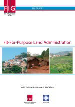
FIG PUBLICATION NO. 60 2ND
EDITION
Fit-For-Purpose Land Administration
JOINT FIG / WORLD BANK PUBLICATION
Stig Enemark
Keith Clifford Bell
Christiaan Lemmen
Robin McLaren
Contents
1 FOREWORD
2 EXECUTIVE SUMMARY
3 DECLARATION
4 INTRODUCTION
5 THE FIT-FOR-PURPOSE CONCEPT
6 LAND GOVERNANCE
- Supporting the global agenda
- Providing responsible governance of tenure in summary
7 BUILDING FIT-FOR-PURPOSE LAND ADMINISTRATION SYSTEMS
- The Spatial Framework
- The Legal Framework
- The Institutional Framework
- Discussion
- Cases (Rwanda, Namibia, Eastern Caribbean, Ethiopia, Indonesia)
8 CAPACITY DEVELOPMENT FOR LAND ADMINISTRATION
9 THE WAY FORWARD
REFERENCES
ABOUT THE AUTHORS
This publication is the result of cooperation between the World Bank and the
International Federation of Surveyors (FIG) over recent years to address the
issue of building and sustaining land administration systems that are basically
fit-for-purpose rather than blindly complying with top-end technological
solutions and rigid regulations for accuracy.
The cooperation started by the joint FIG / World Bank conference in 2009
addressing “Land Governance in Support of the Millennium Development Goals”. A
report from this conference can be found as FIG
Publication No. 45 (FIG/WB, 2010).
At the following annual World Bank Conferences on Land and Poverty concerns
were raised by various stakeholders that the current procedures and requirements
for mapping and boundary delineation were often too cumbersome and expensive and
did not comply with the actual needs of most citizens for achieving security of
tenure. Furthermore, many of the systems that have been established are costly
to maintain and operate and do little to improve service delivery and access to
land information. These
concerns were subsequently addressed at several special seminars and workshops
covering these issues including that of “Spatially Enabling Governments and
Societies for Sustainable Land Administration and Management”.
Emerging from these events is the concept of “fit-for-purpose” indicating
that land administration
should be designed to meet the needs of people and their relationship to land,
to support security of tenure for all and to sustainably manage land use and
natural resources. This perspective calls for a flexible and pragmatic approach
rather than requirements imposed through rigid regulations, demands for spatial
accuracy and systems that may be unsustainable for less developed countries
dependent on donor funding. Of course, such flexibility allows for land
administration systems to be incrementally improved over time, should it be
found necessary. This publication provides guidelines for the building of such
fit-for-purpose land administration systems. The publication presents an
innovative, flexible approach that is jointly endorsed by the World Bank and the
International Federation of Surveyors.
We would like to acknowledge the efforts of the authors in providing this
publication.
It is our hope that the fit-for-purpose approach will be widely applied
throughout the world and especially in less developed countries seeking to
address issues such as poverty alleviation, insecure access to land, inadequate
shelter, social inequity and environmental degradation.
CheeHai Teo FIG President,
Klaus Deininger Lead Economist World Bank
Land administration should be designed to meet the needs of
people and their relationship to land, to support security of tenure for all and
to sustainably manage land use and natural resources. However, the current
solutions to delivering land administration services have very limited global
outreach; 75 percent of the world’s population do not have access to formal
systems to register and safeguard their land rights. The majority of these are
the poor and the most vulnerable in society. There is an urgent need to build
affordable and sustainable systems to identify the way land is occupied and
used. FIG and the World Bank have been cooperating on solutions to this global
issue since 2009 and this fit-for-purpose approach to land administration has
emerged as a game changer.
Fit-for-purpose means that the land administration systems – and
especially the underlying spatial framework of large scale mapping – should be
designed for the purpose of managing current land issues within a specific
country or region – rather than simply following more advanced technical
standards. The fit-for-purpose approach is participatory and inclusive – it is
fundamentally a human rights approach. Benefits relate to the opportunity of
building appropriate land administration systems within a relatively short time
and for relatively low and affordable costs. The fit-for-purpose approach being
proposed here offers governments and land professionals the opportunity to make
a significant improvement in global land issues. It is a realistic approach that
is scalable and could make a significant difference in the intermediate
timeframe. The cases provided in this report highlight just how successful this
approach can be.
The term “fit-for-purpose” is not new at all, but what is new is
relating this term to building sustainable land administration systems.
Therefore, the approach used for building land administration systems in less
developed countries should be flexible and focused on citizens’ needs, such as
providing security of tenure and control of land use, rather than focusing on
top-end technical solutions and high accuracy surveys. A fit-for-purpose
approach includes the following elements:
-
Flexible in the spatial data capture approaches to
provide for varying use and
occupation.
-
Inclusive in scope to cover all tenure and all land.
-
Participatory in approach to data capture and use to
ensure community support.
-
Affordable for the government to establish and
operate, and for society to use.
-
Reliable in terms of information that is authoritative
and up-to-date.
-
Attainable in relation to establishing the system within a
short timeframe and
within available resources.
-
Upgradeable with regard to incremental upgrading and
improvement over time
in response to social and legal needs and emerging economic opportunities.
A country’s legal and institutional framework must be revised to apply the
elements of the fit-for-purpose approach. This means that the fit-for-purpose
approach must be enshrined in law, it must still be implemented within a robust
land governance framework, and the information must be made accessible to all
users.
There is a general consensus that governing the people to land relationship is
in the heart of the global agenda. In this regard, it must be recognised that
land governance and the operational component of land administration systems
need a cost effective spatial framework of large scale mapping to operate. This
will establish the link between people and land, and thereby enable management
and monitoring of improvements to meet the aims and objectives of adopted global
and country based land policies. This is where fit-for-purpose approaches
provide crucial support in building affordable and sustainable land
administration systems. The fit-for-purpose approach includes four key
principles:
- General boundaries rather than fixed boundaries. Using general
boundaries to delineate land areas will be sufficient for most land
administration purposes especially in rural and semi-urban areas. In the
present context, the term “general boundary” means one whose position has
not been precisely determined, although usually, the delineation will relate
to physical features in the field.
- Aerial imageries rather than field surveys. The use of high
resolution satellite/ aerial imagery is sufficient for most land
administration purposes. This approach is three to five times cheaper than
field surveys.
- Accuracy relates to the purpose rather than technical standards.
Accuracy of the land information should be understood as a relative issue
related to the use of this information.
- Opportunities for updating, upgrading and improvement. Building
the spatial framework should be seen in a perspective of opportunities for
on-going updating, sporadic upgrading, and incremental improvement whenever
relevant or necessary for fulfilling land policy aims and objectives.
Ensuring advocacy for change and providing support to change management is a
key role for organisations like the World Bank, UN-FAO, UN-HABITAT, FIG and
other land related professional bodies. The politicians and decision makers in
the land sector are key players in this change process. The hearts and minds of
land professionals need to be turned to fully understand and embrace the
fit-for-purpose approach. Organisations in the land sector need to ensure the
awareness and up-to-date skills of their members and staff. The largest change
will be focused on the public sector where this may involve institutional and
organisational reforms, including legal framework, processes and procedures, and
awareness in terms of incentives and accountability.
To drive this change process there must be effective knowledge-sharing to
ensure the lessons learnt and good practices are widely implemented. It is hoped
that this publication will pave the way forward towards implementing sustainable
and affordable land administration systems enabling security of tenure for all
and effective management of land use and natural resources. This, in turn, will
enable political aims such as economic growth, social equity and environmental
sustainability to be better supported, pursued and achieved.
Read the full FIG Publication 60 in pdf
Copyright © The World Bank and the International Federation
of Surveyors (FIG) 2014., March 2014
All rights reserved
International Federation of Surveyors (FIG)
Kalvebod Brygge 31–33
DK-1780 Copenhagen V
DENMARK
Tel. + 45 38 86 10 81
E-mail: FIG@FIG.net
www.fig.net
Published in English
Copenhagen, Denmark
ISSN 1018-6530 (printed)
ISSN 2311-8423 (pdf)
ISBN 978-87-92853-10-3 (printed)
ISBN 978-87-92853-11-0 (pdf)
Published by
International Federation of Surveyors (FIG)
Front cover: Left: Front cover photos left: Rio de Janeiro, Brazil; mid: Ghana;
right: Nepal.
Design: International Federation of Surveyors, FIG
|


