| |
FIG PUBLICATION NO. 59
International Boundary Making
FIG Commission 1
Professional Standards & Practice

Contents
Preface
Editor and Authors
Foreword
Introduction
Abstracts
PART I
A METHODOLOGICAL COMPREHENSIVE INTERNATIONAL BOUNDARY MAKING MODEL
Chapter 1: The Process of International Boundary Making
Haim Srebro and Maxim Shoshany, Israel
Chapter 2: The Order of Precedence of Boundary Definitions
Haim Srebro and Maxim Shoshany, Israel
Chapter 3: A Model of Boundary Delimitation in a Peace Agreement
Haim Srebro, Israel
PART II
PRACTICAL CASES
Chapter 4: The Israel–Jordan International Boundary
Haim Srebro
Chapter 5: Demarcation of the Iraq–Kuwait Boundary
Miklos Pinther
Chapter 6: Contribution and Challenges for Surveyors in the Establishment of
International Boundaries – Cases in Africa
William A. Robertson
Chapter 7: The Nepal–China and Nepal–India Boundaries
Buddhi N. Shrestha
CheeHai Teo
President
International Federation of Surveyors
Robert Frost in “Mending Wall” poetically said, “good fences make good
neighbours”. In the same vein, our Profession believes good boundaries make good
fences that make good neighbours. This must particularly be so with
international boundaries, as good boundaries unite rather than divide. The
consequence of good international boundaries should promote and contribute
towards peace and shared prosperity. This publication addresses surveying
methodology and experiences in the delimitation and demarcation of international
boundaries. The process of international boundary making is generally
categorised into four recognised phases. They are: the preparations for an
agreement, boundary delimitation, boundary demarcation and, boundary maintenance
and administration.
Surveying for the delimitation and demarcation of international
boundaries is highly specialised.
The team of contributing authors, Miklos Pinther, Bill Robertson, Maxim
Shoshany, Buddhi Shrestha and Haim Srebro, who are also professionals and
practitioners, must be congratulated for their diligent efforts leading to this
publication. It is an accomplishment for this team of authors, from diverse
background yet eminent in their experience and expertise, under the able
leadership of Haim Srebro, Editor for the publication. The support from the
team’s families, employers, and FIG member organisations are equally
appreciated. FIG thanks the New Zealand Institute of Surveyors for co-sponsoring
the printing of this publication.
FIG extends gratitude to the United Nations Cartographic Section
for their contribution to this publication, in particular the peer review
carried out by Ms. Ayako Kagawa, Mr. Ghassan Mkhaimer and Mr. Kyoung-Soo Eom. It
is the hope that this publication will enhance information, knowledge and
practices for the delimitation of international boundaries towards the promotion
of peace throughout the world.
December 2013
The following experts and institutions are acknowledged for their valuable
contributions to this FIG Publication: Editor and Contributing Author
Dr. Haim Srebro is a senior consultant on mapping and boundaries
and author of books on these subjects. Former Director General of the Survey
of Israel (2003–2012). He participated as a leading figure in the
delimitation of the international land and maritime boundaries of Israel.
Since 1994 he is chair of the Israel–Jordan Joint Team of Experts regarding
the international boundary. He is vice chair of FIG Commission 1. He was
FIGWW2009 Congress Director. E-mail:
haim.srebro@gmail.com.
Other Contributing Authors (in alphabetical order)
Miklos Pinther, retired. Former Head, Cartographic Department,
The American Geographical Society (1969–1977). Former Chief Cartographer,
United Nations (1985–2001). He was the Executive Secretary of the United
Nations Iraq–Kuwait Boundary Demarcation Commission at the time of this
demarcation. E-mail:
pinther@optonline.net.
Dr. William Alexander (Bill) Robertson ONZM has been involved in
the demarcation of five international boundaries in Africa and Asia. He has
also acted as an independent consultant on various World Bank
Land Administration projects and for the United Nations. Previously he
served as Director General and Surveyor General of the New Zealand,
Department of Surveying and Land Information. Bill is a Past President of
the New Zealand Planning Institute and a Past President of the Commonwealth
Association of Planners. E-mail:
billrobertson@xtra.co.nz
Prof. Maxim Shoshany is a Professor of remote sensing at the
Department of Transportation and Geo-Information, Faculty of Civil and
Environmental Engineering, Technion, Israeli Institute of Technology. He was
in the past head of the Geography Department at Bar Ilan University.
E-mail: maximsh@tx.technion.ac.il
Buddhi Narayan Shrestha is the former Director General, Survey
Department of Nepal. Currently he is working as the Managing Director of
Bhumichitra Mapping Co. He is the Board Member of ‘Institute of Foreign
Affairs’ nominated by Nepal Government. He has authored seven books on
border demarcation and management of Nepal. He was involved in Nepal–India
and Nepal–China Joint boundary Committees. He is the President of Nepal
Institution of Chartered Surveyors.
E-mail: bordernepal@gmail.com.
Dr Bill Robertson ONZM FNZIS
New Zealand Institute of Surveyors
It is a privilege to write this forword for this important FIG publication
on international boundary making. The New Zealand Institute of Surveyors and I
are proud to be part of the publication under the editorship of Haim Srebro, a
highly experienced international boundary consultant. With this pedigree it
presents an authoritative and knowledgeable outline of the surveyor’s role and
challenges in international boundary making. It serves its purpose well in
promoting the sharing of information, methodological knowledge and experience
required in the delimitation and demarcation of international
boundaries. As such it fills an important gap in publications on the subject of
international boundary determination. Over the last century there have been
numerous determinations of international boundaries and many books and papers on
this. However, these are invariably concerned with the legal and political
dimensions of international boundaries. Thus, this collection of surveying
methodology and experience is particularly timely in emphasising the role of
surveying and describing the range of processes and procedures involved. It
records a full surveying and demarcation methodology that has existed previously
only in the scattered records of various international boundary projects. The
contents confirm surveying for international boundaries is of a high level
specialist nature and that the surveyors’ role demands a wide portfolio of
surveying expertise. These range through documentary research, geodetic
surveying, digital imagery and mapping, reconnaissance, ground marking and
positioning etc. The references to the surveyor working within strict legal and
political parameters are most valuable and highlight the serious constraints
imposed on surveying activity and conduct in the international legal and
political arena. The proposed methodology for establishing a boundary making
process between two states provides a very useful survey guidance model avoiding
the need to continually reinvent from surveying first principles. The process of
international boundary making is categorised in the four generally recognised
phases. These are the preparations for a boundary agreement, boundary
delimitation, boundary demarcation, and boundary maintenance and administration.
All phases require significant surveyors’ input. The compilation of chapters
from five well experienced authors on seven different international boundaries
provides a wealth of surveying experience. It contains a depth of learning
through the application of survey practice in a wide variety of historic,
physical and political circumstances. References to International Court of
Justice and Permanent Court of Arbitration and other cases provide authoritative
sources for detailed follow up by readers and practitioners. This publication is
timely and it provides comprehensive documentation and guidance on a specialist
topic of surveying that has been lacking up until now. It is a very good
reference publication for all involved or interested in international boundaries
and fills a gap both in surveying and international boundary literature. FIG is
to be congratulated on producing this publication at this time as a valuable
service to the international surveying community.
December 2013
Haim Srebro, Editor
This FIG Publication elaborates on the process of boundary
making. Its purpose is to propose a comprehensive methodology for establishing a
boundary making process between two states that wish to constructively and
fairly settle their international boundary together. It begins with preparations
for a boundary agreement and continues with the boundary delimitation, the
boundary demarcation, boundary documentation, and boundary maintenance,
including considerations regarding long-term boundary maintenance and
administration. The methodological part, chapters 1–3, includes a model for
initiating a boundary making process, an order of precedence of boundary
definitions, and a model for the boundary chapter in a peace/boundary agreement.
This part is augmented by reflections made in the second part regarding the
methodology, including those of William Robertson in chapter 6 regarding the
role of the surveyor in the process.
Part two, chapters 3–7, includes practical cases of delimitation
of international boundaries. Many lessons can be learned from these diverse
cases regarding disputes and regarding the models and mechanisms used for
dealing with the issues. We focused on land boundaries between states. The
practical cases have been especially selected in Asia and Africa, two continents
in which a significant part of their area had been controlled by colonial
governments. Most of the new states that have been established since WWII are in
Asia and Africa. Owing to formal decisions and practical trends, the
international boundaries of the post-colonial states follow the colonial
boundaries and, thus, inherited the delimitation problems mentioned above. The
presented practical cases refer to such boundaries. The Israel–Jordan boundary
was defined in a peace treaty, following bilateral negotiations between the two
sovereign states. All the relevant activities were achieved by collaborative
work between the parties. This boundary serves as a successful model for
implementing the methodological model of the boundary-making process. A joint
team of experts of boundary surveyors (JTE) was fully integrated into the
process from its beginning and continues today to be a major contributor to
successful ongoing boundary maintenance and boundary administration.
The Iraq–Kuwait boundary is the first international boundary
demarcated by a special Demarcation Commission in accordance with a UN Security
Council resolution. The boundary line had been demarcated through a systematic
methodological process. An international surveying team carried out the
decisions of the Commission and contributed to its success.
Three boundaries in Africa are presented in the FIG Publication.
The Ethiopia–Eritrea boundary – A special international Boundary Commission was
established in a peace agreement between the states for interpreting the
delimited and demarcated colonial boundary according to international law. A
professional surveying team successfully supported the commission’s work. Lack
of a full agreement
between the two states regarding the placement of boundary markers prevented the
completion of the task. The Cameroon–Nigeria boundary – The two states agreed to
establish a common boundary committee chaired by the UN, in order to implement
the decision of the International Court regarding the international boundary
between them. The level of involvement of the two states regarding the decisions
and their execution was very high. A joint technical committee (JTT) was
established for implementing the decisions. The Abyei boundary Sudan – The
parties established a special arbitration tribunal regarding the reliability of
the interpretation of a previous boundary committee (ABC) that had discussed the
colonial historical boundary, which was subjected to an arbitration agreement
and the law of the Permanent Court for Arbitrations, The process has not yet
been completed.
Chapter 1: The Process of International Boundary Making
Haim Srebro and Maxim Shoshany, Israel
This chapter elaborated on the issue of the boundary-making process and
proposed innovations by adding two designated stages to the traditional three
stages. The three traditional theoretical stages include the allocation, the
delimitation of the boundary, and its demarcation on the ground. These stages
were reviewed including the interrelationship between them. The basic terms and
definitions were also reviewed. The two additional designated stages, proposed
in this chapter, include the preparation of mutually agreed precise
documentation, and implementation of boundary maintenance. Mutually agreed upon
precise documentation of the boundary, which is adequate for boundary
maintenance and boundary restoration, is considered to be the most important
tool for preventing future conflicts over the location of the boundary. Adequate
ongoing boundary maintenance is an important contributor to maintaining
continuous boundary stability. This chapter also analyzed the interrelations
between the political and technical stages and the associated activities. We
believe that a joint effort in following the proposed model, including thorough
preparation of the delimitation line and the treaty, to ensure the proper
incorporation of the main essential elements, greatly contributes to stabilizing
the boundary. This, supported by ongoing joint boundary maintenance, will
prevent future boundary disputes, thus, contributing to peace and security for
all the parties.The proposed model has been successfully implemented during the
last nineteen years along the international boundary between Israel and Jordan.
Chapter 2: The Order of Precedence of Boundary Definitions
Haim Srebro and Maxim Shoshany, Israel
The objective of this chapter is to introduce an order of
precedence of boundary definitions that results from analysis and evaluation of
the implementation of boundary definitions throughout the boundary making
process. The use of such an order of precedence may improve new boundary
delimitation and may contribute to better evaluations of boundary evidences when
restoring old boundaries. This analysis refers to the boundary making process as
described in Chapter 1. Chapter 3 presents the implementation of such an order
of precedence in a new peace agreement, and shows a method
of envisaging later activities such as demarcation and documentation in the
early stage of boundary delimitation.
The authors of this chapter recommend making a list of order of precedence. This
list is based on judgments of ICJ and of international Tribunals, on the
practice of states and on the practice of the authors during the tracing of
several international boundaries. The adoption of the conclusions may prevent
future boundary disputes all over the world and thus may contribute to peace.
Stable international boundaries contribute to peace all over the world. The
achievement of stability and the finality of the boundary is one of the primary
objects according to the International Court of Justice (ICJ reports, 1962, 34).
There are various ways of defining the boundary lines. The traditional ones,
which were put into practice in unilateral Orders or formal Declarations,
or in bilateral Agreements, include verbal descriptions, graphic charts or
schemes, maps, coordinates, or a combination of them.
Sometimes their quality is poor and sometimes there are contradictions between
various definitions. Such cases do not contribute to the stability of the
boundary. Since the boundary-making process takes time, problems may arise as
early as the demarcation phase, when the definition of the boundary in the
delimitation has to be transferred in practical terms to the ground in the
implementation stage. Furthermore, in time, physical markers may disappear and
the boundary line may require restoration. The political status regarding the
two sides of the boundary may also change, and disputes and conflicts may arise
with regard to the location of the boundary line. The solution of such a
conflict can be resolved either by bilateral negotiations, or conciliation, or
arbitration by an international Tribunal and sometimes by the International
Court of Justice itself. Such a solution will always depend on defining a final
boundary line, based on various evidences of the boundary delimitations, which
are available to the Tribunal or the Court.
This article deals with the order of precedence, given to the various boundary
definitions in the delimitation and demarcation stages, in order to provide the
boundary engineer with essential information about the measures, methods, and
techniques that should be used during the boundary-making process, to ascertain
a stable, final, easy-to-restore boundary.
Chapter 3: A Model of Boundary Delimitation in a Peace Agreement
Haim Srebro, Israel
This chapter presents a model of reference for the
responsibilities and assignments to tasks that should be taken care of in treaty
delimitation. In addition, the chapter also refers to specific instructions that
refer to technical activities throughout the boundary making process.
It recommends a model for incorporating these tasks and instructions into the
treaty delimitation. The chapter shows the implementation of the recommended
model in the case of the 1994 Israel–Jordan Peace Treaty. It analyzes the
implementation of the model in this special case and discusses technical lessons
learned from the special case. The joint smooth implementation of the model
during the Israeli-Jordanian boundary making process, and the fact that all the
practical problems with regard to the boundary line for the last 19 years since
the treaty were successfully solved using the model
show the importance of such a model for boundary management and for prevention
or solution of boundary disputes.
Chapter 4: The Israel–Jordan International Boundary
Haim Srebro
The international boundary between Israel and Jordan has been
defined for the first time as an international boundary between two sovereign
states in the 1994 Peace Treaty. The allocation of this boundary has been
referred to as the boundary during the British Mandate. The boundary-making
process followed a systematic methodological model of boundary making, which had
been developed following (bad) experience in other boundary cases around the
world.
The model, which includes the stages of preparatory work, boundary delimitation,
boundary demarcation, boundary documentation, and boundary maintenance has been
developed so that reverse engineering considerations influence the process from
its beginning.
In such a way, the requirements for the boundary maintenance are taken into
consideration and implemented in the boundary documentation and are considered
at earlier stages, from the technical geodetic preparation before the boundary
delimitation, to a peace/boundary agreement and onwards. The requirements for
boundary demarcation influence the boundary delimitation and associated issues.
Thus, thorough preparation, both regarding technical aspects and methodological
considerations, should be carefully handled before the boundary is delimited in
the peace agreement.
This can be achieved only if a joint technical team is established as early as
possible, when the process is launched, to carry out all the required
activities. This was implemented by Israel and Jordan, establishing the Joint
Team of Experts on the first day that the two negotiation committees, including
the boundary sub-commission, convened in WA to open practical negotiations for a
Peace Treaty. Not only was the JTE responsible for the technical activities
prior to the Peace Treaty and for implementing the process during the
demarcation and documentation of the line—the JTE has been playing an important
role regarding the boundary maintenance through the years. For the last 19 years
since the 1994 Peace Treaty was signed, the JTE has been conducting annual
reconnaissance surveys and maintenance activities, repairing and reconstructing
damaged or missing boundary pillars, monitoring deviations, and providing
remedies. The chairs of the JTE prepare a signed annual report to the chairs of
the Joint Boundary Commission. The continuous joint activity of the JTE,
strictly following the predefined process, and quickly monitoring and preventing
local encroachments, greatly contributes to the exceptional maintenance and
stability of the boundary line, in spite of the development on both sides of the
boundary. The JTE tries to actively support the requirements of the development
and to prevent potential obstacles.
Chapter 5: Demarcation of the Iraq–Kuwait Boundary
Miklos Pinther
The present chapter is a summary account of the first complete
demarcation of the international boundary between Iraq and Kuwait, a process
undertaken between May 1991 and September 1993; the first demarcation of an
international boundary to be carried out at the request of the United Nations
Security Council. The chapter describes the circumstances that led to the
formation of the boundary commission, including the geographical setting and the
historical background, the process of surveying the land and off-shore sections,
the deliberations and decisions reached by the commission and the installation
and documentation of the boundary markers. The concluding remarks offer a brief
assessment of the work accomplished.
Chapter 6: Contribution and Challenges for Surveyors in the
Establishment of International Boundaries – Cases in Africa
William A. Robertson
The surveying role reflected in the three international boundary
determinations reported above demonstrate the contribution of surveying in
disputed international boundaries. Although the emphasis in the three boundary
projects is from the perspective of survey support for Boundary Commissions,
surveyors had a much wider involvement. National surveying organizations
belonging to each Party were fully involved throughout the long process of
advising their governments and preparing successive submissions, counter
submissions and responses for the various stages and hearings of the
administrative, political and judicial processes involved. As well as this,
counsel and other expert witnesses in their evidence made frequent references
and use of spatial, geographical and mapping information. Surveyors are
recognized and valued by boundary commissions and tribunals for the integrity
and professional expertise they provide. This role in a testing advocacy
oriented environment inevitably subjects their work and evidence to the closest
of scrutiny, checking and cross examination. The survey role is therefore not
simply a technical one but requires a careful consideration of the role and
function of surveying and cartography in the specific political and legal
environment that applies in each individual international boundary case. The
performance of the surveyor in this role is highly transparent and accountable.
He/she needs to analyze the range of expert evidence submitted requires a level
of insight, maturity of judgement and expertise at a higher level than that
required in normal cadastral surveying it is derived from the same base of
knowledge and skills.
The boundaries described here involved the determination of international
borders where there had been some dispute and hostility. In each of these cases
historic treaties and the establishment of a judicial commission set strict
legal parameters for the conduct of surveying. The discipline involved in such
cases also applies to the contribution of surveyors where two sovereign states
are independently determining their boundary. In this much more usual situation,
knowledge of the legal/judicial constraints on map and understanding surveying
evidence and documentation is still very important.
However surveyors discharge their technical and quasi judicial role, their
performance needs to withstand searching legal scrutiny.
Chapter 7: The Nepal–China and Nepal–India Boundaries
Buddhi N. Shrestha
The Height of Mount Everest
The third joint boundary inspection to sign the fourth boundary protocol
between Nepal and China should be completed as soon as possible. The connection
of the recently found boundary marker 57 to the borderline must be based on the
boundary delineation and facts on the ground.
Technical skills must be used, and the issue should not be influenced by
sentiments, simply because border demarcation and inspection is purely a
technical job. To find a proper solution, both countries should act according to
the spirit of the treaty and previous boundary protocols and maps. These issues
should be resolved by higher authorities through diplomatic channels, since they
have already been forwarded from the technical level. From the perspective of
good relations, friendship, and mutual understanding between Nepal and China in
all spheres, this type of minor border issue should be resolved in an amicable
manner. The Fourth Boundary Protocol should be signed as soon as possible,
sorting out the debatable items in due course. Nepal and China should
measure and determine jointly the precise height of the tallest mountain in the
world. The height controversy should be settled once and for all.
Establishment of Nepal–India–China Tri-Junction Points
The total length of the Nepal–China boundary line demarcated so far is
1,439.18 km. The main boundary pillars erected along the boundary line are
numbered 1 to 79 in serial order from west to east, with many reference pillars
on both sides of the borderline. However, the tri-junction points on both the
western and eastern ends of the borderline, where the Nepalese, Chinese, and
Indian territories meet, have not yet been fixed. This is because an Indian
representative was not present during the Nepal–China boundary demarcation.
Nowadays, India and China have improved their relations. India–Nepal neighborly
relations have been maintained for centuries. Nepal must formalize all its
border issues through diplomatic channels, including the establishment of
Nepal–India–China tri-junction points. The western tri-junction point should be
determined according to the maps and documents published by the Survey of India
around the time of the treaty of Sugauli. Nepal has to convince its southern
neighbor, India, and to invite its northern neighbor, China, to decide on a
single platform for the finalization of the triple point, since this point is
related to all three countries, and their joint presence is required.
Copyright © International Federation of Surveyors, December
2013,
All rights reserved
International Federation of Surveyors (FIG)
Kalvebod Brygge 31–33
DK-1780 Copenhagen V
DENMARK
Tel. + 45 38 86 10 81
E-mail: FIG@FIG.net
www.fig.net
Published in English
Copenhagen, Denmark
ISBN 978-87-92853-08-0
Published by
International Federation of Surveyors (FIG)
Editor: Haim Srebro
Authors: Miklos Pinther, William A. Robertson, Maxim Shoshany, Buddhi N.
Shrestha, Haim Srebro
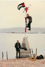
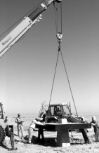
Front cover and introdcution photos: Haim Srebro
Design: International Federation of Surveyors, FIG
|