News in 2018

|
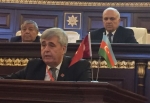
FIG Vice President Orhan Ercan attends Euroasian GIS Congress 2018
4-7 September 2018, Baku Azerbaijan
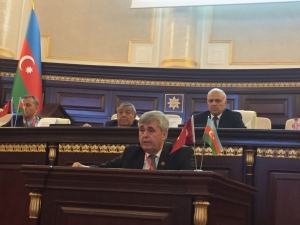
FIG Vice President Orhan Ercan gave an address on behalf of FIG
in the Opening Ceremony |
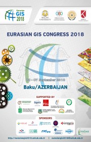
The Euroasian GIS 2018 Congress was held on September 4-7 in
Baku. I joined the Congress as Vice President of FIG. I made the
opening speech on the opening ceremony on 4 September 2018.
Approximately 300 people attended the congress. It is necessary
to implement works on identification and prevention of different
problems through taking big advantages enabled by Geographic
Information Systems, usable in analyzing sustainable
socio-economic development of regions and countries.
|
Congresses in this direction confirm that this event can play a
significant role in the establishment of scientific, economic, political
and cultural relationship between the countries in the field of
scientific cooperation and communication among scientists and
specialists of the region, as well as discussing the acquired scientific
and experimental materials.
 |
One of the attributes of the implementation of the orders and
instructions of the President of the Republic of Azerbaijan Ilham Aliyev
on the establishment of e-government in the country, the structure of
spatial data and their placement on government portals is the
development of GIS technologies throughout the country, the study and
the application of theoretical issues of these technologies in practice.
Relatedly, the held Congress was focused on the discussing and sharing
of practical issues and carrying of innovative analysis in the field of
Geographic Information Systems, as well as the combining of efforts of
the representatives of science and research, representatives of the NGOs
and government entities.
|
Taking into consideration the importance of applying modern
technologies based on the Geographical Information Systems, the
interpretation and analysis of remote sensing data, and also the use of
space images, the followings are taken into decision:
- Improvement of geographical information systems, spatial
database structures and spatial analyses by carrying wide scientific
researches and also relevant tuitions and trainings at the level of
modern requirements, as well as conduction of training of highly
qualified personnel is needed.
- The role and application of GIS analyses in prior revealing of
threats and preventing of disasters must be considerably promoted,
with based on use of environmental monitoring, as well as management
of natural disasters and natural resources.
- Establishing a database and contributing to development of
agricultural branches through applying GIS analyses in researches on
land resources, water and climate, as well as cadaster issues, land
planning and management would favor the increasing of the share of
non-oil sector within national economies, and particularly in
Azerbaijani economy.
- Conduction of studies on climate change, tectonic movements,
desertification and other global problems makes necessary to foster
works on establishing the international database with using the GNSS
methods, remote sensing and geodetic measurements.
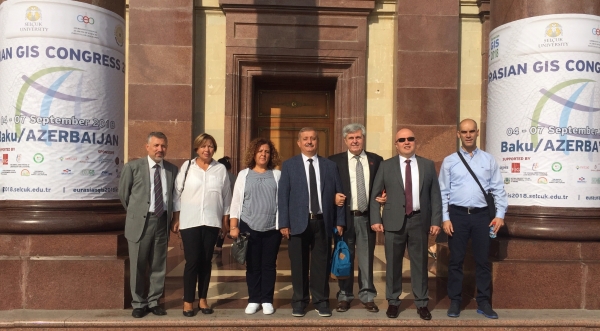
FIG Vice President Orhan Ercan together with the Turkish delegation at the Congress
and Prof Dr Ferruh Yıldız, co-Congress director, standing to the
left of Orhan Ercan. Turkish delegates included Sedat Bakıcı, head of
the Department of information technologies at central cadastre
organisation, Mert Yasin Öz, GIS branch head at cadastre and to the very
left Dr Muzaffer Kahveci.
Orhan Ercan
October 2018