Climate Change and Responsible Governance: The Role of Surveyors in Assisting Small Island Developing StatesJohn HANNAH, New Zealand
1) This paper was presented in a plenary session at the Pacific Region Small Island Developing States Symposium, 18-20 September 2013 in Suva, Fiji. The paper discuss how surveyors can contribution to the issues of climate change and responsible governance, particularly as they affect Small Island Developing States (SIDS). The paper reflects some of the work the FIG Task Force on Climate Change has been undertaking since it was established in 2010. John Hannah is chair and at the FIG Congress 2014 in Kuala Lumpur, Malaysia the task force will deliver a final report. ABSTRACTSmall Island Developing States (SIDS) face much
higher vulnerabilities than developed nations. A substantial number of
these vulnerabilities are linked to climate change and involve decisions
over the future best use of land and other resources. The surveyor has a
diverse skill set that can be used to provide the data, the analyses,
the insights and the understanding needed to help make these decisions. 1. INTRODUCTIONThe professional skills that form an essential part of the surveyor’s tool kit, while not widely appreciated or understood, are diverse, varied and valuable. In its most recent definition of the functions of a surveyor, the International Federation of Surveyors (FIG) considers that such a person has the, “academic qualifications and the technical expertise to conduct one or more of the following activities:
While these are very broad statements of capability,
they give rise to a practical, pragmatic professional person who
understands spatial measurement, who can represent and interpret spatial
information, who is very competent in the administration and governance
of rights to the land and sea, and who is capable of planning for the
development and use of land. Such a person typically has much of the
technical understanding and many of the skills necessary to exercise
responsible governance over land, being willing to innovate and reform
where necessary. The breadth of professional knowledge and experience in
these issues that surveyors have is an invaluable resource to a world
seeking long-term sustainable solutions to its many and varied land
administration problems. 2. CLIMATE CHANGE – THE ROLE OF THE SURVEYORThe evidence for present day, human induced climate change is overwhelming. However, the full extent to which climate is likely to change in the future (both near term and long term) remains unclear. Climate models produce a wide range of possible outcomes depending upon the various forcing factors used – factors that, in turn, depend upon assumptions relating to industrial growth, greenhouse gas emissions, deforestation, and human response (amongst other things). Coping with the resulting environmental change (the 20th ranked issue in UNEP, 2012) requires the assessment of a wide variety of response options. In the same vein, other UN documents (e.g., FAO, 2012) encourage states to have laws, policies, strategies and actions that are designed to protect the legitimate tenure rights of those affected by climate change. Such states are encouraged to prepare and implement strategies and actions to help those displaced by the impacts of climate change. Similar (but wider) provisions are suggested for dealing with the effects of natural disasters. The question may be asked, ”Where do surveyors fit into this picture?” What particular knowledge does the surveyor have that can assist the global community as it grapples with its understanding of the quantum of change and, with it, the various mitigation or adaptation strategies that may be required? The paragraphs below seek to answer these questions. 2.1 Measuring and Monitoring ChangeThe surveyor, by virtue of his/her spatial measurement skills, is closely involved in monitoring spatial change. Typically, such change is determined with respect to some coordinate (or reference) system – a system most likely established by professional surveyors. It was surveyors, for example, who were responsible for the definition of the current Fiji Geodetic Datum (1986) [c.f., Hannah and Maseyk, (1989)]. As with any reference system, its long term stability (or alternatively, an accurate knowledge of movement in that system with respect to time), is crucial if the data provided by global monitoring systems are to be correctly interpreted. For example, best estimates of global mean sea level (GMSL) change from satellite altimetry indicate a sea level rise from 1993-2013 of 3.2 ± 0.4 mm/yr compared to in-situ tide gauge data of 2.8 ± 0.8 mm/yr (Church and White, 2011, 2013). While this would seem to imply recent acceleration in the rate of rise of mean sea level (MSL) from its long-term average of 1.8 ± 0.2 mm/yr, no clear evidence of such acceleration can be detected in the long-term tide gauge records. Could this discrepancy then, in part, be a reference system problem? While the above example highlights issues at the global level, monitoring issues at the local level are just as important to climate change studies. It is the local surveyor who is responsible for providing the high precision measurement link between a tide gauge and the various bench marks needed to monitor its stability. In New Zealand, it is the surveying community (in conjunction with others) that has been at the forefront of the long-term sea level change analyses that have informed public policy makers on future climate change scenarios (e.g., Hannah et al, 2010). 2.2 Data Integration and AnalysisIn any climate change analysis, “what if” scenarios form an important part of that analysis. In principle, integration and analysis of the relevant data needs to precede mitigation and adaptation. It is the outcome of such analyses that will inform policy makers if the primary need is one of mitigation or adaptation. Not only must the spatial data used be in the same reference system (see 2.1, above), but the spatial analysis tools used for such analyses must be capable of the necessary analyses. Such tools, which are typically part of a GIS, are found in the surveyor’s tool kit (e.g., Mardkheh et al, 2012). 2.3 Mitigation and AdaptationFrom the surveyor’s spatial perspective, climate change mitigation measures need to be developed for three primary land use categories.
In addition to the above, climate change adaptation
will involve the design and construction of new infrastructure
(particularly in the coastal margins and in flood prone areas), the
re-location of land boundaries (particularly those abutting water
bodies), re-forestation, the development of carbon markets and the
construction of renewable energy sources. All of these activities
require the intimate involvement of the surveyor. 3. RESPONSIBLE GOVERNANCE – THE ROLE OF THE SURVEYORIn 2012 the United Nations Environment Programme issued its report on the most important emerging issues related to the global environment (UNEP, 2012). The top ranked issue in that report relates to aligning governance procedures to the challenges of global sustainability. It involves the task of putting in place environmental administrative and governance processes that are representative, accountable, effective and transparent. This, too, is an underlying theme in FIG (2010). 3.1 Measurement and MappingThe land and seas form two crucial components of the global environment. In the modern world, the first step to sustainable governance of a resource is to understand the environmental characteristics of that resource and its spatial dimensions. In this regard, it is the surveyor who undertakes the spatial measurements that determine the dimensions and the topography of both the land and the sea floor. It is the surveyor who integrates these data into the Geographic (or Hydrographic) Information System (GIS) that, in turn, allows these areas to be displayed in digital form, thus providing the basic stepping stone for their sustainable management and governance. 3.2 Administration and GovernanceWhile the accurate definition of the global topography is a vital component in any move towards global sustainability, it is but a supporting part of a bigger picture. The Voluntary Guidelines on the Responsible Governance of Tenure of Land, Fisheries and Forests in the Context of National Food Security (FAO, 2012), point to this bigger picture when they note the three important elements of responsible governance. Such governance:
Amongst other things, states are encouraged to establish up-to-date tenure information on land, fisheries and forests and to hold this information in such a manner that ownership rights are transparent. Where appropriate, land consolidation is suggested as a means of improving layout and use. The Voluntary Guidelines then proceed to recommend that, “States should provide systems (such as registration, cadastre and licensing systems) to record individual and collective tenure rights in order to improve security of tenure rights“- (Sec. 17.1). At their very essence, these tasks fall squarely within the professional domain of the surveyor. In most jurisdictions it is the surveyor who defines land (and sea) boundaries, who understands the rights associated with the associated land parcels and who helps devise the administrative and governance processes used to control these parcels. The successful land titling project in Thailand that was initiated in 1984 has served as a model for other Asian nations as an example of what the surveying community can achieve (Brits et al, 2002). On a much smaller scale it was two New Zealand surveyors who, in 1957, travelled to Tonga to begin work on designing and implementing the official cadastral survey system – a system that continues to work well to this day. Their task was to help fulfill the constitutional requirement that every Tongan man should be allocated an area of arable land for the support of his family, (Alexander and Wordsworth, 2013). Unfortunately, in some cases, while the surveyor may wish to be a change agent, that which can be achieved is constrained by institutional impediments such as political systems and gender bias. Long-term sustainable solutions depend, in part, upon addressing such issues. 3.3 Land Use PlanningThe 11th ranked issue in UNEP, (2012) is the need to
boost urban sustainability and resilience. The key to such
sustainability is seen to lie in the concept of “green” cities or “eco”
cities which differ from conventional cities in that they, “have a vital
mix of land uses within their borders, produce renewable energy and
provide low-energy transportation opportunities”. It is clear that the
design of such cities will require multi-skilled teams of whom the urban
planner is but one. It is of relevance to note that in some
jurisdictions (e.g., New Zealand and NSW, Australia) such planning
functions form an important part of the surveyor’s training and tool
kit. In these jurisdictions, the design of urban and rural subdivisions,
with their associated planning constraints, are an integral part of
professional surveying practice. 4. SMALL ISLAND DEVELOPING STATES (SIDS) – WHAT ARE THE ISSUES?SIDS were first recognized as a distinct grouping of countries at the UN Conference on Environment and Development held in June, 1992. They are a distinct grouping of developing countries, typically low lying, that share similar social, economic and environmental vulnerabilities. Their greatest challenge is one of sustainable development at a time when, for some, their very existence may be under threat. Briguglio (1995), in developing a vulnerability index for such countries, noted their small size (thus leading to limitations in natural resources, small domestic markets, a dependence upon exports from a narrow range of products, and poor economies of scale), their insularity and remoteness (resulting in high transportation costs and uncertainties in supply), their proneness to a disproportionally high level of disruption from natural disasters, and other environmental factors. These other environmental factors were seen to include any or all of the following:
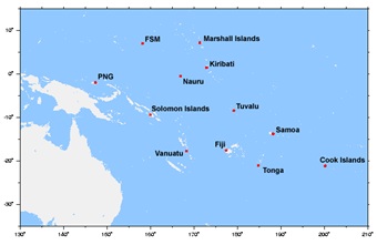
In many regards it is a combination of small size and this latter reliance that makes them particularly vulnerable to sea level rise and storm related devastation – both potential consequences of climate change. It is thus no surprise that, amongst other things, the 2005 Mauritius Strategy for SIDS (UN, 2005) specifically mentions the need for strategies and actions related to climate change and sea level rise, natural and environmental disasters, and land resources. In order to provide a first measure of vulnerability, Brigugilo (1995) developed a normalized vulnerability index. By his assessment, SIDS countries had a vulnerability factor of 0.635 versus an index of 0.418 for non-island developing countries and an index of 0.328 for developed countries. Even allowing for subsequent refinements in these indices, the message remains clear, that SIDS are far more vulnerable to natural disasters and external shocks than larger, non-island developed nations. Of the 52 identified SIDS countries, 14 are in the Pacific Region. Of these 14, three (Tuvalu, Marshall Islands, and Micronesia), are particularly subject to the consequences of sea level rise. Indeed, even the seemingly modest rise of 18–59 cm by 2100, based upon IPCC (2007) has the potential for very significant consequences. Wong (2010) identifies some of the difficulties that the majority of SIDS face with respect to climate change. Such difficulties include:
In total, the problems arising from climate change
that directly affect SIDS are vastly greater in overall magnitude than
those facing many of the non-island developing nations. It is in this
arena that surveyors give thought to the contribution that they can
make. 5. PULLING IT TOGETHER - WHERE CAN SURVEYORS ASSIST? The previous paragraphs provide a foundation for understanding the role of surveyors and the particular problems faced by SIDS. From them it should be clear that surveyors have an important role to play in helping SIDS, not only in their development (as has been the case in the past), but also in their adaptation to future change and the mitigation of the effects of such change. The following avenues for action are suggested.
CONCLUSIONS Surveyors have traditionally played an unheralded but
leading role in the development of small nations. Their spatial
measurement, planning, and land administration skills have combined to
support the development of essential elements of island infrastructure.
As SIDS face the significant changes that lie ahead, the surveying
profession has the skill base to provide assistance through this next
phase of their development. In recent years it has perhaps been the
profession’s lack of public profile that has limited the call for such
contributions. This need not be the case in the future. The author would
advocate strongly that great benefit could be derived by SIDS if they
had greater access to the knowledge and skills that are an integral part
of the surveyor’s professional tool-kit. This should be an integral part
of their capacity building exercises. REFERENCES Alexander, B., and Wordsworth, L.S (2013). 100 Fathoms Square - the Surveying of Tonga. Available from Bruce Alexander, 111 Hackthorne Road, Cashmere, Christchurch, 8022, NewZealand. Bell, R.G., and Hannah, J., (2012). Sea-Level Variability and Trends: Wellington Region. Report prepared by the National Institute of Water and Atmospheric Research (NIWA). Briguglio, L (1995). Small Island Developing States and Their Economic Vulnerabilities”. World Development, Vol. 23, No. 9, pp.1615-1632. Brits, A-M., Grant, C., Burns, T., (2002). Comparative Study of Land Administration Systems with Special Reference to Thailand, Indonesia and Karnataka (India). Regional Workshops on Land Policy Issues, Asia Program. Available at http://www.landcoalition.org/sites/default/files/legacy/legacypdf/wbtcsind.pdf?q=pdf/wbtcsind.pdf Church, J.A., and White, N.J., (2011). Sea-Level Rise From the Late 19th to the Early 21st Century”. Surveys in Geophysics 32:585-602, doi:10.1007/s10712-011-9119-1 FAO, (2012). Voluntary Guidelines on the Responsible Governance of Tenure of Land, Fisheries and Forests in the Context of National Food Security, available from FAO, Rome. FIG, (2004). Found at www.fig.net/general/definition.htm and accessed on 4 Sept. 2013. FIG, (2010). Sydney Agenda for Action (Small Island Developing States and the Millenium Development Goals: Building Capacity). FIG Publication No. 53, available from http://www.fig.net/pub/figpub/pub53/figpub53.pdf Hannah, J., Bell, R., Paulik, R., (2010). Sea-Level Change in the Auckland Region. Report prepared for the Auckland Regional Council. Hannah, J., and Maseyk, J., (1989). The Definition and Adjustment of
the Fiji Geodetic IPCC, (2007). Climate Change 2007: Impacts, Adaptation and Vulnerability. Cambridge University Press. Mardkheh, A.J., Mostafavi, M.A., Bédard, Y., and Long, B., (2012). Toward a Spatial Decision Support System to Improve Coastal Erosion Risk Assessment: Modeling and Representation of Risk Zones. Presented at the FIG Working Week, Rome, May, 2012. Available at http://www.fig.net/pub/fig2012/papers/ts04k/TS04K_jadidimardkheh_mostafavi_et_al_5958.pdf UN, (2005). Found at http://www.sidsnet.org. UNEP, (2012). 21 Issues for the 21st Century: Result of the UNEP Foresight Process on Emerging Environmental Issues. United Nations Environment Programme, Nairobi, Kenya. White, N., (2013). Historical Sea-Level Changes Over the Last Two Decades. CSIRO sea-level rise web site: http://www.cmar.csiro.au/sealevel/sl_hist_last_15.html Wong, P.P. (2010). Small Island Developing States. WIREs Climate
Change 2011 2 1-6 DOI:10.1002/wcc.84. John Wiley and Sons Ltd. BIOGRAPHICAL NOTES |