Geodesy and Surveying in the Future, The Importance of Heights
15th-17th of March, 1999 in Gävle, Sweden
By Michel Kasser and Jean-Marie Becker
Introduction.
FIG Commission 5 organised an important international seminar entitled "Geodesy and Surveying in the Future" with special focus on the subject "The Importance of Heights". The seminar was made in collaboration with the Height Determination Working Group from the Nordic Commission of Geodesy (NKG) and the Geodetic Divisions from the National Land Survey of Sweden (NLS).
The choice of the subject, place and date for this event were connected to the 25th anniversary of the introduction of the Motorised Levelling (ML) technique in Sweden. It was decided that it was suitable to celebrate it with a "Jubilee Seminar".
Jean-Marie Becker, Mikael Lilje and Per-Ola Eriksson from NLS in collaboration with the FIG WG-5.2 " Height Determination Techniques" (chaired by Michel Kasser) was the organisers of the seminar.
About 120 participants coming from more than 20 countries contribute with 50 presentations during the 3 seminar days and made it to a success.
An exhibition about height determination techniques and instrumentation from the past 50 years and a practical demonstration on Motorised levelling were also organised at the same time.
In connection with the seminar FIG C5 also had its first SC5 (Steering Committee) meeting. All FIG-C5 Working Groups were represented at this meeting by their chair and/or vice chair. In total 13 persons were present. Reports about ongoing and future activities were given and discussed. Also the participation or organising of WW or seminars were on the agenda. All participants expressed their satisfaction about this kind of working meeting for the officers and members of the commission 5. It is planned to make reports on it in our C5 Newsletters.
Furthermore several C5 Working Groups (WG-5.2 and WG-5.5) organised separate meetings specific for their WG-mission. These meetings were open to all participants and we noticed around 15 to 20 participants at each meeting. It is important to make full use of these meetings when people are actual meeting each other. Internet and telephones are great thing to use to discuss certain items but an actual meeting when you meet several people in person is the best way. A problem though is that these meetings are usually not in the seminar program from the beginning and it is sometimes hard to find appropriate times for the meetings during the seminar. We are happy that two working groups were able to have meetings.
Different Working Groups within the Nordic Commission of Geodesy as the Height Determination Group, Satellite Geodesy Group and Geodynamics Group used also their presence in Gävle to have several WG meetings the 18th March. In total about 30 members of NKG participated to these meetings. These were first held as separate meetings for each WG in the morning, and then in the afternoon to a common joint meeting about the Nordic Levelling Networks in the different countries and a common finalisation of them.
The Technical Sessions.
This seminar was the first in its kind about "Heights" organised in the Nordic countries and probably the only one in the world during the last decade. As indicated in the title the seminar had two main and complementary directions namely Geodesy and Surveying. The objective was to give a complete overview and the state of the art concerning height determination questions. The different technical sessions concern the whole spectrum of techniques, instruments, and applications and cover all aspects from purely scientific to practical end users applications. 50 papers were presented and 19 refused for lack of time. This shows that the subject "Importance of Heights" is for the time being again in the focus of the Geodesy and Surveying society.
The seminar was also a good opportunity to communicate and exchange information, knowledge and experience between different actors (scientists, developers, manufacturers, practitioners) and communities (IAG = International Association of Geodesy and FIG).
For that purpose the organisers had invited eminent speakers representing all this different aspects with specific presentations covering the whole spectrum.
This integrated seminar around a given technical subject "heights" made it possible to better understand each other (FIG and IAG members or scientists and practitioners) and that will hopefully benefit both. It was also the first attempt from FIG C5 to clarify its role as a link between the scientific community (IAG) and the practitioners and end users (FIG members, surveyors), to make possible the transfer of knowledge and new developments.
Some of the questions of the Surveyor community, which were treated, are the following:
It is clear that the answers to such questions have to take into account the latest results of research work for points such as:
Many of these subjects are part of the research work done by IAG and normally presented in its symposium. Prof. Klaus-Peter Schwartz (President of IAG) and many IAG members participated actively to our seminar and contribute with several presentations to make it successful. The IAG being the main international scientific union in Geodesy, its activity should be kept close to the work of some commissions of FIG which themselves should be as close as possible to the practising surveyor. The role of FIG Commission 5 is to be the link between the scientific community (IAG) and the practitioners and end users (surveyors), to make possible the transfer of knowledge and of new developments.
For example in FIG Commission 5 (Positioning and Measurement), the aspects covered during the Gävle seminar included:
In most of these sessions, IAG and FIG aspects of the theme were treated as well.
25 Years of motorised Levelling
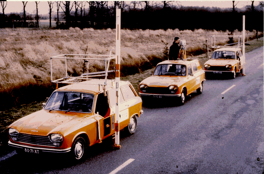
This figure shows a ML team in the Netherlands( introduced by NLS)
25 years ago, Motorised Levelling was introduced in the NLS in order to perform all levelling measurements to complete the new national height network of Sweden. Several papers were presented concerning the specific interesting features of this extremely efficient and precise methodology in various countries.
One of the objectives of the seminar was to give all participants a complete overview of all existing techniques that may be used for different height determination applications. Furthermore, the goal of the presentations and of the practical demonstration at the end of the seminar was to make it possible for the users to choose appropriate instrumentation and methods for a specific project.
This overview concerning the present state of the art, illustrating actual possibilities and limitations was also aimed at the preparation of future investigations and developments.
At the exhibition pictures and illustrations over height determination techniques and especially the utilisation of motorised techniques (both for direct and indirect levelling) around the world were presented.
Table Round Discussions: GPS for National levelling networks?
After a general introduction by Prof. K. P. Schwarz, the discussions dealt mainly with the use of GPS for high precision levelling. The specifications for national levelling networks are slightly different from one country to another. Nevertheless it appears that in many countries it is more and more difficult to get national and institutional support for the realisation and the maintenance of a unique altimetric reference. Thus a general reflection on national height networks is welcome, as the situation that predominated since the middle of last century has completely changed in many aspects, the last one being the availability of GPS and good geoidal models. Another important idea concerning this need for a new global outlook comes from the fact that half a century after the last world war, most countries have generally the disposition of a good height network for since at least tens of years:
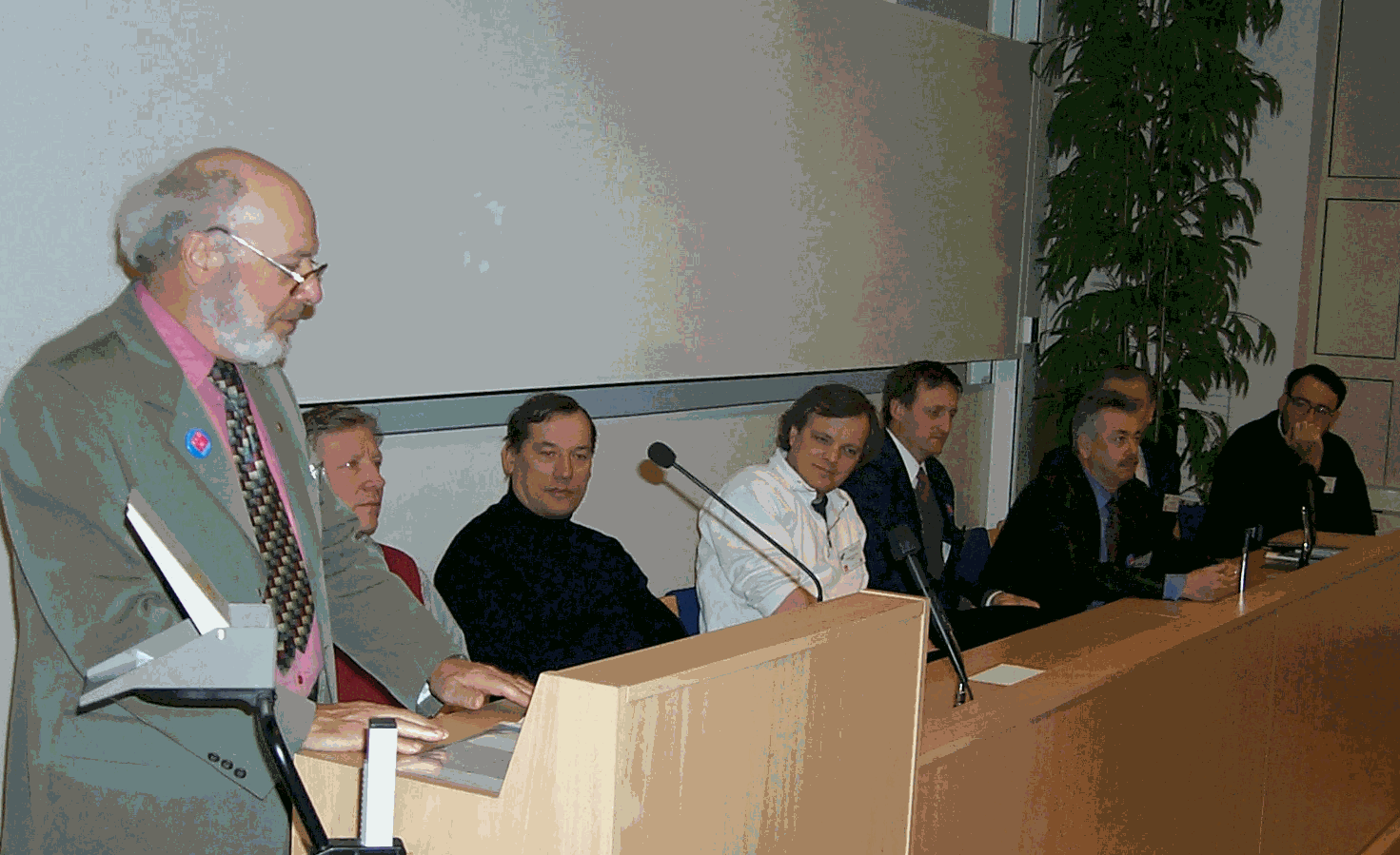
JM Becker (chair FIG-C5), Kl. P. Schwarz (IAG), H. Ingensand (WG-52), S. S. Villadsen(Denmark), M. Kasser(WG5.2), H. Heister(WG5.2), J. Kääriäinen(Finland) and M. Higgins (v.chair FIG C5
)During the seminar several papers pointed out the difference in needs of different users. Concerning accuracy, density, monumentation and accessibility, the biggest differences for optimal use appear between rural and urban areas. In the rural case, GPS will certainly be the optimal solution to satisfy most of the needs. On the other hand, in peri-urban areas and cities, GPS use will be limited due to at least three reasons: limited availability of satellites due to the presence of buildings, no direct access to benchmarks (e.g. located on walls), and insufficient accuracy (hardly better than 2 cm in most cases).
The discussion was too short to converge on the production of specific recommendations, but at least it was widely accepted that these issues were suitable to be addressed by FIG; for example through the Working Groups of Commission 5.
Technical visits
NLS presented its activities during the afternoon of the last day and had for this purpose 5 different stations illustrating:
The Motorised Levelling (one team with full equipment outdoor): demonstration
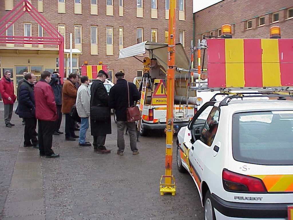 The participants to the demonstration of the Motorised Levelling Team outside NLS
The Organising Committee would like to take this opportunity to thank all participants and especially the speakers and everyone present in Gävle for making the seminar such a pleasant and successful one. I want also to express my thanks to all C5 members for their engagement and I hope that we can organise several seminar of this kind on different specific technical subjects in the future.
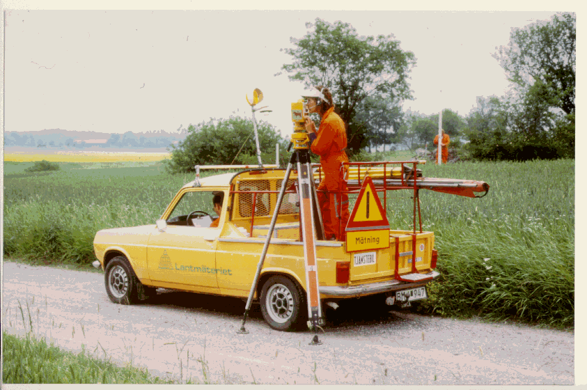
The Swedish Motorised Levelling in action: connection to a Benchmark from the Instrument car