"A World and a Profession in Transition"
SPONSORED BY THE NATIONAL LAND SURVEY OF SWEDEN
Geodesy and Surveying in the Future, The Importance of Heights
Forthcoming events for FIG Commission 5
By Mikael Lilje, secretary FIG Commission 5
Dear Friends,
It is now time for the second Newsletter. We do apologies for the delay. In this number you can read about the meeting in Gävle, Sweden (March), Bangkok, Thailand (April) and Sun City, South Africa (May/June). All meetings must be said to have been successful in all ways.
The Working Groups have started to work. Some have been able to go forward faster than others, but we believe that all five working groups will do an excellent job for the next few years. The seminar in Gävle had a major input from WG-5.2 and at the seminar in Bangkok, WG-5.3 had an important role and the whole commission contributed to the technical program in Sun City.
We are now looking forward to several meetings next year and hopefully the working groups will have a lot to report at these meetings. The forthcoming events are listed in the end of the Newsletter and more information can always be found on our homepage.
I do hope that you all have visited our homepage (www.lm.se/fig5) and I am happy for all sorts of comments on how to improve it. Please, do not forget that FIG has a homepage as well (http://www.ddl.org/figtree/).
By Jean-Marie Becker, chair FIG Commission 5
Colleagues,
Due to serious health problems I was not able to work during a two-month period. For that reason I was unable to participate to the FIG Working Week in Sun City where Matt Higgins and Mikael Lilje successfully took over my engagements. I would like to thank them for that. Now I am again back in office but have been forced to reduce my engagement in several different projects to just a few and have chosen to put high priority to projects close to FIG.
We can be satisfied with the outcomes after one year of activities. Several work shops, symposiums, seminars and seminars have been successfully organised by our Commission members through their working groups. You can read about some meetings in this Newsletter as well as find a commission report on Internet (http://www.ddl.org/figtree/Agenda/com5rep.html).
We now have to continue and together to prepare for coming events where Commission 5 play a major role, namely the seminar in Malta (18-20 September, 2000) about "The Mediterranean Surveyor in the new Millennium" and thereafter the International Workshop on Mobile Mapping in Luxor (4-6 January, 2001). It is important that all our members and especially the National Delegates contribute actively to these events by promoting, presenting reports and encouraging colleagues to participate. I therefore ask you all to contact myself and Mikael concerning contribution and suggestions to these and other meetings.
It is also important that we organise more meetings with the surveyors at the local/regional level to listen to them and their problems. This is also important in countries that are not yet members of FIG. We are open for suggestions and proposals about such events.
I am no longer the only FIG liaison person to ISO TC211. Following the recommendations of FIG Standard Task Force, there will now be five different persons in the future. Vaclav Slaboch and myself will not continue our engagements within TC211. However, I will still be actively working within ISO TC172 and TC59. This is also the intentions of FIG Task Force on Standards.
Geodesy and Surveying in the Future, The Importance of Heights
15th-17th of March, 1999 in Gävle, Sweden
By Michel Kasser and Jean-Marie Becker
Introduction
FIG Commission 5 organised an important international seminar entitled "Geodesy and Surveying in the Future" with special focus on the subject "The Importance of Heights". The seminar was made in collaboration with the Height Determination Working Group from the Nordic Commission of Geodesy (NKG) and the Geodetic Divisions from the National Land Survey of Sweden (NLS).
The choice of the subject, place and date for this event were connected to the 25th anniversary of the introduction of the Motorised Levelling (ML) technique in Sweden. It was decided that it was suitable to celebrate it with a "Jubilee Seminar". Jean-Marie Becker, Mikael Lilje and Per-Ola Eriksson from NLS in collaboration with the FIG WG-5.2 " Height Determination Techniques" (chaired by Michel Kasser) was the organisers of the seminar.
About 120 participants coming from more than 20 countries contribute with 50 presentations during the 3 seminar days and made it to a success.
An exhibition about height determination techniques and instrumentation from the past 50 years and a practical demonstration on Motorised levelling were also organised at the same time.
In connection with the seminar FIG C5 also had its first SC5 (Steering Committee) meeting. All FIG-C5 Working Groups were represented at this meeting by their chair and/or vice chair. In total 13 persons were present. Reports about ongoing and future activities were given and discussed. Also the participation or organising of WW or seminars were on the agenda. All participants expressed their satisfaction about this kind of working meeting for the officers and members of the commission 5. It is planned to make reports on it in our C5 Newsletters.
Furthermore several C5 Working Groups (WG-5.2 and WG-5.5) organised separate meetings specific for their WG-mission. These meetings were open to all participants and we noticed around 15 to 20 participants at each meeting. It is important to make full use of these meetings when people are actual meeting each other. Internet and telephones are great thing to use to discuss certain items but an actual meeting when you meet several people in person is the best way. A problem though is that these meetings are usually not in the seminar program from the beginning and it is sometimes hard to find appropriate times for the meetings during the seminar. We are happy that two working groups were able to have meetings.
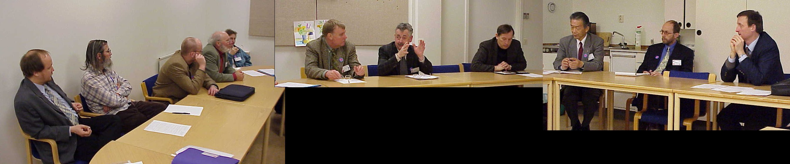
Some of the participants to the WG 5.2 meeting (Kasser (chair) on the right side)
Different Working Groups within the Nordic Commission of Geodesy as the Height Determination Group, Satellite Geodesy Group and Geodynamics Group used also their presence in Gävle to have several WG meetings the 18th March. In total about 30 members of NKG participated to these meetings. These were first held as separate meetings for each WG in the morning, and then in the afternoon to a common joint meeting about the Nordic Levelling Networks in the different countries and a common finalisation of them.
The Technical Sessions
This seminar was the first in its kind about "Heights" organised in the Nordic countries and probably the only one in the world during the last decade. As indicated in the title the seminar had two main and complementary directions namely Geodesy and Surveying. The objective was to give a complete overview and the state of the art concerning height determination questions. The different technical sessions concern the whole spectrum of techniques, instruments, and applications and cover all aspects from purely scientific to practical end users applications. 50 papers were presented and 19 refused for lack of time. This shows that the subject "Importance of Heights" is for the time being again in the focus of the Geodesy and Surveying society.
The seminar was also a good opportunity to communicate and exchange information, knowledge and experience between different actors (scientists, developers, manufacturers, practitioners) and communities (IAG = International Association of Geodesy and FIG).
For that purpose the organisers had invited eminent speakers representing all this different aspects with specific presentations covering the whole spectrum.
This integrated seminar around a given technical subject "heights" made it possible to better understand each other (FIG and IAG members or scientists and practitioners) and that will hopefully benefit both. It was also the first attempt from FIG C5 to clarify its role as a link between the scientific community (IAG) and the practitioners and end users (FIG members, surveyors), to make possible the transfer of knowledge and new developments.
Some of the questions of the Surveyor community, which were treated, are the following:
| How to perform optimal levelling for national networks or local project needs? | |
| What methodology the surveyor should prefer in a given situation? | |
| What problems should be taken in consideration when starting a levelling operation? | |
| Which instrument can perform demanded accuracy? | |
| Which problems can be expected using a specific instrument type? Specific method? | |
| How to operate in an optimal way: quality, quantity, costs? | |
| What can the end-users expect from GPS for heighting? | |
| How the user can check in the field the achievable precision/accuracy of his equipment? | |
| Which factors affect the results? Refraction? Magnetism? Vibrations? Multipaths? etc. | |
| How to perform the field operations to minimise the effects of all these errors sources? Etc. |
It is clear that the answers to such questions have to take into account the latest results of research work for points such as:
| the capabilities of the instruments available on the market, through complete analysis performed independently of the manufacturers, | |
| the refraction effects in the first metres, as the refraction which is correctly documented is generally produced by much higher atmospheric layers while (except for GPS applications) the surveyor has to deal exclusively with what happens in the very first meters above the ground, | |
| the computation of high precision geoids, as GPS heighting requires such geoids to allow access to the vertical accuracy generally required in heighting operations (e.g. a few cm), | |
| the effects of earth tides and oceanic tidal loading on continental margins, susceptible to interfere with heighting methodologies at an unacceptable precision level, | |
| how to mitigate multipath errors in GPS, as multipath effects are one of the main instrumental limitation of GPS used for high precision vertical determinations, | |
| the computations of levelling data taking care of geophysical movements, for example the post-glacial rebound of Scandinavia. |
Many of these subjects are part of the research work done by IAG and normally presented in its symposium. Prof. Klaus-Peter Schwartz (President of IAG) and many IAG members participated actively to our seminar and contribute with several presentations to make it successful. The IAG being the main international scientific union in Geodesy, its activity should be kept close to the work of some commissions of FIG which themselves should be as close as possible to the practising surveyor. The role of FIG Commission 5 is to be the link between the scientific community (IAG) and the practitioners and end users (surveyors), to make possible the transfer of knowledge and of new developments.
For example in FIG Commission 5 (Positioning and Measurement), the aspects covered during the Gävle seminar included:
| TS 1: Advance in techniques and instrumentation for terrestrial height determination: Chair M. Kasser | |
| TS 2: Applications of modern terrestrial height determination techniques: Chair H. Ingensand | |
| TS 3a: Heighting using satellites or other techniques: Chair P. A. Cross | |
| TS 3b: Heighting using satellites or other techniques: Chair M. Higgins | |
| TS 4a: Quality Control: Chair H. Heister | |
| TS 4b: Standards: Chair J. Kääriäinen | |
| TS 5: Different aspects: Chair Y. Gao | |
| TS 6: Height Networks: Chair K. P. Schwarz | |
| TS 7: How to fulfil the User needs: Chair M. Lilje | |
| TS 8: How to meet the End-users needs? : Chair B. Engen | |
| TS 9: National reports: Chair S Villadsen and A. Ellman | |
| Table Round Panel Discussion and Summary of the seminar: J-M Becker, K. P. Schwarz, M. Kasser, H. Ingensand, J. Kääriäinen, H Heister, S Villadsen and M Higgins. |
In most of these sessions, IAG and FIG aspects of the theme were treated as well.
25 Years of motorised Levelling
25 years ago, Motorised Levelling was introduced in the NLS in order to perform all levelling measurements to complete the new national height network of Sweden. Several papers were presented concerning the specific interesting features of this extremely efficient and precise methodology in various countries.
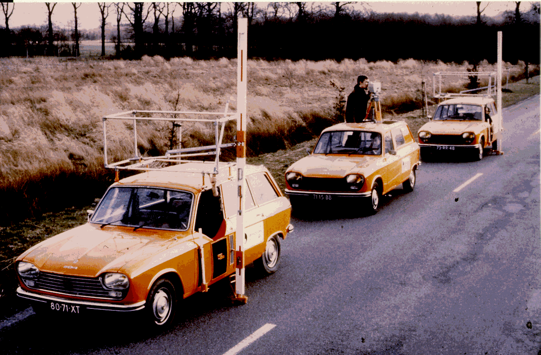
This figure shows a ML team in the Netherlands (introduced by NLS)
One of the objectives of the seminar was to give all participants a complete overview of all existing techniques that may be used for different height determination applications. Furthermore, the goal of the presentations and of the practical demonstration at the end of the seminar was to make it possible for the users to choose appropriate instrumentation and methods for a specific project.
This overview concerning the present state of the art, illustrating actual possibilities and limitations was also aimed at the preparation of future investigations and developments.
At the exhibition pictures and illustrations over height determination techniques and especially the utilisation of motorised techniques (both for direct and indirect levelling) around the world were presented.
Table Round Discussions: GPS for National levelling networks?
After a general introduction by Prof. K. P. Schwarz, the discussions dealt mainly with the use of GPS for high precision levelling. The specifications for national levelling networks are slightly different from one country to another. Nevertheless it appears that in many countries it is more and more difficult to get national and institutional support for the realisation and the maintenance of a unique altimetric reference. Thus a general reflection on national height networks is welcome, as the situation that predominated since the middle of last century has completely changed in many aspects, the last one being the availability of GPS and good geoidal models. Another important idea concerning this need for a new global outlook comes from the fact that half a century after the last world war, most countries have generally the disposition of a good height network for since at least tens of years:
JM Becker (chair FIG-C5), Kl. P. Schwarz (IAG), H. Ingensand (WG-52), S. S. Villadsen (Denmark), M. Kasser (WG5.2), H. Heister (WG5.2), J. Kääriäinen (Finland) and M. Higgins (v.chair FIG C5)
During the seminar several papers pointed out the difference in needs of different users. Concerning accuracy, density, monumentation and accessibility, the biggest differences for optimal use appear between rural and urban areas. In the rural case, GPS will certainly be the optimal solution to satisfy most of the needs. On the other hand, in peri-urban areas and cities, GPS use will be limited due to at least three reasons: limited availability of satellites due to the presence of buildings, no direct access to benchmarks (e.g. located on walls), and insufficient accuracy (hardly better than 2 cm in most cases).
The discussion was too short to converge on the production of specific recommendations but at least it was widely accepted that these issues were suitable to be addressed by FIG; for example through the Working Groups of Commission 5.
Technical visits
NLS presented its activities during the afternoon of the last day and had for this purpose 5 different stations illustrating:
The Motorised Levelling (one team with full equipment outdoors): demonstration
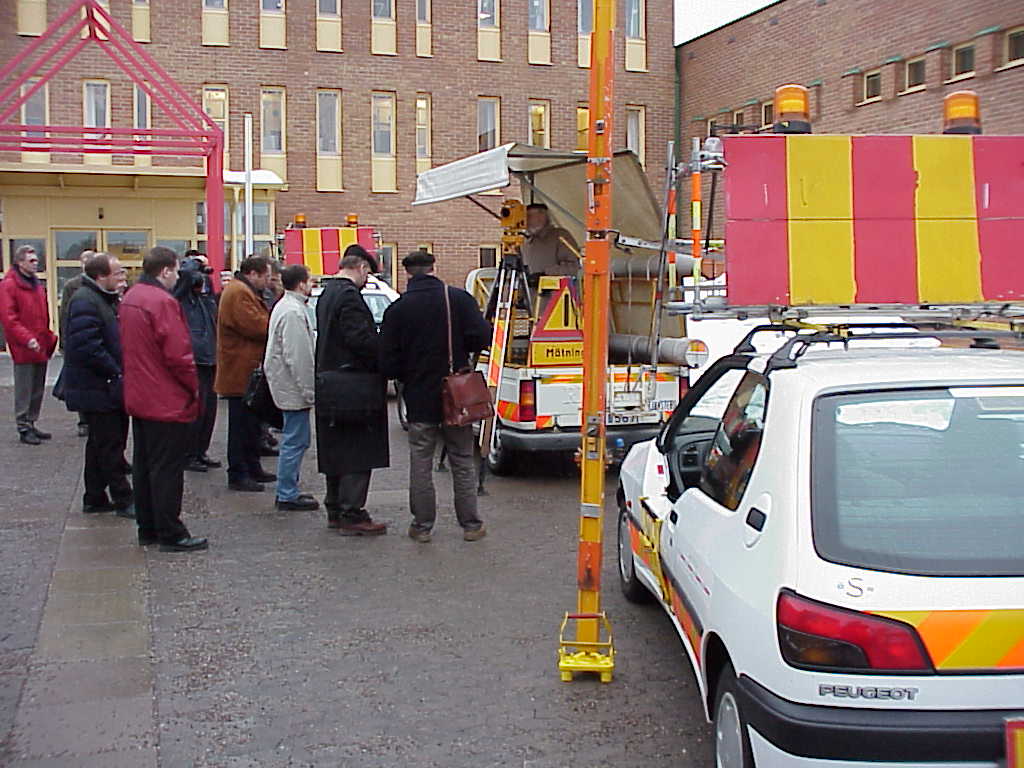
The participants to the demonstration of the Motorised Levelling Team outside NLS
| Demonstration of the control centre of SWEPOS (national network of permanent GPS reference stations) | |
| The National Historical Map Centre – Swedish maps from several centuries | |
| The production of modern digital maps | |
| The Laser interferometer comparator in action – calibration of levelling staffs. |
The Organising Committee would like to take this opportunity to thank all participants and especially the speakers and everyone present in Gävle for making the seminar such a pleasant and successful one. I want also to express my thanks to all C5 members for their engagement and I hope that we can organise several seminar of this kind on different specific technical subjects in the future.
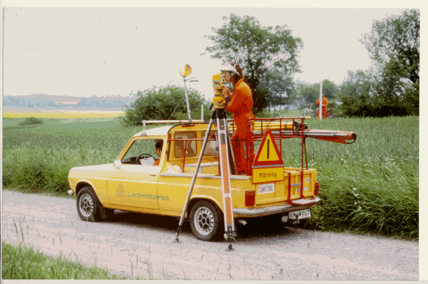
The Swedish Motorised Levelling in action: connection to a Benchmark from the Instrument car
By Nicolas Paparoditis, chair WG-5.4
Map production techniques together with modern acquisition equipment belong to the field of digital mapping and are in constant and rapid evolution. Digital cameras, laser ranging systems, GPS, digital photogrammetry workstations, digital image processing tools, GIS, are all coming to full maturity. The integration of these new technologies in mapping systems will as a consequence change mapping production habits radically. It is thus crucial for all potential digital mapping system beneficiaries to be aware of all strategic changes and to have a clear idea of the performances (possibilities, limitations, and precision) of all existing systems.
Our end-user oriented working group will aim at identifying, sorting, evaluating, giving practical information and exchanging experiences on these new operational technologies and their possible applications but also at giving an overview of research issues in the short, medium and long term. Our progress in this task will be punctuated by regular reports. The goal of our working group is also to be a creative interface between researchers, beneficiaries and manufacturers to help the improvement of software and hardware packages. To do so, each of these actors should and will be represented in this working group.
The fields of interests covered by our group are vast, so to be efficient we have decided to create two ad-hoc groups to concentrate our efforts on two specific fields where those technologies can be integrated and where we think that the requirements from a surveyors point of view is of capital importance.
Most of the 3-D data useful for surveying applications can be in an easily and quickly captured by exploiting aerial images. For this reason, the first ad-hoc group concerns "Digital Aerial Photogrammetry". The subjects we will study are:
| integration of techniques and technologies (GPS real time positioning, trajectography, cinematic, stabilised platforms) to improve aerial digital frame cameras data capture and aerial triangulation; | |
| laser ranging systems; | |
| digital photogrammetric workstations; | |
| digital image processing tools: surface and terrain reconstruction, raised structure extraction and classification, 3-D building reconstruction; | |
| orthophoto production and radiometric corrections. |
Aerial views often have limitations for some surveying applications such as building facade measurements for instance. Thus, a terrestrial survey is often necessary to provide complementary information. Therefore our second ad-hoc group concerns "Digital terrestrial photogrammetry combined with geodetic surveys for 3-D inside and outside monitoring of buildings". Our aim here is to find all possible solutions to help and ease both surveyors field and office work. The subjects we will study are:
| data collection and system integration: digital cameras, video theodolites, GPS, laser rangers, mobile vehicles; | |
| use of aerial images | |
| image transmission, image compression and storage; | |
| image indexing and referencing; | |
| automated calibration and orientation of images and of mobile video image sequences; | |
| digital workstations for terrestrial photogrammetry; | |
| mapping virtual constructions in video sequences. |
To enable an efficient co-operation and to avoid redundancy with working groups of other organisations such as ISPRS and ICA, chairs or members of these working groups will also be invited to join us in our two ad-hoc groups.
By Mikael Lilje and Matt Higgins
Introduction
The FIG Working Week was organised in Sun City, South Africa in late May/early June. The number of delegates was fairly high but the organisers had hoped for even more. Specifically, participation from Southern Africa was lower than expected. Commission 5 was represented by a large number of people, e.g. Matt Higgins, Mikael Lilje, Vaclav Slaboch, Martin Lang, Naser El-Sheimy and Nicolas Paparoditis. Unfortunately, Jean-Marie Becker was not able to go due to medical reasons. The South African delegate to Commission 5, Richard Wonnacott, played an active role during planning for the Working Week and throughout the technical sessions and business meetings. Such local involvement is crucial to the success of Working Weeks.
This report is a short description on the major events that took place there. For more information on a specific topic, please contact one of the mentioned persons above.
General Assembly
The General Assembly was divided to two different days as usual. There was not much discussion during the plenary sessions. FIGTree will soon be moved to a new domain (www.FIG.net) and there will also be a new email address to FIG (FIG@fig.net). This is a more direct and simpler domain name and is a gratifying development given that our Steering Committee in Gävle had resolved to press FIG to do exactly that.
The Bureau proposed that FIG should terminate its membership within the International Union of Surveying and Mapping (IUSM) and instead seek to enter into bilateral agreements with each of its other members and with ISPRS. Through ACCO, Commission 5 and 6 clearly stated that we would like to be involved in the process when we are discussing with e.g. IAG and ISPRS. Chair of ACCO agreed and would support any such initiative on our part. Whether IUSM is a functional organisation or not has been questioned but actions to be taken within IUSM in the near future will perhaps improve its work. For instance, ISPRS are considering whether to become a member again. The motion by the Bureau was however agreed with the condition that if IUSM was indeed revitalised, FIG should reconsider the situation.
Three bids were received for FIG Working Week 2004. These were Stockholm, Rotterdam and Athens. It was decided by vote at the end of the week that Athens should be responsible for the event.
Calendar for the FIG Working Weeks and Congress
2000: 22-27 May, Prague, Czech Republic
2001: 6-11 May, Seoul, South Korea
2002: 21-26 April, Washington D.C., USA
2003: 19-23 May, Eilat, Israel
2004: August, Athens, Greece
ACCO
ACCO stands for the Advisory Committee of Commission Officers. Matt Higgins and Mikael Lilje represented Commission 5 during these meetings.
The discussion in the ACCO group was mainly towards the FIG Working Weeks and how these should be organised in the future. Several commissions explained their disappointment that they had had difficulties in finding regional speakers to Sun City and that the local organisers should have help them in greater extent. Somewhat against the trend in other Commissions, Commission 5 was able to get the help of Richard Wonnacott, who is the national delegate. With his help, and also the help of Trevor Harpham, we were able to get several speakers from South Africa
Commission 5, with the support of several other commissions, strongly pointed out three major points that must be determined concerning the Working Week. One concerns the affordability. The event should have an overall cost for a participant that he/she can afford to go there. This is very important for visitors from developing countries. The second point concerned the local contacts. The local organisers must appoint a person per commission in the organising country that can help the commission to find specific speakers from the region. The third point regarded the size of the Working Week. Shall each commission be able to have as many technical sessions as they wish or should the amount of technical sessions be held at a minimum? Some voices where heard that the technical program at a working week should not have any parallel sessions and only joint commission sessions. By this, we should be able to learn more about each other as well as be able to discuss jointly matters instead. Commission specific papers should then be preferred to be held at a separate occasion. This discussion will continue during the autumn and shall be discussed at an ACCO-meeting in Copenhagen in January with a view to making recommendations to the General Assembly in Prague. Other items to be discussed in Copenhagen will be future strategies of FIG and implementing the Bureau work plan for 2000-2003.
FIG Commission 5 meetings
Commission 5 had three meetings during the week. The first meeting was a lunch meeting on the Monday called only to set the agenda for the open Commission meeting in the afternoon and will not be reported on in detail here. The third meeting was a steering committee meeting.
We had 12 people at our Open Commission meeting, which was less than we had hoped for. A major problem is that this meeting was held before the Technical Sessions had started and thus only attracted people already in Sun City (e.g. for the General Assembly). Most of the participants to the FWW arrived the day after. The commission introduced itself by short presentations of the present working group chairs and Matt. Also Yola Georgiadou, the Netherlands presented her ideas on how FIG could help developing countries by active participation in workshops. She had experiences from three events like this with the help of Larry Hothem, Stig Enemark and Iain Williamson and she pointed out that such workshops have more credibility if outside participation is unbiased and FIG sponsored involvement is seen as more independent than say specific consultants.
Technical program with excursion
Commission 5 had a very interesting and good technical program. A proof of that was the number of delegates who attended our sessions which ranged from 40 to 80 people. All papers from all Commissions will be presented on the FIG homepage. In total, we presented 13 papers spread over 4 sessions. Almost each paper attracted good discussions. Our thanks goes to Richard Wonnacott and Trevor Harpham for helping us but also Matt Higgins should be recognised for his efforts with the preparing of the technical program.
The titles of the sessions are as follows and the papers will be found on FIG Homepage http://www.ddl.org/figtree/) shortly.
Trends in Positioning and Measurement
Technical Tour (Hartebeesthoek remote sensing station and VLBI/GPS site and Positioning in wildlife applications)
Technological Front Lines and Frontiers
Reference Frame in Practice - Position
Reference Frame in Practice - Heighting
Task Force on Standards
Iain Greenway chairs this task force and convened two meetings during the week. Commission 5 steering committee members involved included Vaclav Slaboch and Matt Higgins. Larry Hothem and Yola Georgiadou (both aligned to Commission 5) also attended given there existing involvement in such matters. The major work was to develop the work plan for the task force. Two specific developments are worth mention. Firstly, there was good progress on creating a guide on standardisation activity for the Bureau, Commissions and Member Organisations. An outline for the chapters of the guide was developed and specific people tasked with responsibility for chapters. The second significant development was presentation of a report on the FIG Questionnaire on Standards. Mr Greenway undertook to finalise and release the work plan soon after the Working Week including details of the guide.
Task Force on underrepresented groups in Surveying
The task force had a break out session during one of the General Assembly plenary sessions that Mikael Lilje attended. The discussion concerned how FIG should get younger professionals and students more interested in FIG and how FIG could help them. We discussed things from having students to help the organisers running the conference to special sessions with technical papers presented by younger people.
Coming events
More information on these events can always be found in the end of the Newsletter as well as on the Commission home page.
By Naser El-Sheimy, chair WG-5.3 and Michael Chapman, chair WG-5.31
This is the first report of the activities of the FIG C5.3 and the FIG C5.3.3. It was almost four years ago, in 1995, when the Ohio State University, the ASPRS, and the FIG organised the first meeting on Mobile Mapping Technology, in Columbus, Ohio, USA. There, geodesists, photogrammetrists, GIS and Computer scientists met together to discuss the future of mobile mapping systems. Since then, substantial progress has been made in the integration of many different sensor technologies for a variety of applications that have not been anticipated in that meeting. The practical results of this progress are remarkable: Real-time mapping for emergency applications, GPS/INS integration supporting aerial triangulation, airborne digital mapping, bridging of GPS and INS by photogrammetric techniques, highway and railway mobile mapping systems, and softcopy photogrammetric workstations that integrate land and airborne digital images. This was the main initiative for the organizing the 2nd International Workshop on Mobile Mapping Technology, which took place in Bangkok, Thailand on April 21-23.
The International Workshop on Mobile Mapping Technology was successfully held in Bangkok, Thailand, April 21-23, 1999. It was co-organised by ISPRS WG II/1 Real-time Mapping Technologies, IAG SC4/WG1 Mobile Multi-Sensor Systems, FIG C5/WG3 Real-time Precise Mapping, ISPRS WG V/1 Close-Range Imaging and Metrology, ISPRS IC WG V/III Image Sequence Analysis. The sponsoring organisations included International Society for Photogrammetry and Remote Sensing (ISPRS), Asian Institute of Technology (AIT), National Research Council of Thailand (NRCT), International Association of Geodesy (IAG), International Federation of Surveyors (FIG), Association for Real-time Imaging and Dynamic Analysis (ARIDA), and Japan Association of Remote Sensing (JARS). The FIG C5 actively participated in the symposium by having two members in the organising committee (Dr. Naser El-Sheimy and Prof. Jean-Marie Becker) and 4 members as chairpersons of four different sessions (Dr. Naser El-Sheimy, Prof. Jean-Marie Becker, Prof. Michael Chapman, and Dr. Vincent Tao.
The workshop, held at Maruay Garden Hotel in Bangkok, provided a stimulating casual environment to promote scientific presentations, interactive discussions, and information exchange. It brought together 190 participants from 17 countries, who are specialists, engineers, users and those interested in mobile mapping technology, kinematic real-time positioning, sensor integration and calibration, feature extraction and 3-D data acquisition. 42 oral presentations in 12 sessions and 18 posters reported most recent R&D and application achievements of mobile mapping. Among them were 2 oral sessions and 2 poster sessions organised by ARIDA and JARS. In addition, a visit to AIT ’s Asian Centre for Research on Remote Sensing (ACRoRS) was organised as a social event. Most participants also enjoyed the visit to Old Ruins and Sleeping Buddha in Ayuttaya, Bangkok.
Keynote speaker, Prof. A. Gruen, made a very informative talk "Mobile & Real-time Mapping" at the opening session. Ron Li delivered a speech "Large-scale Mapping of Landing Sites on Mars and Rover Localisation – An Application of Mobile Mapping?" which presented an on-going joint JPL/OSU project on Mars rover localisation.
The well-attended workshop also offered technical papers covering a full spectrum of mobile mapping technology. The following highlights some of the papers presented.
A paper from Hong Kong Polytechnical University reported difficulties of kinematic positioning in applications using GPS in densely structured urban areas. Most systems reported by other speakers approach the kinematic positioning by integrating GPS with Initial Navigation System (INS). Such systems are able to maintain positions even when the GPS measurements are not available within a short period. Better estimates can be made until GPS signals return. Furthermore, the combination of forward and reverse Kalman filter estimates enhances the precision of the platform location over the period.
Sensor integration and calibration have become an important part of mobile mapping technology. Calibration aspects of a rapid route mapping system developed in University of Melbourne, Australia was presented. A paper from University of East London discussed the details of calibrating a zoom lens CCD imaging unit in a motorised videotheodolite system. A concept of integrating multi-platform and multi-sensor data was introduced in a presentation from OSU. University of Stuttgart discussed an approach to assist positioning using spatial databases.
Automatic object extraction and recognition from mobile mapping data is understood to be a critical issue. The Calgary team summarised their efforts in the development of automatic approaches to acquisition and processing of mobile mapping images. The OSU team presented results of feature extraction from mobile mapping imagery sequences using geometric constraints and 3-D object recognition using neural networks. Royal Institute of Technology, Sweden, reported automatic road width measurements in a colour image sequence acquired by a mobile mapping system.
There is a growing number of mobile mapping systems developed in different parts of the world, including land based and airborne systems. Some are developed for special purpose, for example, for railway survey by Royal Melbourne Institute of Technology, Australia. Wuhan Technical University of Surveying and Mapping, China newly developed an economic mobile mapping system without INS component. However, map matching is tested to improve image orientation. Delft University of Technology presented a method for fast determination of parametric house models from dense airborne laserscanner data that have an average point density of approximately five points per square meter. A more sophisticated system developed at the Ohio State University has been improved to integrate LIDAR data with direct digital GPS/INS oriented imagery for the surface extraction purpose. The mobile mapping system developed by the University of Calgary has now additional functions that use expert knowledge in calibration, planning, surveying and post-mission quality control.
Building a mobile mapping system by integrating off-the-shelf hardware and software components is getting easier, but it requires significant courage, investment and efforts. We have seen development activities by many universities and companies on almost all continents in recent years. Land-based systems have demonstrated the power promised at the early time of the development, for example in road and railway survey, utility survey and others. The take over of the part of such traditional surveying markets is believed to be only a start. Meanwhile, the very same concept has been transferred to airborne and satellite-borne platforms where positional and orientational sensors are integrated with imaging sensors to approach real-time mapping that is not restricted to where only land vehicles can reach. The "dream" is to achieve the same level of ground position accuracy as traditional aerial triangulation. Of course, an integration of the sensor-based orientation data with aerial triangulation would provide much better results. We trust that with the rapid development in mobile mapping, automatic triangulation, and automatic feature/image matching, real-time systems will be a reality in the near future.
Today, mobile mapping is supported by a series of advanced technologies, including navigation sensors of GPS and INS, imaging sensors of high-resolution CCD, SAR, multispectral and hyperspectral sensors, computers and high intelligent processing/automation algorithms. A question we may want to ask ourselves is "have the current mobile mapping systems reached full potential?" The answer is a definite NO. We still see that mobile mapping takes only a small percentage of the overall surveying market where it ought to do a better job. Four aspects need our attentions: a) prices of mobile mapping systems are high, partly contributed by high cost components such as INS and very large CCD chips, b) better tools for efficient and automatic extraction of useful information from massive mobile mapping data are needed, c) accuracy should be increased for applications where higher accuracy is desirable, and d) efforts should be made to make the spatial data community more aware of the existence and potential of the technology. This workshop served as a forum for researchers, developers and users of mobile mapping systems to summarise the achievements, find out the current problems, and map out the future development. The 410 page proceedings of International Workshop on Mobile Mapping Technology, edited by R. Li and S. Murai (ISSN 0256-1840), can be ordered from RICS Books, Surveyor Court, Westwood Way, Coventry CV4 8JE, United Kingdom, Fax: +44-171-334-3800.
The next International Conference on Mobile Mapping Technology will be held in Luxor, Egypt, January 4-6, 2001. For further information please contact Dr. Naser El-Sheimy, Department of Geomatics Engineering, The University of Calgary, 2500 University Dr. N.W., Calgary, Alberta, Canada T2N 1N4, Tel : (403) 220 7587, Fax : (403) 284 1980, E-mail: naser@ensu.ucalgary.ca.
Finally, on behalf of the FIG C5, many thanks Dr. Ron Li and Prof. Shunji Mauri for the work that went into the preparation for this meeting and for the success in attracting all these working groups from different professional and scientific organizations.
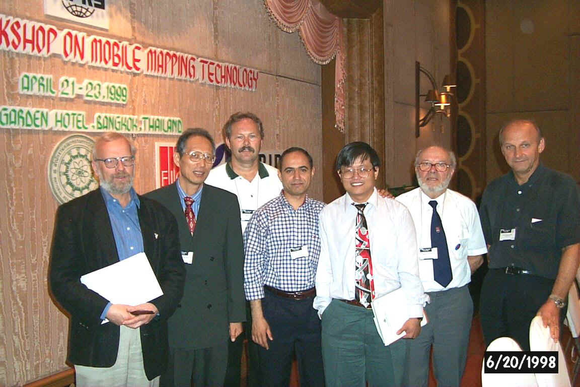
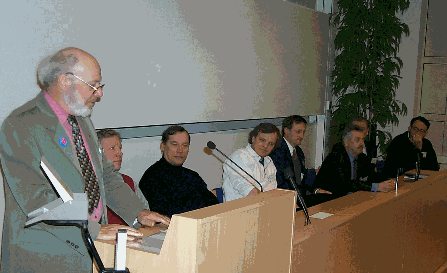
H. Kahmen, S. Mauri, M. Chapman, N. El-Sheimy, R. Li, JM Becker, A. Gruen
Forthcoming events for FIG Commission 5
By Mikael Lilje, Naser El-Sheimy and Matt Higgins
2000:
13 - 17 March
, XIII International Kurs für Ingenieurvermessung, München, Germany, Contact Prof. Dr.-Ing. Klaus Schnädelbach, Geodätisches Institut, Technische Universität München, Arcisstr. 21, D- 80290 München, Email: geodaetisches.institut@tum.deMore information will be presented in the next issue.
22-26 May, FIG Working Week, Prague, Czech Republic, Contact: Czech Union of Surveyors and Cartographers, Novotneho lavka 5, 116 68 Praha, Czech Republic Fax +420 2 210 82374 Email geodeti@csvts.cz Internet: http://www.fig2000.cz
A preliminary program can now be obtained from the Czech Organisers. The input to the technical program will be two joint sessions with Commissions 4 and 6. In total the three comissions will have 10 papers presented in Prague. Commission 5 is responsible for three papers.
18-21 September, The Mediterranean Surveyors in the New Millennium, Malta, Contact: Mikael Lilje, National Land Survey, 801 82 Gävle, Sweden, Fax: +46 26 61 06 76 Email: mikael.lilje@lm.se
A joint seminar between several commissions within FIG will be held on Malta. Commission 5 is responsible for the technical program while Randolph Camilleri, Malta is responsible for the local organisation. A first circular letter will be out in late August.
2001:
4-6 January, 3rd International Workshop on Mobile Mapping, Contact: Naser El-Sheimy, Department of Geomatics Engineering, The University of Calgary, 2500 University Dr. N.W., Calgary, Alberta T2N 1N4, Fax: (+1) 403 284 1980, Email: naser@ensu.ucalgary.ca
The 2nd International Workshop is reported on in this issue. The meeting was a success and it is already decided that there will be a third. The date and place is fixed and the organiser is our chair of WG-5.3 Dr. Naser El-Sheimy. More information will be given in future issues of the newsletter as well as on Internet.
Next issue
We intend to have the third Newsletter in print in the beginning of 2000. We will present the coming seminars in the year 2000. We also intend to have information brief from every working group letting us know what they have done during the first year.
If there is something that you would like us to include in future newsletters, please let us know.
Contact addresses
Jean-Marie Becker chair fax: +46 26 61 07 76 email: jean-marie.becker@lm.se
Matt Higgins v. chair fax: +61 7 3891 5168 email: matt.higgins@dnr.qld.gov.au
matt.higgins@uq.net.au
Mikael Lilje secretary fax: +46 26 61 06 76 email: mikael.lilje@lm.se
Working Group 1 Standards, Quality Assurance and Calibration
Vaclav Slaboch chair fax: +420 2 685 7056 email: vaclav.slaboch@cuzk.cz
Hansbert Heister v. chair fax: +49 89 60 04-39 04 email: heister@glabse.bauv.unibw-muenchen.de
Working Group 2 Height Determination Techniques
Michel Kasser chair fax: (+33) 2 4343 3102 email: kasser@esgt.cnam.fr
Hilmar Ingensand v. chair fax: (+41) 1 633 11 01 email: ingensand@geod.ethz.ch
Working Group 3 Kinematic and Integrated Positioning
Naser El-Sheimy chair fax: (+1) 403 284 1980 email: elsheimy@ensu.ucalgary.ca
Orhan Altan v. chair fax: email: oaltan@srv.ins.itu.edu.tr
Yang Gao v. chair fax: (+1) 403 284 1980 email: gao@ensu.ucalgary.ca
Working Group 4 Integration of Techniques for Digital Mapping
Nicolas Paparoditis chair fax: (+33) 1 43 98 85 81 email: nicolas.paparoditis@ign.fr
Working Group 5 Reference Frame in Practice
Paul Cross chair fax: +44 171 380 0453 email: paul.cross@ge.ucl.ac.uk
Matt Higgins v. chair fax: +61 7 3891 5168 email: matt.higgins@dnr.qld.gov.au
matt.higgins@uq.net.au